Peatling Magna & Arnesby From Countesthorpe
Leicestershire Walk
County/Area - Leicestershire
Author - David McMahon
Length - 6.8 miles / 11.1 km Ascent - 250 feet / 76 metres
Time - 3 hours 40 minutes Grade - easy/mod
Walk Route Description
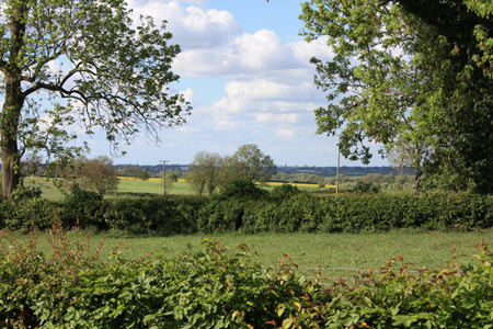
Click image to see photo description.
Countestorpe is a large village six miles to the south of Leicester. There is a regular bus service Arriva 85 (see timetable) from Leicester St Margaret's Bus Station. To start the walk go south along Main St, with St Andrew's Church on your right. Continue past the left and right-hand bends and then go up Austrey Lane, which is on the corner of the second left-hand bend.
Walk along Austrey Lane and when you reach a field aim for the furthest point away. Go through a gate and this becomes a narrow enclosed footpath. It finishes with another gate. Go left with the hedgerow on your left-hand side. Steam straight ahead along this well-marked footpath through several fields which will take you to the right-hand side of Westdale Farm.
Go along the driveway, past the farm and into the field straight ahead. Follow the hedgerow and then take the left-hand bridleway. Continue along the well-defined track until you reach Bambury Farm and immediately afterwards a farm track. Turn right along it and very soon turn left onto a wide grassy track and walk along this until you reach a section of the Leicestershire Round on your left, which will take you into Peatling Magna.
When you reach the road, turn left and then take Church Lane on your right until you reach the gates of All Saints church. Turn left before entering the churchyard and follow the track to the main road. On reaching the road turn right and continue until you reach a sharp right-hand.
Take the footpath off to the left and follow the well-signposted route until you can see the windmill signifying you're on the outskirts of Arnesby. The footpath swings off to the right; over a footbridge and going to the right of a barn brings you onto a well-manicured lawn. Go straight across it over a stile onto a driveway and straightaway over another stile and then turn sharp left and follow the narrow, enclosed footpath which swings left and then right before straightening up and eventually entering a field.
Head north along this footpath until you reach a T-junction. Go left through the hedgerow into the next field and immediately turn right following the footpath which aims to the left of the wood. On reaching the wood, follow the hedgeline and then continue on past the farm and another wood.
When you reach a side road, turn right and you will see a footpath sign stating Countesthorpe 1.25 miles on your left. Walk along what originally is a grassy track and then becomes a headland. Continue perambulating along this headland until you see on the opposite side of the hedgerow a sheepfold made of motorway crash barriers. Climb the stile down into it and climb the gate to get out of it, head diagonally right to the yellow post almost at the opposite end of the field.
Walk past the post and when you are almost up to the field boundary turn left and cross the footbridge into a field. From here you have a choice of routes.
Footpath to the left: climb the stile into the alleyway and follow it round until you come out in a cul-de-sac (Orkney Way).Turn left onto the road (Rosebank Road) and carry on along it as it swings right up its junction with Scotland Way. Cross the road into Stromat Way and take the footpath at the top end of it. Follow it round and you will come onto Orchard Lane which is not far from your starting point of Austrey Lane.
Footpath to the right: Cross the field, over the stile and then walk over the lawn and up Shetland Way. At the top take the alleyway to the right. This will bring you into a playground. Cross it diagonally left onto the road; Turn left and continue along and it will bring you out opposite the Axe & Square pub in the centre of Countesthorpe.
Maps 

| Ordnance Survey Explorer 233 | Sheet Map | 1:25k | BUY |
| Anquet OS Explorer 233 | Digital Map | 1:25k | BUY |
| Ordnance Survey Digital Map Subscription | |||
| Latest Ordnance Survey Discounts | |||
Other walks nearby
| Walk 1441 | Broughton Astley, Leire, Claybrooke Magna & Sharnford | easy/mod | 11.0 miles |
| Walk 3415 | Wistow and Newton Bridge from Fleckney | easy | 6.5 miles |
| Walk 1455 | Great Glen and Burton Overy circular | easy | 6.0 miles |
| Walk 1457 | Great Glen, Burton Overy, & Illston | easy/mod | 11.0 miles |
| Walk 3338 | Burton Overy from Great Glen | easy | 3.0 miles |
| Walk 3087 | Normanton Park & Desford Crossroads | moderate | 11.5 miles |
| Walk 2084 | Grand Union Canal from Great Glen | easy | 3.1 miles |
| Walk 1972 | Foxton Locks & Laughton from Saddington | easy/mod | 7.9 miles |
| Walk 1456 | Carlton Curlieu & Illston on the Hill | easy | 5.0 miles |
| Walk 1627 | Debdale Wharf & Foxton from Smeeton Westerby | easy/mod | 7.5 miles |
