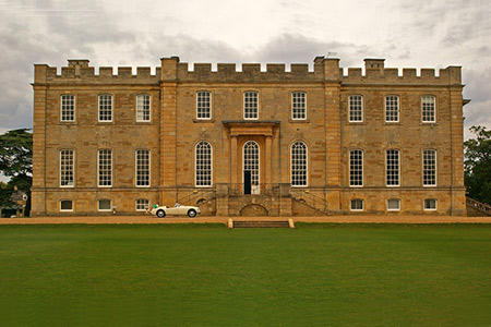
Graffham Water from Kimbolton
Cambridgeshire Walk
County/Area - Cambridgeshire
Author - Lou Johnson
Length - 7.8 miles / 12.7 km Ascent - 300 feet / 91 metres
Time - 4 hours 10 minutes Grade - easy/mod
Walk Route Description
Click image to see photo description.
This Cambridgeshire walk explores the countryside east of Kimbolton and includes a walk along the shores of Graffham Water reservoir. Convenient on street parking is available on East Street (grid ref. TL100677). The village is worth exploring with Kimbolton Castle, now a school, one of the highlights.
After parking, walk along East Street to the B645 (London Road) and turn left. Just after a sharp right hand bend, turn left onto a signed bridleway at some metal fencing. Almost immediately there are two footpaths on the right. Take the left-hand path and follow this across fields to reach a bridleway at the southern end of Warren Spinney (grid ref. TL109679). Turn left (north) and continue on the bridleway to reach a junction of lanes by Bigram's Farm (grid ref. TL116688).
Go straight across onto Stocking Lane (signed to Easton). Continue along this quiet lane passing the entrance to High Park Farm on your right to reach a bridge over a former railway line. A few yards past the bridge (grid ref. TL124699), turn right towards Magpie Farm. Follow this lane past the farm and, around a right-hand bend to reach Magpie Crossing (grid ref. TL1336969). Enter the Wildlife Trust nature reserve and follow the path through Savage's Spinney to a junction with a cycle path. Turn left and continue to the shores of Graffham Water.
Turn around and retrace your route for a short way until the Savage's Spinney sign. Turn left along the woodland path ignoring a path to Savage Creek hide to re-join the cycle path. Turn left and follow the clear path through Littless Wood to reach a T-junction with a bridleway (grid ref. TL135671). If you have time and energy you can turn left here and continue to Perry with its landing stages and slipways.
To continue with the walk, turn right along the bridleway across several fields to reach the OS trig point (grid ref. TL125671). Continue ahead along the southern edge of Lady Grove Wood to briefly join The Three Shires Way. Where the long-distance footpath turns north, continue ahead with the hedge to your left to reach Easton Road (grid ref. TL116676). Turn left and after 200 metres take the footpath on your right. This path heads diagonally across the field to reach a bridleway (grid ref. TL105675). Go straight across and continue across one field. In the next field bear half left and this will lead you back to the bridleway used very briefly at the start of the walk. Turn right along the B645 to return to the start.
Maps 

| Ordnance Survey Explorer 225 | Sheet Map | 1:25k | BUY |
| Anquet OS Explorer 225 | Digital Map | 1:25k | BUY |
| Ordnance Survey Digital Map Subscription | |||
| Latest Ordnance Survey Discounts | |||
Other walks nearby
| Walk 3605 | Shelton & Yelden from Upper Dean | easy/mod | 7.5 miles |
| Walk 3271 | Grafham Water Circular | easy/mod | 8.7 miles |
| Walk 1798 | Little Paxton & River Ouse Circular | easy/mod | 6.4 miles |
| Walk 2477 | Alconbury Weston & Buckworth Circular | easy | 6.9 miles |
| Walk 3623 | Wood Walton Circular | easy | 4.1 miles |
| Walk 1974 | Lyveden New Bield from Wadenhoe | easy/mod | 8.2 miles |
| Walk 2123 | Everton & Potton | moderate | 12.0 miles |
| Walk 2714 | Between Beeston and Old Warden | easy/mod | 11.5 miles |
| Walk 3113 | Sandy and Everton Circular | easy/mod | 7.5 miles |
| Walk 3741 | St. Ives, Houghton & the Hemingfords | easy | 5.6 miles |
