Cefn Bryn & Penrice from Oxwich
Gower Peninsula Walk
Region - Gower Peninsula
County/Area - Swansea
Author - Lou Johnson
Length - 7.7 miles / 12.5 km Ascent - 800 feet / 242 metres
Time - 4 hours 40 minutes Grade - easy/mod
Walk Route Description
Click image to see photo description.
A varied walk from Oxwich that features a sandy beach, woodland, open moorland, and salt marsh. The route follows the Wales Coast Path to Nicholaston where the walk heads inland to reach the Cefn Bryn ridge. Joining the Gower Way, there are excellent views to the coast as you traverse the ridge. The route then descends into woodland and passes through Penrice with its interesting church before continuing along the edge of Penrice Marsh back to the start.
The walk starts from Oxwich Bay car park (grid ref. SS502865) which lies close to the extensive beach. After parking return towards the entrance and turn right along a clear path that runs parallel to the road. You are on a section of the Wales Coast Path. After 600 metres the path veers away from the road and passes through the dunes of Oxwich Burrows to reach a footbridge (grid ref. SS514878). An alternative is to walk along the beach from the car park to reach this bridge. Cross the bridge and continue along the Wales Coast Path which climbs gently up to the edge of Nicholaston Woods on your left. You soon reach an open area that is crossed by many paths. Keep left here and climb up to enter the wood to where the Wales Coast Path turns sharp right (grid ref. SS552882). Leave the coast path here and turn left up to lane. Follow the lane around to the left and head uphill to the A4118 (grid ref. SS521884).
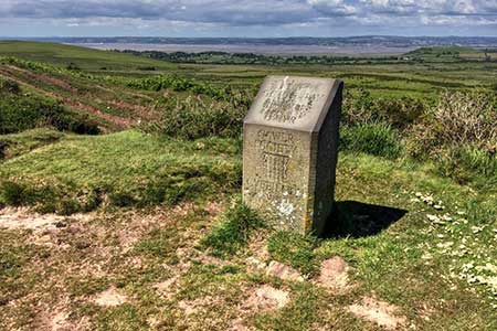
Cross the road with care and take the lane opposite. Continue uphill for 400 metres and fork right onto a track just Past Nicholaston House (on your left). The path climbs steadily across the hillside After 500 metres a smaller path forks left and continues up to the main ridge path (grid ref. SS512891). Bear left and continue along the Gower Way Keep ahead following the path up the crest of the ridge over Cefn Bryn. The undulating path crosses two minor tops before descending again to a broad col (grid ref. SS500896). Continue ahead and keep to the crest of the ridge to pass a topograph on your right, which can be reached by a short diversion off the main path. Return to the main path and continue for 200 metres and turn left down a grassy path. Continue to a road in Reynoldston. Turn left and continue to reach the A4118. Cross the A4118 and take the track opposite. The track soon enters Mill Wood and descends into the valley. Continue to a junction by a pool and bench (grid ref. SS489882) and fork right. Pass between two notices on either side of the track and take the next path on the left (with adjacent yellow topped marker post).
Follow this path through to a kissing gate and lane in Penrice. Turn right and continue to the village green. Turn left and pass St Andrew's Church on your left soon joining a track. The track enters a field and bears right, and a descending path follows a hedge on your right. Reaching woodland, the path turns left through the trees to reach a path junction (grid ref SS499875). Turn right and follow the path across fields to a metal gate and a lane. Turn left and after 400 metres you reach the car park used at the start of the walk.
Maps 

| Ordnance Survey Explorer 164 | Sheet Map | 1:25k | BUY |
| Anquet OS Explorer 164 | Digital Map | 1:25k | BUY |
| Ordnance Survey Digital Map Subscription | |||
| Latest Ordnance Survey Discounts | |||
Other walks nearby
| Walk 3761 | Cefn Bryn & Three Cliffs Bay from Penmaen | moderate | 9.0 miles |
| Walk 2358 | Parc le Breos near Parkmill | easy | 3.6 miles |
| Walk 1828 | Three Cliff Bay & Ilston Cwm from Southgate | easy/mod | 9.0 miles |
| Walk 1980 | Pwlldu Head & Bishopston Valley from Southgate | easy | 4.0 miles |
| Walk 1960 | Worms Head from Pilton Green | easy/mod | 7.5 miles |
| Walk 2144 | Port-Eynon from Pilton Green | easy/mod | 6.4 miles |
| Walk 2191 | Cheriton & Weobley Castle from Landimore | easy/mod | 5.2 miles |
| Walk 2424 | Harding's Down & Rhossili Down | moderate | 9.0 miles |
| Walk 3258 | The Beacon from Rossili | easy | 4.0 miles |
| Walk 1967 | Worms Head from Rhossili | easy | 3.3 miles |
