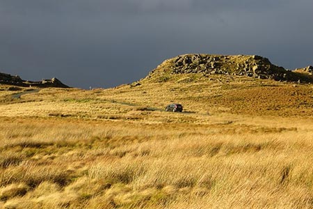
Bowland Knotts from Cross of Greet Bridge
Forest of Bowland Walk
Region - Forest of Bowland
County/Area - Lancashire & North Yorkshire
Author - Lou Johnson
Length - 7.4 miles / 12 km Ascent - 1200 feet / 364 metres
Time - 4 hours 50 minutes Grade - moderate
Walk Route Description
Click image to see photo description.
The gritstone outcrops of Bowland Knotts lie on the Yorkshire and Lancashire border rising to nearly 500 metres above sea level. This route traverses some wild country and offers excellent views north to the Yorkshire Dales and the Three Peaks. The landscape is unforgiving in inclement weather and the route should only be attempted by experienced walkers with good navigational skills and appropriate maps.
The start is the small parking area at Cross of Greet Bridge (grid ref. SD702590) on the minor road running north from the village of Slaidburn to Betham. After parking cross the road and continue across boggy ground with the slope to your left and the River Hodder to your right. Continue past the sheep pens (to your right), go through a gate and continue ahead. About 500 metres beyond the sheep pens turn right onto a farm track. Cross a stream and continue ahead. Turn left where the track forks and walk uphill above Catlow farm. Once over the bow of the rise, aim for a gate in a wall corner (grid ref. SD717589).
Careful navigation with the help of a 1:25000 map is now required. Head northwest to a wall corner and gate (grid ref. SD723592). Once through the gate follow the track heading east of north. Bowland Knotts soon comes into view. Continue along the track to reach a minor road (grid ref. SD726605).
Turn left along the road to the col which marks the Lancashire and North Yorkshire boundary. If you have time it is worth turning right off the road and exploring the crags of Bowland Knotts and the Hanging Stone before retracing tour steps back to the road. Otherwise turn left off the road along a rough track and follow the wall (on your left). This is a wonderful spot from which to enjoy the extensive panorama to the north. The route now heads roughly west. Descend slight to Copy Nook and continue uphill to Cold Stone (grid ref. SD710607).
With map in hand, continue west to reach Ravens Castle (grid ref. SD700606) where there is a wall on the left. Continue with the fence and eventually a wall on your left to Raven's Castle or Crowd Stones (grid ref. SD693612). Cross the stile at the fence/wall junction and walk downhill just south of west with the wall to your left. This leads down to the road at Cross of Greet (grid ref. SD682608). Turn left down the road towards Slaidburn. An easy downhill walk of about two miles takes you back to the start.
Maps 

| Ordnance Survey Explorer OL41 | Sheet Map | 1:25k | BUY |
| Anquet OS Explorer OL41 | Digital Map | 1:25k | BUY |
| Ordnance Survey Digital Map Subscription | |||
| Latest Ordnance Survey Discounts | |||
Other walks nearby
| Walk 3730 | Stocks Reservoir Circular | easy/mod | 7.0 miles |
| Walk 2216 | Slaidburn Village Trail - Ribble Valley | easy | 0.8 miles |
| Walk 3329 | Stocks Reservoir from Slaidburn | moderate | 11.5 miles |
| Walk 2452 | Dunsop Head from Slaidburn | easy/mod | 7.0 miles |
| Walk 3505 | Whitewell via Crag Stones from Dunsop Bridge | easy/mod | 8.5 miles |
| Walk 2508 | Dunsop Fell & the Forest of Bowland | moderate | 10.0 miles |
| Walk 2510 | Totridge Fell via Langden & Bleadale Water | mod/hard | 10.0 miles |
| Walk 2555 | Whitendale from Dunsop Bridge | moderate | 8.0 miles |
| Walk 2556 | Whitendale & Dunsop Fell from Dunsop Bridge | mod/hard | 15.0 miles |
| Walk 2331 | Whin Fell & Ouster Rake from Dunsop Bridge | moderate | 8.3 miles |
Recommended Books & eBooks
Walking on the West Pennine Moors
 This guidebook describes 30 walks on the West Pennine Moors, around Blackburn, Darwen, Chorley and Bolton, home to some of the most inspiring and exhilarating walking country. The walks range from short, easy rambles to more challenging hikes covering a variety of terrain, all of it easily accessible for day walking.
More information
Walking in the Forest of Bowland and Pendle
 A guidebook to 40 diverse circular day walks suitable for walkers with navigational skills. The Forest of Bowland and Pendle are two of north west England's upland AONBs, perfect for walkers who enjoy exploring rough hilly, sometimes pathless terrain. The routes include Ward's Stone, Pendle Hill, Longridge Fell and Fair Snape Fell.
More information
