Kentmere Valley Circular from Staveley
Fell Walk + Valley Walk
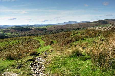
Lake District Walk
Nat Park - Lake District - Lake District Far Eastern Fells
County/Area - Cornwall
Author - Lou Johnson
Length - 10.0 miles / 16.3 km Ascent - 1200 feet / 364 metres
Time - 6 hours 10 minutes Grade - moderate
Walk Route Description
Click image to see photo description.
Starting from Staveley, this Lake District walk explores the Kentmere Valley following a route across the higher ground to the east of the valley. The walk includes Stevely Head Fell, the flanks of Green Quarter Fell to reach the village of Kentmere. The return route keeps to lower ground passing Kentmere Tarn to follow the River Kent back to Staveley. The walk also offers some glorious views in fine weather.
The start is the centre of Staveley village (grid ref. SD470984) where limited on street parking is available near the village hall. After parking take the road signed to Kentmere and continue for 350 metres to reach Barley Bridge. Turn right signed to Burneside, cross the bridge and fork left into Hall Lane. The lane climbs steadily out of the valley and after two kilometres you reach Park House, a group of buildings on your left. Continue ahead up a clear track which runs between walls. Reaching a small enclosure continue ahead into open country (grid ref. NY469014). Continuing following the track across the western shoulder of Staveley Head Fell ignoring bridleways on your left.
Pass through a gate (grid ref. NY469019) and stay on the clear track. Nearing a ruined building, fork left over Birk Rigg. The track soon forks again, either path leads to the same point. Continue ahead to a gate in a wall corner. Pass through the gate and follow a clear path heading north. Reaching a ruined barn on your left, turn left at a waymark (grid ref. NY473033) onto a bridleway heading southwest. Continue to pass through a gate in a wall corner. After 150 metres, turn right and continue through another gate. The onward path initially heads half-left, crosses Nuttera Beck and then swings right and descends through fields across the western flank of Green Quarter Fell to reach Lowfield lane and the hamlet of Green Quarter.
Bear right along the lane which swings left in the centre of the hamlet. Descend to the first junction and fork left down Hellwell Lane. Reaching a T-junction with the main valley road, turn right and continue into Kentmere village. Reaching the small church (on your right), fork left off the lane (to the left of railings with white posts) to join a track (Hodgson Brow). Which leads to Kentmere Hall. Just past a farm, turn left (grid ref. NY452042) onto a signed footpath leading south. Cross Hall Gill and continue ahead to a wooden gate. A track leads through a field before entering Hall Wood. Athe first junction fork right and shortly atter fork right and continue to exit the wood.
The path continues south across a field with Kentmere Tarn on your left. Maintain direction through a plantation, exit the trees and continue through a factory site. At the end of the buildings, ignore the track heading left, and bear right to follow the access road to a house (grid ref. NY454017). Bear left along a path enclosed with railings, cross a footbridge over Park Beck, and continue along a walled track.to a T-junction. Turn left. Just before the River Kent turn right onto a path which leads to Browfoot Lane (grid ref. NY454007). Turn left and follow the lane for two kilometres to Scraggs Bridge.
Cross the river and turn right along a driveway. Reaching a house on the right, turn left onto a path. Cross one field following the right-hand field edge. Reaching a walled lane, turn right and continue through to Hall Lane. Bear right, cross Barley Bridge and then left to return to Staveley.
Maps 

| Ordnance Survey Explorer OL7 | Sheet Map | 1:25k | BUY |
| Anquet OS Explorer OL7 | Digital Map | 1:25k | BUY |
| Ordnance Survey Digital Map Subscription | |||
| Latest Ordnance Survey Discounts | |||
Other walks nearby
| Walk 1049 | Staveley Tarns circular | easy/mod | 6.0 miles |
| Walk 1555 | Brunt Knott from Staveley | easy/mod | 7.0 miles |
| Walk 1463 | School Knott & Grandsire from Ings | easy/mod | 6.5 miles |
| Walk 3590 | Orrest Head & Allen Knott from Windermere | easy | 4.4 miles |
| Walk 1320 | Shorter Kentmere Horseshoe | mod/hard | 10.5 miles |
| Walk 2652 | Photographer's Kentmere Horseshoe | mod/hard | 13.5 miles |
| Walk 2488 | Shipman Knotts & Kentmere Pike | moderate | 6.2 miles |
| Walk 3451 | Underbarrow, Lord's Lot and Crossthwaite | easy/mod | 5.6 miles |
| Walk 1147 | Longsleddale and Kentmere Pike | moderate | 8.0 miles |
| Walk 3033 | Tarn Crag & Harrop Pike from Sadgill | moderate | 5.5 miles |
Recommended Books & eBooks
Walking the Lake District Fells - Buttermere
 Part of the Walking the Lake District Fells series, this guidebook covers a wide range of routes to 32 Lakeland summits that can be climbed from the Buttermere, Lorton and Newlands valleys, with highlights including Haystacks, High Stile, Grasmoor and the fells of the Coledale Round. Suggestions for longer ridge routes are also included.
More information
Lake District: Low Level and Lake Walks
 This guidebook describes 30 of the best low-level walks in the Lake District. From delightful wooded glades and sparkling tarns, to waterfalls and glacier-carved valleys towered over by craggy mountains. The walks described aim to seek out the best walking that the lower areas of the Lake District have to offer.
More information
