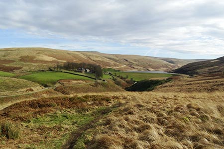
Black Hill & Four Reservoirs from near Wessenden Head
South Pennines Walk
Nat Park - Peak District - Black Hill Dovestone
Region - South Pennines
County/Area - West Yorkshire
Author - Paul Webb
Length - 10.0 miles / 16.3 km Ascent - 1190 feet / 361 metres
Time - 6 hours 10 minutes Grade - moderate
Walk Route Description
Click image to see photo description.
This is a very nice Peak District walk on a fine day with good open views of the Yorkshire valleys and the open expanses of moorland. It's a good mixture of erosion-saving stone paving for quicker progress and getting covered in peat moss for the rest. On a low cloud day it's better described as crossing a bog in the fog - an experience in itself!
Park on the roadside on the A635 where it joins the Wessenden Head Road coming up from Meltham (Grid ref. SE076073). There's usually an excellent snack caravan here for a good start breakfast and a well earned tea and cakes at the end.
From the road, 50 yards SW of the junction take the signposted Pennine Way SSE on a stone flagged section which will take you all the way across Dean Clough and Black Dike and up the impressive Issue Clough to the peat bog which is Black Hill. At the OS trig. point on Black Hill (now well accessible because of the stone flagging) it may not be immediately obvious (especially in cloud) where the path starts for the next section, which is NW towards Dean Head Moss. You are safe to walk on a bearing from the trig. point keeping slightly to the right and you will find cairns and posts to assist. This is beautiful open moorland and is a lesser used path for those who prefer some solitude.
Crossing the A635 again at the car park (Grid ref. 051064) carry on NW across Featherbed Moss, White Moss and NNW to the southern point of Black Moss Reservoir. About one third of this section is stone flagged. The rest is in and out of peat bog with cairns and posts to assist route finding.
Here you join the Pennine Way again heading east past Swellands Reservoir on your left and down Blakely Clough. At Grouse Butts stay on the main path which contours southwest around delightful weirs and waterfalls and eventually down to cross the dam at Wessenden Reservoir.
Turn right once you are over the Dam and make sure you have saved some energy for a steady climb for the last one and a half miles up to Wessenden Head and the road back to your vehicle.
NOTE : I did a walk today which included part of the above route and found that the path from the foot of Blakely Clough around the weirs to the dam of Wessenden Res is currently closed because of subsidence.(OL1 Dark Peak map GR051085). The diversion is via the route now shown as the Pennine Way on the latest version of OL1. The details are: From the water tank at the foot of Blakely Clough (GR052088), bear left down the steep path to the bridge over Wessenden Brook. On the other side go up the path to join the Wessenden track at GR053090 and turn right to rejoin the original route at the Wessenden Reservoir dam adjacent to Wessenden Lodge." - Peter Schofield 9/11/2005
PS - Afterwards, if you have the time and energy, take the short permissive path from the Wessenden Head Road, for one mile north of the junction, up to West Nab for some splendid views.
Maps 

| Ordnance Survey Explorer OL1 | Sheet Map | 1:25k | BUY |
| Anquet OS Explorer OL1 | Digital Map | 1:25k | BUY |
| Ordnance Survey Digital Map Subscription | |||
| Latest Ordnance Survey Discounts | |||
Other walks nearby
| Walk 2561 | Digley & Ramsden Reservoirs from Wessenden Head | moderate | 9.5 miles |
| Walk 1583 | Digley Reservoir | easy/mod | 5.0 miles |
| Walk 2630 | Upper Holme Valley & Ramsden Clough | moderate | 9.0 miles |
| Walk 2719 | Huddersfield's green fringe | easy/mod | 10.0 miles |
| Walk 1829 | Holme & Marsden Clough from Ramsden Reservoir | moderate | 9.0 miles |
| Walk 2613 | Boundary Walk from Marsden | moderate | 13.0 miles |
| Walk 2359 | Cuckoo Walk & Bacon Butties from Marsden | hard | 19.5 miles |
| Walk 2644 | Marsden and the Standedge Trail | moderate | 11.0 miles |
| Walk 2926 | Cupwith & Shooter's Nab from Marsden | moderate | 13.0 miles |
| Walk 2946 | Buckstones and Linsgreave Head from Marsden | moderate | 8.8 miles |
Recommended Books & eBooks
Dark Peak Walks
 Guidebook to 40 walks in the Dark Peak area of the Peak District National Park. 35 circular routes for most abilities, from 8km to 19km, around Edale, Marsden, Fairholmes, Baslow and Castleton, including Kinder Scout and Mam Tor, and 5 longer (25km to 45km) routes highlighting the best of the Gritstone Edges, High Moorland and Deep Valleys.
More information
Great Mountain Days in the Pennines
 An inspirational guidebook to 50 classic walks on the rolling Pennine landscape. The graded routes, between 6 and 13 miles in length, cover classic Pennine fells and moorland such as Whernside, Ilkley Moor and Pendle Hill; exploring the North and South Pennines, Yorkshire Dales, Howgills and Dark Peak. Many routes are also suited to fell running.
More information
