Cadair Idris from Llanfihangel-y-pennant
Snowdonia/Eryri Walk
Nat Park - Snowdonia - Cadair Idris
County/Area - Gwynedd
Author - Lou Johnson
Length - 10.0 miles / 16.3 km Ascent - 3500 feet / 1061 metres
Time - 8 hours 30 minutes Grade - mod/hard
Walk Route Description
Click image to see photo description.
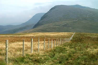
Cadair Idris is a great mountain and sees many visitors to its fine summit each year. Most walkers use either the pony path from the north or the southern approach using the Minffordd path. This route starts near the village of Llanfihangel-y-pennant and climbs steadily on the southern section of the pony path and descends by a less well-known route back to the start.
Limited parking is available on the verge just before the bridge over the Afon Cadair (Grid ref. SH673095) or in the village carpark at Llanfihangel-y-pennant which adds a little extra mileage to the walk. Cross the bridge over the Afon Cadair and bear right following the track signed to Cadair Idris. This climbs steadily up the valley to reach a ford just past Hafotty Gwastadfryn from where the route steepens briefly before easing for the climb up to the col east of Carnedd Lwyd. From here the views open out and you get a grand panorama looking north.
Turn right at the Col to follow the clear path rising towards the summit of Cadair Idris. At the first clear junction bear left to take the secondary path to the summit of Cyfrwy from where there is an excellent view down to Llyn y Gadair far below. Keeping the steep drop into the cwm on your left continue to the summit of Cadair Idris with its trig point and stone shelter.
Descend south west with Llyn Cau below you on your left following the upper stages of the Minffordd path to reach a col. A steep climb takes you onto the summit of Craig Cwm Amarch. Using the fence as a guide walk just south of west following the crest of a clearly defined ridge to Mynydd Pencoed. Maintaining the same line descend for a short way until the ground steepens and then trend right to the small farm buildings at Pencoed (Grid ref. 685111). Be careful however of the steep ground and hidden crags. Also note that this section of the route is not shown as footpath on maps even though there is evidence of one on the ground.
Reaching Pencoed locate the footpath marked on the OS Outdoor Leisure map and descend through fields to join a track. Turn left and follow this back to the road and the start.
Maps 

| Ordnance Survey Explorer OL23 | Sheet Map | 1:25k | BUY |
| Anquet OS Explorer OL23 | Digital Map | 1:25k | BUY |
| Ordnance Survey Digital Map Subscription | |||
| Latest Ordnance Survey Discounts | |||
Other walks nearby
| Walk 1643 | Llanfihangel-y-pennant & Castell y Bere | easy/mod | 6.8 miles |
| Walk 3582 | Castell y Bere & Llanfihangel-y-pennant from Abergynolwyn | easy/mod | 5.7 miles |
| Walk 1309 | Tarren y Gesail | moderate | 8.0 miles |
| Walk 3230 | Tarrenhendre from Abergynolwyn | easy/mod | 5.0 miles |
| Walk 1851 | Cregennen Lakes & Pared y Cefn-hir | easy/mod | 2.5 miles |
| Walk 1172 | Cadair Idris by the Pony Path | mod/hard | 11.0 miles |
| Walk 2668 | Cadair Idris, Craig Cau and Cyfrwy by the Pony Path | mod/hard | 5.3 miles |
| Walk 1204 | Cadair Idris Minffordd Path | mod/hard | 6.0 miles |
| Walk 2100 | Circuit of Cadair Idris from Minffordd | mod/hard | 11.0 miles |
| Walk 3229 | Mawddach circular | moderate | 9.0 miles |
Recommended Books & eBooks
The Cambrian Way
 Guidebook to the Cambrian Way, a challenging three-week mountain trek through Wales from Cardiff to Conwy. The 470km un-waymarked route is presented from south to north. Often sticking to long, beautiful ridgelines, it crosses wild and rugged terrain and visits many of Wales's highest mountains, including Snowdon.
More information
Snowdonia: 30 Low-level and easy walks - North
 Guidebook describing 30 walks in Snowdonia, Wales. Routes are mostly low level and on clear paths and showcase the region's beautiful scenery and rich history and culture. Part of a 2-volume set, this northern volume includes the Snowdon area, the Ogwen and Conwy Valleys, Betws-y-Coed, Beddgelert, Ffestiniog and the coast.
More information
