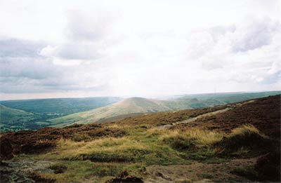
Kinder Scout and Castleton Ridge from Hope
Peak District Walk
Nat Park - Peak District - Kinder Scout Edale
County/Area - Derbyshire
Author - Jake Robertson
Length - 13.5 miles / 21.9 km Ascent - 2800 feet / 848 metres
Time - 9 hours 30 minutes Grade - mod/hard
Walk Route Description
Click image to visit gallery of 2 images.
Crookstone Knoll, on the eastern tip of Kinder Scout, makes for a good excuse to get your walking boots on and head for the hills to explore a quieter area of the Kinder plateau. This Peak District walk sets out from Hope, climbs up to Crookstone Knoll then crosses peat bogs to join the edge path to Grindslow Knoll, another superb viewpoint. The return is over a section of the Great Ridge above Castleton making for a walk full of contrasts.
The start is the village of Hope where the car park is located on the Castleton side of the village on the south side of the A6187 (Grid ref. SK171834). Leave the car park and turn right and then first left onto the road to Edale. Follow this for a quarter of a mile turning right down a track to Killhill Bridge and eventually over to Fullwood Stile Farm and a road (Grid ref. SK 171849).
This road becomes a track and climbs slowly up the hillside along the route of a former Roman Road to reach Hope Cross (Grid ref. SK 161874). To your left the bulk of the eastern sector of the Kinder Plateau looms above. Continue along the track past a signpost to reach a wall. On the other side of the wall an National Trust sign marks the boundary of Open Country.
Turn immediately left and follow a path climbing over Crookstone Hill to a wall where the pastures are left as the path winds over the grouse moor above Jaggers Clough. The path climbs between two disused quarries to meet the edge path. Go right to Crookstone Knoll, a short distance away. This is Kinder's most easterly point and it is a fine vantage point and place to have a stop.
Madwoman's Stones should be visible to the west and they are easily reached. If you were thinking that they might explain their curious name you're sadly wrong. From the Stones, continue roughly westwards to the OS column (Grid ref. SK 129878), which is visible over a section of groughs and peat bogs, keeping you compass on a fixed bearing.
From the trig point marking Kinder's fine eastern summit take a bearing on Nether Tor (Grid ref. 125876) where the popular edge path is reached after more groughs and bogs. From here a clear path leads over Hartshorn to Fox Holes at the head of Grindsbrook Clough then on to the distinctive summit of Grindslow Knoll (Grid ref. SK 110868). This is a lovely top with good views of Grindsbrook's dramatic ravine and of the Woolpacks away to the west.
Drop steeply down on a path heading southeast, crossing a moor before a final drop to meet the Pennine Way. Turn left along the Pennine Way for a quarter of a mile to reach the road at Edale. Walk right down the road to meet the main road through the valley (Grid ref. SK 124853). Turn left and after half a mile a signposted path on the right takes you up onto the ridge at Hollins Cross.
Follow the ridge path over Barker Bank, turning left over a stile to climb the impressive Back Tor and on to Lose Hill. Lose Hill is another nice viewpoint and the useful topograph adds interest. Descend south-eastwards along the ridge to reach Townhead. Go right down a track to Townhead Bridge then right again for an easy road finish back into Hope village.
Maps 

| Ordnance Survey Explorer OL1 | Sheet Map | 1:25k | BUY |
| Anquet OS Explorer OL1 | Digital Map | 1:25k | BUY |
| Ordnance Survey Digital Map Subscription | |||
| Latest Ordnance Survey Discounts | |||
Other walks nearby
| Walk 1087 | Mam Tor & Cave Dale | moderate | 6.5 miles |
| Walk 1519 | Catleton & Speedwell Cavern Circular | easy | 4.3 miles |
| Walk 1521 | Cave Dale and Winnats Pass | easy | 4.5 miles |
| Walk 1665 | Hollins Cross & Lose Hill | easy/mod | 6.0 miles |
| Walk 3426 | Lose Hill & Hollins Cross | easy/mod | 5.0 miles |
| Walk 1080 | Shatton Moor and Offerton | easy/mod | 7.5 miles |
| Walk 2588 | Win Hill & Hope Cross | moderate | 7.5 miles |
| Walk 1688 | Old Dam & Sparrowpit from Mam Nick | moderate | 9.0 miles |
| Walk 3620 | Bretton Clough & Abney Moor | easy/mod | 6.0 miles |
| Walk 1270 | Abney Circular | easy/mod | 7.2 miles |
Recommended Books & eBooks
Walking in the Peak District - White Peak East
 Guidebook describing 42 half-day and day walks in the limestone landscapes of Derbyshire's White Peak, part of the Peak District National Park. One of two volumes, this book covers the east of the region, with potential bases including Bakewell, Eyam, Castleton, Birchover, Matlock and Wirksworth.
More information
Great Mountain Days in the Pennines
 An inspirational guidebook to 50 classic walks on the rolling Pennine landscape. The graded routes, between 6 and 13 miles in length, cover classic Pennine fells and moorland such as Whernside, Ilkley Moor and Pendle Hill; exploring the North and South Pennines, Yorkshire Dales, Howgills and Dark Peak. Many routes are also suited to fell running.
More information
