Stanage Edge, Redmires & Hallam Moors
Peak District Walk
Nat Park - Peak District - Gritstone Edges Higger Tor
County/Area - South Yorkshire
Author - Mike Bexley
Length - 8.5 miles / 13.8 km Ascent - 1000 feet / 303 metres
Time - 5 hours 20 minutes Grade - easy/mod
Walk Route Description
Click image to visit gallery of 5 images.
This pleasant and varied Peak District walk is not to be hurried. It provides superb views with very little effort. All paths and the route are easy to follow. You can start from Moscar Heights on the A57 Sheffield to Ladybower Reservoir road or at Redmires Reservoir on the outskirts of Sheffield.
This description is based on starting from Moscar Heights (Grid ref. SK242884) where there is a small parking area on a un-classified road just off the A57. It is approached by a short winding lane climbing north near the corner opposite Hollow Meadows.
After parking, set off west (left) on the muddy bridleway to Moscar Cross Farm turning left on reaching the wall ahead, through a five bar gate down to the main road, passing the impressive Moscar Lodge on the right with its etched window. Turn right to cross over the main road and follow the footpath sign left.
Go over a stile marked 'dogs to be kept on the lead on this footpath '. On reaching a fork, keep to the left path in a gully. Continue to steadily climb up to Stanage End then follow the path left up to the higher ground. Then go right to head in the same general direction, south, following the edge.
Stanage Edge is a popular playground for climbers and you will no doubt hear their shouts and gear rattling as you enjoy your walk. For walkers it offers unrestricted views across Moscar Moor to Win Hill. You will notice numbers carved into the rocks on the ground with shallow depressions and channels to direct water to these carved depressions. These are all shotgun positions with water for the dogs when grouse shooting on the moor.
Follow the edge passing the High Nab trig point. On reaching the sandy Long Causeway (Grid ref. SK 241 844) turn left to follow this old track towards Stanage Pole (Grid ref. SK 247 844). The iron clad wooden pole marks the southernmost point of Yorkshire with the surrounding rocks having many carved names and dates.
Continue along the rutted bridleway, now showing signs of severe erosion due to off-road four wheel drive vehicles and trail bikes. On reaching the Redmires (Grid ref. SK 256 853) turn left with the reservoir on your right. Keep on this road passing the car park. (there is also plenty of parking on the road if the car park is full) until you are level with the dividing wall between the two reservoirs.
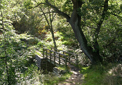
Turn left through a gate and follow the man made ditch or conduit. The well made path with its gates curves left. Look out for the second footpath on you right over the stile next to a five bar gate opposite a bridge over the Conduit (Grid ref. SK 260 858). The clear path rapidly descends down the moor to a footbridge over Hollow Meadows Brook. It continues up over a wall. Then with a wall and gate on your left, proceed to the wall stile near the five-bar gate on to the main road.
Cross the road to the stile on the right and straight up the field to a wall stile, to the right of the gate. Then continue over a series of wall stiles heading for Crawshaw Lodge visible ahead (Grid ref. SK 261 883). The path ends in a very steep but short climb and a further stile to the road. Turn left for a two kilometre walk along the quite road to the start.
Maps 

| Ordnance Survey Explorer OL1 | Sheet Map | 1:25k | BUY |
| Anquet OS Explorer OL1 | Digital Map | 1:25k | BUY |
| Ordnance Survey Digital Map Subscription | |||
| Latest Ordnance Survey Discounts | |||
Other walks nearby
| Walk 2235 | Bamford & Stanage Edges | moderate | 9.9 miles |
| Walk 3540 | The Derwent Edge from Cutthroat Bridge | moderate | 10.0 miles |
| Walk 1541 | Redmire, Stanage & Ughill Moor circular | moderate | 13.0 miles |
| Walk 1580 | Redmires Reservoir | easy | 2.5 miles |
| Walk 1578 | Dale Dike Reservoir | easy | 2.5 miles |
| Walk 1285 | Dungworth & Rod Moor | moderate | 9.4 miles |
| Walk 1577 | Low Bradwell & Agden Reservoir | easy | 3.5 miles |
| Walk 1754 | Agden Reservoir Circular | easy/mod | 4.8 miles |
| Walk 1090 | Stanage Edge | moderate | 7.0 miles |
| Walk 1579 | Damflask Reservoir | easy | 3.5 miles |
Recommended Books & eBooks
Great Mountain Days in the Pennines
 An inspirational guidebook to 50 classic walks on the rolling Pennine landscape. The graded routes, between 6 and 13 miles in length, cover classic Pennine fells and moorland such as Whernside, Ilkley Moor and Pendle Hill; exploring the North and South Pennines, Yorkshire Dales, Howgills and Dark Peak. Many routes are also suited to fell running.
More information
Dark Peak Walks
 Guidebook to 40 walks in the Dark Peak area of the Peak District National Park. 35 circular routes for most abilities, from 8km to 19km, around Edale, Marsden, Fairholmes, Baslow and Castleton, including Kinder Scout and Mam Tor, and 5 longer (25km to 45km) routes highlighting the best of the Gritstone Edges, High Moorland and Deep Valleys.
More information
