The River Severn from Hampton Loade to Bridgnorth
Shropshire Walk
County/Area - Shropshire
Author - Lou Johnson
Length - 6.0 miles / 9.8 km Ascent - 120 feet / 36 metres
Time - 3 hours 10 minutes Grade - easy/mod
Walk Route Description
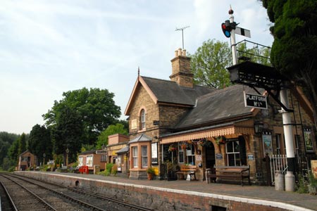
Click image to visit gallery of 9 images.
This linear walk follows the Severn Way along the west bank of the River Severn from the small village of Hampton Loade to Bridgnorth. The return is made using the Severn Valley Railway which operates steam trains for many of its services. Do note that there are some times of the year when the railway does not operate so check timetables before starting the walk.
The start is the small station at Hampton Loade (grid ref. SO744862). This reached using a lane leading down from the B4555 Bridgnorth to Highley road to the River Severn. Parking at the station is permitted if you travel on the railway. After parking make your way down to the riverside and turn left upstream walking with the river on your right. Almost immediately you pass the un-powered river ferry that operates in season.
Continue along the river walking through the camp site. The walking is easy and the path well trodden. On your left you will see Severn Valley trains passing at regular intervals. The walk requires very little description as you head upstream towards Bridgnorth. Just enjoy the walk. As you approach Bridgnorth there is one short diversion off the riverbank onto a road. However within 100 metres or so you are back alongside the river.
Reaching the main road bridge across the Severn at Bridgnorth you have two options. The most direct option is to turn left along the main road (i.e. don't cross the bridge) and follow this round to the Severn valley railway station, the entrance to which is some way round on the left. The better option is to explore Bridgnorth and to do this you can take the funicular railway up the cliff (small charge applicable). At the top you can visit the town centre, visit Telford's Church, see the ruined castle or relax in the gardens by the castle. There is also a wide choice of places for refreshments.
On completion of your exploration, cross the footbridge over the valley from just below the castle gardens to the SVR station. Enjoy the atmosphere and chug quietly down the valley back to the start.
Maps 

| Ordnance Survey Explorer 218 | Sheet Map | 1:25k | BUY |
| Anquet OS Explorer 218 | Digital Map | 1:25k | BUY |
| Ordnance Survey Digital Map Subscription | |||
| Latest Ordnance Survey Discounts | |||
Other walks nearby
| Walk 2092 | Highley from the Severn Valley Country Park | easy/mod | 4.5 miles |
| Walk 1451 | Dudmaston Estate circular | easy | 4.0 miles |
| Walk 3504 | Highley to Bewdley along the River Severn | easy/mod | 7.0 miles |
| Walk 1933 | Wyre Forest & River Severn from Upper Arley | easy/mod | 7.6 miles |
| Walk 2466 | The Severn Valley from Trimpley Reservoir | easy | 6.0 miles |
| Walk 2874 | Enville Estate and the Sheepwalks | easy | 4.0 miles |
| Walk 2288 | Pound Green and Dowles Brook from Hawkbatch | easy | 5.0 miles |
| Walk 1603 | Shatterford Wood and Castle Hill circular | easy/mod | 5.5 miles |
| Walk 3003 | Kinver Edge & Blakeshall from Holy Austin Rock | easy | 4.3 miles |
| Walk 2834 | Kinver Edge circular | easy | 4.2 miles |
Recommended Books & eBooks
Hillwalking in Shropshire
 Guidebook to 32 walking routes in Shropshire in the West Midlands. The routes range from 3 miles (5km) to 12 miles (19km), taking in highlights such as The Wrekin, Wenlock Edge, Long Mynd and Stiperstones, Castle Ring and Bury Ditches. Many routes start near delightful towns and villages including Church Stretton, Ludlow and Bishops Castle.
More information
