Melynllyn & Dulyn Reservoir from Llyn Eigiau parking
Snowdonia/Eryri Walk
Nat Park - Snowdonia - Eastern Carneddu
County/Area - Conwy
Author - Lou Johnson
Length - 5.5 miles / 8.9 km Ascent - 900 feet / 273 metres
Time - 3 hours 40 minutes Grade - easy/mod
Walk Route Description
Click image to see photo description.
The Carneddau Mountains form the largest area of high ground in England and Wales rising to over 3000 feet above sea level. This walk does not visit any of the peaks in the range but still captures the flavour of the wild country in this part of Snowdonia (Eryri). The outward half of the route is easy to follow but some navigational skills are required for the return. Suitable boots are needed and there are no refreshment opportunities. Also be prepared for rapid changes in the weather.
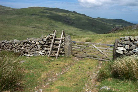
The start of this Snowdonia (Eryri) walk is the small parking area for Llyn Eigiau (grid ref. SH731662), which is reached by a narrow lane from Tal-y-bont on the B5106 Conway to Betws-y-coed road. After parking take the clear track heading north-west. Cross the stile and take the track past the sheepfold (grid ref. SH725667). Continue along this track as it climbs around the northern flank of Clogwynyreryr to enter a broad valley. The track continues climbing and after just under two miles you pass a ruin (grid ref. SH706656) where the track bends right and heads north-west to the corner of Melynllyn Reservoir.
From here a clear path heads north down to the shores of Dulyn Reservoir, which like Melynllyn has a backdrop of impressive crags. From here take the footpath on the north side of the valley (Pant y Griafolen) for about a mile and a quarter to cross Afon Garreg-wen at grid ref. SH717675. Turn right just after this point heading almost due east walking downhill towards a dam. You will near to cross the Afon Dulyn below the dam. Choose the shallowest point as there is no bridge. Pick up the track on the other side and continue to the derelict farm of Maeneira (grid ref. SH727673).
From here continue south along a clear path/track to rejoin the outward route at a sheepfold. Cross the stile and head southeast along the track back to the start.
Maps 

| Ordnance Survey Explorer OL17 | Sheet Map | 1:25k | BUY |
| Anquet OS Explorer OL17 | Digital Map | 1:25k | BUY |
| Ordnance Survey Digital Map Subscription | |||
| Latest Ordnance Survey Discounts | |||
Other walks nearby
| Walk 2592 | Llyn Geirionydd & Llyn Bychan from Llyn Crafnant | moderate | 9.5 miles |
| Walk 2608 | Crimpiau & Creigiau Gleision from Llyn Crafnant | moderate | 7.5 miles |
| Walk 2679 | Circuit of Llyn Crafnant | easy | 3.5 miles |
| Walk 3061 | Eastern Carneddau from near Rowen | mod/hard | 10.5 miles |
| Walk 2547 | Carnedd Llewelyn from near Rowen | mod/hard | 12.0 miles |
| Walk 2536 | Llyn Crafnant, Capel Curig & Llyn Colwyd from Trefriw | mod/hard | 13.0 miles |
| Walk 2285 | Llyn Geirionydd & Llyn Crafnant | easy/mod | 5.5 miles |
| Walk 3056 | Pen yr Helgi Du from Ogwen Valley | moderate | 5.5 miles |
| Walk 1232 | Carnedd Llewelyn, Llyn Eigiau & Llyn Cowlyd | hard | 16.0 miles |
| Walk 2855 | Gallt yr Ogof & Braich y Ddeugwm | moderate | 4.0 miles |
Recommended Books & eBooks
Mountain Walking in Snowdonia
 Guidebook to 40 of Snowdonia's best day walks, with routes up Snowdon and Tryfan, including the Snowdon Horseshoe, Cadair Idris, Y Garn and The Rhinogs. The routes range from Grade 1 scrambles like Crib Goch or Bristly Ridge, to riverside and forest walks. Includes details of a 2-day traverse of all 15 of Snowdonia's 3000ft peaks.
More information
The Cambrian Way
 Guidebook to the Cambrian Way, a challenging three-week mountain trek through Wales from Cardiff to Conwy. The 470km un-waymarked route is presented from south to north. Often sticking to long, beautiful ridgelines, it crosses wild and rugged terrain and visits many of Wales's highest mountains, including Snowdon.
More information
