Cairn Toul Circular from Coylumbridge
Cairngorms Walk
Nat Park - Cairngorms - Cairngorm North
County/Area - Highland
Author - Peter Smyly
Length - 26.5 miles / 43.1 km Ascent - 6100 feet / 1848 metres
Time - 19 hours 20 minutes Grade - severe
Walk Route Description
Click image to visit gallery of 12 images.
This walk includes three of the highest mountains in Scotland, Braeriach (4,252 feet), Cairn Toul (4,236 feet) and Sgor an Lochain Uaine (4,127 feet). Another Munro, the Devil's Point, is close at one point, but not included on this walk due to serious overall time constraints. It would be a different matter if doing the walk over two days. The walk is so long that it is often spread over two days with an overnight stop at somewhere like the Corrour Bothy. These high peaks of the Cairngorms to the west of the Lairig Ghru valley are among the most remote and inaccessible in Scotland. Therefore, to climb them in one day requires a long approach and return route, wherever you start from. The route avoids the boulder-filled ravine of the Chalamain Gap which may be significant for those who do not like traversing it. However, there are sections of the walk where the terrain is similar, though for relatively short sections and distances.
This is not a walk to be undertaken lightly as, not only does it include three of the highest UK summits, it is very long and it passes through some very remote and rugged terrain several miles from civilisation. To complete it in one very long day requires strong powers of endurance to keep going for long hours with minimal time spent stopping to rest. Weather conditions in the Cairngorms can often be cold, harsh and unforgiving even in summer and therefore appropriate extra clothing should be taken. The route involves a long walk along a valley before starting the main ascent. Therefore "peak" is the word when it comes to physical fitness.
When planning the walk, the following considerations should apply in order to do it in one day only. An early start makes sense as the walk may take twelve hours or more to complete and it should be done in summer when there are long hours of daylight. It is also best to choose a day with a good weather outlook, partly to enjoy the magnificent views, but also the long, high plateau between the higher points of the main ridge could well be a confusing place in mist.
It is also recommended that bikes are hired for the first few miles through part of the Rothiemurchus Forest as far as Piccadilly, a route that it reversed at the end of the walk. As an idea, a timetable should look something like the table below. The schedule allows occasional brief stops of a few minutes at a time, therefore the estimated times should be adjusted in the event of longer stops.
Coylumbridge to Piccadilly - Cycle - 1 hour
Piccadilly to Corrour Bothy - Walk - 4 hours
Corrour Bothy to Cairn Toul summit - Walk - 2 hours
Cairn Toul summit to Braeriach summit - Walk - 2 hours
Braeriach summit to Piccadilly - Walk - 2 hours
Piccadilly-Coylumbridge - Cycle - 1 hour = TOTAL 12 hours
Start by cycling from Coylumbridge and turn off road to the south along a cycle track through the Rothiemurchus Forest, passing a small camping area on the left and follow the main track ahead. There are a few points along this route where you have to stop to open and then close gates behind you and landmarks are few. This is the easiest stretch of track to cycle along and progress should be quick. Cross the Cairngorm Club Footbridge over the Allt Druidh river and continue along a more bumpy track with the river now on the right. After a few hundred yards, a path appears on the right and this point is known as Piccadilly. Stop here in accordance with a sign asking cyclists to dismount and follow another sign for the Lairig Ghru. Unless you are an experienced mountain biker, there is nothing to be gained by trying to continue cycling along here as the path is frequently narrow and bumpy and it goes uphill in places as the path gains height with the Allt Druidh appearing way below on the right.
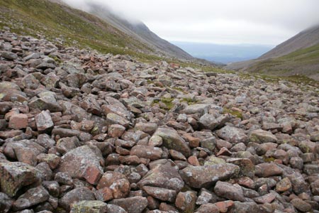
On emerging from the forest, a path appears on the left from Rothiemurchus. Continue to follow the path ahead along the Lairig Ghru, a long, wide, rugged and remote valley that cleaves the main high peaks of the Cairngorms. Further up the valley, after about a mile, another path, from the direction of the Chalamain Gap also comes in from the left as the river on the right disappears under a pile of rocks on the left of the path, an unusual feature. The path goes uphill for a short distance and divides, the path to the right heading up Sron la Lairige while the path ahead leads further along the Lairig Ghru valley. It is at this point that the rest of the walk comprises a circular route. Therefore, the route could be done in an anti-clockwise direction but this route goes the other way round along the valley to the Corrour Bothy. The ground underfoot is often stony and rugged and height is gained as far as a cairn before the valley drops down again long before the bothy is reached with the Devil's Point seen to the right in the distance beyond the Pools of Dee. The Pools of Dee are a useful landmark, a few small, shallow tarns in the valley that swell in size after heavy rainfall, sometimes covering part of the main path. High up to the left a rushing waterfall, the March Burn, tumbles down from the skyline. After leaving the Pools of Dee, it can take as long as two more hours to reach the bothy. The best option from the pools is to go to the left of the rushing river ahead to follow a clear path. Following the narrower path to the right leads to difficulties later on for three reasons: the path eventually goes off to the right which is not the way to go, the rushing river to the left offers little or nothing in the way of crossing opportunities depending on the water level (another river coming in from the right to join this river complicates matters) and thirdly, even if a way across is found, to get on to the main path involves crossing terrain which in places includes bog and heather with hollows below. This is not the best use of time and effort, especially when the main part of the climb is still ahead.
The stretch of valley between the Pools of Dee and the bothy may seem longer than it actually is, but in the right weather, the view to the right offers an inviting preview as to what follows next once the climb begins in earnest. From left to right, the mountains line up in a row - the Devil's Point, Stob Coire an t-Saighdeir, Cairn Toul and Braeriach. The outflow of Lochan Uaine is also seen as a long cascade tumbling down the felllside to the side valley below.
The bothy is not seen until within a few hundred yards of it and a footbridge provides access across the river. The granite cliffs of the Devil's Point tower above to the left while a clear footpath to the left of the bothy leads up Coire Odhar past the river the Allt a' Choire Odhair on the right to begin with, up to the col, crossing some cascades just before the col is reached. Now follow the stony ridge up to the right of the col, with a path appearing in places and skirt round on the top of Stob Coire an t-Saighdeir. Although this summit is considered to be a "top" rather a Munro it is in fact higher than the Devil's Point which is classified as a Munro. The view across Coire an t-Saighdeir to Cairn Toul shows clearly the next objective, the pyramid-like form of Cairn Toul. Another forty minutes of descent and re-ascent should allow Cairn Toul's summit to be reached, in places clambering up over rocks reminiscent of the Chalamain Gap. There are two cairns on Cairn Toul's rocky summit ridge and it may not be immediately apparent which is the higher but it is in fact the one to the north. The Corrour Bothy and the Lairig Ghru are now seen a long way below beyond the corries overlooked by Cairn Toul. The rim of the corrie may well feature a snow cornice as these features tend to linger even in the summer.
This is a rare walk where the first main objective, in summit terms, is not reached until several hours of the walk have already elapsed. In the right weather conditions, the views are excellent with the cliffs of Braeriach seen to stark effect with snow patches often formed at the rims of corrie tops, and Sgor an Lochain Uaine (The Angel's Peak) seen in between. The dome shape of Cairngorm and the ridge leading to Ben Macdui can be seen across the great divide of the Lairig Ghru.
One day in June 2012, a large snow cornice was present just a few feet below the col, providing a foreground to the blue water of Coire Lochain below. The ascent to the Angel's Peak follows a similar pattern of an occasional path and rocks underfoot with a small cairn crowning the top. Descending to the other side, the pull up to the next plateau is offset by the dramatic cliffs to the right and the waterfall of the Falls of Dee streaming down, fed by the Wells of Dee. The walk to Braeriach via Carn na Criche involves mostly striding out across a broad plateau followed by the sloping felllside up to its top but some ingenuity may be required to cross a stream which passes under a snow field to the right before plunging down cliffs as a waterfall that is seen from afar, the Falls of Dee.
In good visibility, the summit plateau of Braeriach presents no route-finding difficulties and the foreground cliffs above Coire Bhrochain are starkly apparent, often containing lingering patches of snow in summer. The summit cairn sits just a few feet from the edge on a stony plateau. The view across to Cairn Toul with Lochan Uaine in its lap and the Lairig Ghru beyond is impressive. Next, drop down to the col and up again for the last uphill stretch of the walk to the broad plateau of Sron na Lairige. The path drops steeply down from the ridge and progress may be slow before reaching the bottom of the slope and the path then continues down to the Lairig Ghru and the first point in the walk where you are back on part of the earlier route. Now follow the path to the other side of the Allt Druidh and back to the forest to retrieve the bicycles to reverse the outgoing initial part of the route.
Maps 

| Ordnance Survey Explorer OL37 | Sheet Map | 1:25k | BUY |
| Anquet OS Explorer OL37 | Digital Map | 1:25k | BUY |
| Ordnance Survey Digital Map Subscription | |||
| Latest Ordnance Survey Discounts | |||
Other walks nearby
| Walk 1906 | Lochan Mor & Rothiemurchus Forest from Inverdruie | easy/mod | 3.6 miles |
| Walk 1505 | Craigellachie National Nature Reserve | easy/mod | 5.0 miles |
| Walk 1904 | Loch Morlich circular (near Aviemore) | easy | 4.0 miles |
| Walk 2412 | Craiggowrie & Creagan Gorm from Loch Morlich | mod/hard | 7.3 miles |
| Walk 2607 | Lairig Ghru & Chalamain Gap from Glenmore | mod/hard | 11.0 miles |
| Walk 3579 | Meall a'Bhuachaille & Ryvoan Bothy from Glenmore | moderate | 5.5 miles |
| Walk 3218 | Eag a' Chait gap Via Rothiemurchus Lodge from Glenmore | moderate | 8.2 miles |
| Walk 1020 | Glenmore to Linn of Dee via Lairig Ghru & Corrour | hard | 21.0 miles |
| Walk 1605 | Loch an Eilein & Rothiemurchus Forest from Loch Morlich | easy/mod | 10.0 miles |
| Walk 2421 | Braeriach via the Chalamain Gap | hard | 15.0 miles |
Recommended Books & eBooks
Walking in Torridon
 This guidebook contains 52 day walks in Torridon, a remote and much-loved area of the Scottish Highlands. Based around Shieldaig and Slioch, the routes are split into 3 sections: easy walks, long and high level walks and mountain ascents over 2000ft including 9 Munros, and 5 outline suggestions for major ridge walks.
More information
Great Mountain Days in Scotland
 Inspirational guidebook to 50 challenging routes for mountaineers, scramblers, hillwalkers and fell runners, many long enough to backpack over 2 days, especially in winter (12 to 25 miles). A mix of classic routes and unsung gems across Scotland from Galloway to the Outer Hebrides in widely differing wild landscapes. With customised OS mapping.
More information
