Windsor Great Park Circular
Berkshire Walk
County/Area - Berkshire
Author - Lou Johnson
Length - 10.2 miles / 16.6 km Ascent - 700 feet / 212 metres
Time - 5 hours 50 minutes Grade - moderate
Walk Route Description
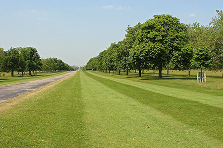
Click image to see photo description.
This walk explores Windsor Great Park in Berkshire. The route explores this beautiful park and many of its outstanding features including the view towards the castle from Snow Hill, the Village with its string of ponds and Cranbourne Tower which was a medieval hunting lodge.
The walk starts from Windsor & Eton Riverside station (grid ref. SU969772) which is served by trains from London Waterloo. Leave the station and turn right along Datchet Road. Take the first road on the left (Thames Street and follow the road to pass Windsor Castle on your left. Follow the road as it bends left and continue uphill into High Street. Pass the Soldier's Statue on your left and bear half left into Park Street and pass through the gates to enter Windsor Great Park (grid ref. SU970766).
Turn right onto the Long Walk. After a kilometre you cross the A308. Cross with care and continue along the Long Walk for a further three kilometres to reach the Copper Horse statue of King George III (grid ref. SU968727). Maintain direction over grass along the Three Castles Path to pass Ox Pond on your right. Reaching a road (grid ref. SU967717), turn right and at the first fork keep right and continue ahead to the Village and Windsor Great Park Post Office (grid ref. SU954724). Continue ahead to reach Prince Consort's Drive (grid ref. SU9537124). Go straight across this drive and almost immediately head half right along a grassy path. Reaching a tarmac drive, turn left towards the A332 at Cranbourne Gate with a substantial house on your left.
Cross the road with care and take the tarmac drive opposite. Continue ahead for 650 metres to reach the Cranbourne Tower (grid ref. SU943731). Retrace your steps for 300 metres and turn left onto a track through trees (just past the water storage tank). You reach a T-junction just after leaving the trees. Turn right and continue to the A332 at Ranger's Lodge (grid ref. SU934734).
Cross the A332 at the pedestrian crossing and continue through the gates past the lodge on your left. Almost immediately turn left onto a gravel path and follow this through a group of trees to pass Russel's Pond on your right. Turn sharp left onto Queen Annes's Drive (grid ref. SU958729). Continue for two kilometres to reach the A332 where you turn right onto a track (grid ref. SU965750). This track leads to the Long Walk (grid ref. SU969747) where you turn left and retrace your steps back to the start.
Maps 

| Ordnance Survey Explorer 160 | Sheet Map | 1:25k | BUY |
| Anquet OS Explorer 160 | Digital Map | 1:25k | BUY |
| Ordnance Survey Digital Map Subscription | |||
| Latest Ordnance Survey Discounts | |||
Other walks nearby
| Walk 1385 | Windsor & Runnymede circular | easy/mod | 11.5 miles |
| Walk 1821 | Circuit of Virginia Water | easy | 5.0 miles |
| Walk 1814 | Staines to Windsor along the River Thames | easy/mod | 9.0 miles |
| Walk 1714 | Virginia Water & the Wentworth Estate | easy/mod | 9.0 miles |
| Walk 1381 | Uxbridge to Ruislip | easy/mod | 13.3 miles |
| Walk 3420 | Cookham to Gerrards Cross via Burnham Beeches | moderate | 12.5 miles |
| Walk 3321 | Denham Circular | easy/mod | 10.0 miles |
| Walk 2173 | Hatton Cross to Uxbridge (London Loop) | moderate | 10.3 miles |
| Walk 1780 | Warren Wood and Little Marlow | easy | 4.4 miles |
| Walk 2669 | Beaconsfield Circular | easy/mod | 9.0 miles |
Recommended Books & eBooks
The Kennet and Avon Canal
 Guidebook to walking along the Kennet & Avon Canal. The 94 mile route from Reading to Bristol is split into 7 stages of fairly easy walking and includes the UNESCO World Heritage Site of Bath and Bristol's Floating Harbour. 20 circular walks are also included, ranging from 4¼ to 9 miles, taking in the best sections of the canal.
More information
