Hatton Cross to Uxbridge (London Loop)
London Walk
County/Area - London
Author - Peter Smyly
Length - 10.3 miles / 16.7 km Ascent - 250 feet / 76 metres
Time - 5 hours 20 minutes Grade - moderate
Walk Route Description
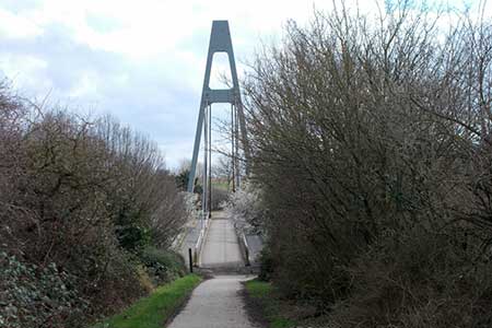
Click image to visit gallery of 4 images.
This linear route follows part of the London Loop in west London, starting at Hatton Cross tube station on the Piccadilly Line and ending at Uxbridge tube station, the terminus of the Uxbridge branch of both the Piccadilly and Metropolitan Lines. If not wanting to do the full length of this walk, there are options to shorten the route at Hayes and Harlington or West Drayton stations.
In keeping with the London Loop more generally, there are sections which involve passing alongside busy roads or through residential or industrial areas, but there are pleasanter green areas as well and much of this route follows alongside part of the Grand Union Canal (GUC).
On exiting Hatton Cross tube station, a left turn alongside the A30 leads to a less busy side road. Once on the side road, a bridge crossing is shortly followed by a sharp left turn, to enter the River Crane Park. Follow the path ahead roughly in parallel with the River Crane on the left, which in appearance is more like a stream than a river. The proximity of Heathrow Airport is apparent with planes coming and going, heard if not also seen. The route ahead leads to a park. Keep ahead through the park, bear right and then left to exit on to Waye Avenue. Turn left on to the road, follow it ahead, then bear right and then left to reach a T junction at Bath Road. Cross at the lights and continue left to cross a bridge. The River Crane can be seen from the bridge. Leave the road with a right turn at the next turning to the right to enter Cranford Park. At the end of this section turn right along a road and then left into woods. The way ahead here is not so obvious as there are different paths but keep ahead with the river on the right until you reach a bridge over the river. Don't cross the bridge but instead bear diagonally left across a grassy area to reach a car park. Pass through the car park and continue ahead under the motorway via a subway. Bear right and follow the path round to the left.
Keep ahead now on a very good path as far as Watersplash Lane. Turn right at the T junction and cross to the other side of the road, continuing to the right. This is one of the less pleasant sections of the route as you contour round to the left by a roundabout next to a very busy main road, the A312, that goes to the left uphill. The GUC soon comes into view way below on the left and a walkway appears, also on the left, leading down to it and this is the way to go next.
The majority of the route between here and Uxbridge follows a canal towpath next to the GUC but the London Loop "does a little exploring" (to quote David Sharp in his London Loop book) in a couple of places - in other words, it leaves the canal to return to it later. Firstly, at Stockley Country Park and later at the Slough Branch of the GUC.
The key to starting the Stockley Country Park digression is to be alert to the turning off from the GUC. It may help to have a picture in your mind at the outset as to the overall layout of the park. Shaped a bit like an inverted letter U bisected roughly in two by the A408, there are different paths, and it is not always clear which the right one is. At one point the route passes next to a golf course and you may be sharing the path with golfers moving from one part of the course to another before you cross the bridge over the A408.
There should be little difficulty finding the A-shaped bridge over the A408, but to reach the route continuation at Horton Road, a left turn after the bridge will bring you to the same point on Horton Road as contouring all the way round, though the latter is part of the London Loop if you want to strictly follow its course and not digress. When the path exits Stockley Country Park at this road, a relatively new park directly opposite provides direct access to the GUC; back in the day when David Sharp's London Loop book was published (2001) you needed to do a longer route via the road to return to the GUC.
Next follows more towpath walking next to the GUC. Look out for the next digression from the canal, crossing a bridge to follow the Slough branch for about a mile, before leaving it via another bridge and then along a rather undistinguished section but next up is one of the more scenic sections of this walk, the Little Britain lakes. The main lake is overhung in places by weeping willows and you may well want to stop here for a while. In March 2022 there were snowdrops in the wood through which the path passes after leaving the lakes and streams.
The route ahead crosses Iver Lane and then contours alongside an industrial area to the right - despite a stream on the left, this is rather a drab section of the route. The path contours round to the right and follows a road ahead back to the canal. Follow the canal towpath ahead to the left into Uxbridge. Once you leave the canal, it's all road walking to end the route at Uxbridge station, leaving the GUC at the A4020. The route can also be shortened slightly by leaving the canal at Rockingham Road.
Maps 

| Ordnance Survey Explorer 160 | Sheet Map | 1:25k | BUY |
| Anquet OS Explorer 160 | Digital Map | 1:25k | BUY |
| Ordnance Survey Explorer 172 | Sheet Map | 1:25k | BUY |
| Anquet OS Explorer 172 | Digital Map | 1:25k | BUY |
| Ordnance Survey Digital Map Subscription | |||
| Latest Ordnance Survey Discounts | |||
Other walks nearby
| Walk 1814 | Staines to Windsor along the River Thames | easy/mod | 9.0 miles |
| Walk 3448 | Richmond Park and Petersham Circular | easy/mod | 8.9 miles |
| Walk 1734 | Hampton Court Parks and Gardens | easy/mod | 6.5 miles |
| Walk 1381 | Uxbridge to Ruislip | easy/mod | 13.3 miles |
| Walk 3446 | Dog Rose Ramble (London Borough of Ealing) | easy/mod | 8.1 miles |
| Walk 1714 | Virginia Water & the Wentworth Estate | easy/mod | 9.0 miles |
| Walk 3054 | Barnes to Richmond along the Thames Path | easy | 6.0 miles |
| Walk 3259 | Windsor Great Park Circular | moderate | 10.2 miles |
| Walk 1385 | Windsor & Runnymede circular | easy/mod | 11.5 miles |
| Walk 1821 | Circuit of Virginia Water | easy | 5.0 miles |
Recommended Books & eBooks
Walking in London
 A guidebook to 25 walks in London's green spaces and nature reserves, covering both the city centre and Greater London area. Taking in woods and forests, parks and heaths, canals and rivers, the guide includes a wealth of information about some of the species you might encounter as well as the history and conservation of these areas.
More information
