Howick & Cullernose Point from Craster
Northumberland County Walk
County/Area - Northumberland County
Author - Lou Johnson
Length - 4.5 miles / 7.3 km Ascent - 200 feet / 61 metres
Time - 2 hours 30 minutes Grade - easy
Walk Route Description
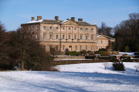
Click image to see photo description.
Famous for its kippers, Craster is a small "working" fishing village north of Alnmouth. The start is the National Trust car-park just outside the village (grid ref NU256197) where there is also an information centre. After parking, walk to the car park exit. Just before the road take the signed footpath on your left. This climbs slightly and leads to a road (grid ref. NU251193) with Craster South Farm opposite.
Take the farm access track and follow the footpath signs through the property. The path turns half left after the last building on your right and continues along a field with the boundary on your immediate left. Continue along the path into the next field again with the boundary on your immediate left. At the end of this field you will see a small hill ahead with a trig point on its summit. This is Hips Heugh with its steep western flank.
The onward path goes to the right of Hips Heugh and bears half right across field towards some trees. Cross the small stream and join a bridleway which is followed south to reach a road and the entrance to Holwick Hall (grid ref. NU249175). Turn left along the quiet road and walk east towards the sea ignoring the lane off to the left.
Where the road bends sharp left, continue ahead on a track leading to the coastal footpath. Reaching the sea, turn left and follow the Northumberland Coast Path and St Oswald's Way back into Craster. Remember to allow time to explore the harbour and perhaps sample the local kippers before returning to the car park on the edge of the village.
Maps 

| Ordnance Survey Explorer 332 | Sheet Map | 1:25k | BUY |
| Anquet OS Explorer 332 | Digital Map | 1:25k | BUY |
| Ordnance Survey Digital Map Subscription | |||
| Latest Ordnance Survey Discounts | |||
Other walks nearby
| Walk 2282 | Bewick Moor | moderate | 9.1 miles |
| Walk 3522 | Bamburgh Castle circular | easy/mod | 7.5 miles |
| Walk 2738 | Budle Bay from Bamburgh | easy | 4.0 miles |
| Walk 1805 | An introduction to the Breamish Valley | easy | 2.0 miles |
| Walk 3242 | Holy Island - Lindisfarne Castle & Emmanuel Head | easy | 4.4 miles |
| Walk 3344 | Holy Island & Lindisfarne Castle Circular | easy | 4.3 miles |
| Walk 2095 | Simonside Hills & Rothbury | moderate | 7.9 miles |
| Walk 1766 | Cushat Law and Bloodybush Edge from Hartside | mod/hard | 12.5 miles |
| Walk 2677 | Circuit of Doddington Moor | easy | 3.8 miles |
| Walk 1202 | The Simonside Hills near Rothbury | easy | 4.5 miles |
Recommended Books & eBooks
Hadrian's Wall Path
 Hadrians Wall Path guidebook to walk the 84 mile National Trail. Described in both directions, the main description is west to east between Bowness-on-Solway and Wallsend, Newcastle, with extensions to Maryport and South Shields. With extensive historical information related to this World Heritage site and separate 1:25,000 OS map booklet included.
More information
Walking in Northumberland
 This guidebook contains detailed route descriptions for 36 day walks in Northumberland including the Cheviot Hills. The terrain varies from wild walks and craggy ascents to gentle riverside strolls. Each route ranges from 4 to 16 miles in length and there is the opportunity to link several walks together to create longer treks.
More information
