Cushat Law and Bloodybush Edge from Hartside
Northumberland Walk
Nat Park - Northumberland
County/Area - Northumberland County
Author - Lou Johnson
Length - 12.5 miles / 20.3 km Ascent - 2200 feet / 667 metres
Time - 8 hours 30 minutes Grade - mod/hard
Walk Route Description
Click image to see photo description.
This Northumberland walk from Hartside approaches the summits of Cushat Law (615 m.) and Bloodybush Edge (610 m.) from the east. The route needs careful navigation as there are many tracks and paths crossing this area so the relevant OS 1:25k map is essential. The route initially heads for Alnhammoor before striking southwest to Little Dod. The walk continues across unpathed moor to reach Cushat Law. The route then turns north over Bloodybush Edge and into the Breamish Valley to return to the start.
The start is the roadside parking at Hartside (grid ref. NT976162) in the Breamish Valley. After parking turn left down a tarmac track (signed to Little Dod) and follow this through to Alnhammoor. Just before reaching the farm, leave the track and follow the path on the left across a field to a gate. Turn right and walk beside the wall to a wall corner (grid ref. NT972153) following a track. Where the track bends right, continue ahead on a clear path that runs parallel to the River Breamish on your right.
After 300 metres the path crosses a stream and then veers southwest. Maintain direction for two kilometres to cross the northern flank of Little Dod and a track (grid ref. NT951143). Note that on this section there are places where the path fades. Turn right onto the clear track and continue for 700 metres to pass through a gate (grid ref. NT945146). Just past the gate turn left and walk over unpathed ground onto Bush Knowe. Continue west keeping to the broad ridge before veering south the summit of Cushat Law (grid ref. NT928137) where you can enjoy an extensive view.
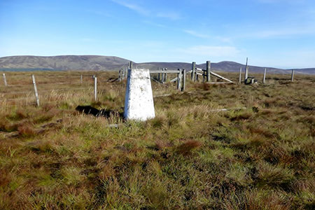
Turn right long the fence and continue northwest and then west to pick up a good path leading to the summit of Bloodybush Edge with its OS trig column. From the summit head north shadowing the fence dropping down to reach Salter's Road (grid ref NT905158). Turn right and continue to descend on a clear path into the Breamish Valley (grid ref. NT920163). Bear right and follow the river downstream on a clear track to reach a group of farm buildings (grid ref. NT9434153). Ignore the track on the right and follow the main track as it swings north-east beside the river into a steep sided valley.
The track veers east and climbs away from the river across Snout End before descending to Alnhammoor Farm where you re-join the outward route back to the start.
Maps 

| Ordnance Survey Explorer OL16 | Sheet Map | 1:25k | BUY |
| Anquet OS Explorer OL16 | Digital Map | 1:25k | BUY |
| Ordnance Survey Digital Map Subscription | |||
| Latest Ordnance Survey Discounts | |||
Other walks nearby
| Walk 1805 | An introduction to the Breamish Valley | easy | 2.0 miles |
| Walk 1764 | The Cheviot from Langleeford | mod/hard | 8.2 miles |
| Walk 1765 | Comb Fell & Hedgehope Hill from Langleeford | mod/hard | 8.9 miles |
| Walk 1776 | The Cheviot & Auchope Cairn from Langleeford | mod/hard | 10.0 miles |
| Walk 2152 | Hartshope Linn (waterfall) from Langleeford | easy | 4.4 miles |
| Walk 2153 | Housey Crags from Langleeford | easy/mod | 2.0 miles |
| Walk 2299 | The Cheviot | moderate | 9.0 miles |
| Walk 3085 | The Dodd & Wether Cairn | moderate | 9.5 miles |
| Walk 1200 | Windy Gyle | moderate | 7.5 miles |
| Walk 1763 | Mozie Law & Windy Gyle | moderate | 8.2 miles |
Recommended Books & eBooks
Hadrian's Wall Path
 Hadrians Wall Path guidebook to walk the 84 mile National Trail. Described in both directions, the main description is west to east between Bowness-on-Solway and Wallsend, Newcastle, with extensions to Maryport and South Shields. With extensive historical information related to this World Heritage site and separate 1:25,000 OS map booklet included.
More information
Walking in Northumberland
 This guidebook contains detailed route descriptions for 36 day walks in Northumberland including the Cheviot Hills. The terrain varies from wild walks and craggy ascents to gentle riverside strolls. Each route ranges from 4 to 16 miles in length and there is the opportunity to link several walks together to create longer treks.
More information
