Cropredy & Chipping Warden Circular
Oxfordshire Walk
County/Area - Oxfordshire & Northamptonshire
Author - Millennium Way
Length - 8.6 miles / 14 km Ascent - 350 feet / 106 metres
Time - 4 hours 40 minutes Grade - easy/mod
Walk Route Description
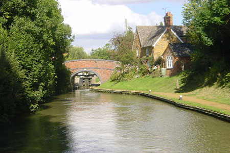
Click image to see photo description.
This Oxfordshire circular walk starts from the delightful village of Cropredy in the Cherwell Valley. The route includes three delightful villages, open countryside and farmland, quiet lanes, and an attractive section of the Oxford Canal. Refreshments are available in Cropredy, Wardington and Chipping Warden. For part of the walk, you will enjoy the delights of The Millennium Way where you will be guided by the distinctive black Millennium Way way markers.
A - We begin our walk from the Red Lion Inn, which is situated in Red Lion Street, close to the Oxford Canal. With your back to the Red Lion Inn, go left and over the canal bridge and keep ahead on lane to pass through large wooden gate keeping stream right. Continue past Prescote Manor House on your left, staying on surfaced drive for about 0.75 mile.
B - When you reach a crossroads of paths by wood, turn right down bridleway (no waymark), immediately crossing over stream and stay ahead on wide path through woodland. Continue into fields along cinder track bearing left then keeping hedge left for some while. Go gently uphill and then through large metal gate, staying ahead with hedge left to eventually exit field to main road via another large metal gate.
C - Turn right, taking care along busy main road into Wardington (it may be best to cross road). Take the lane on left signed Edgcote by the Hare and Hounds Inn heading gently downhill. Stay on the quiet country lane for approx. 0.75 mile passing Wardington Gate Farm and past a group of quaint cottages.
D - Where the road swings right continue ahead down cul-de-sac passing a posting box set in brick structure left, heading towards the church. Just past the church you will have a fine view of Edgcote House on your right. Go past the house and take track left (you are now on The Jurassic Way) to pass through green metal kissing gate. Continue down track between beech hedges passing through gateway and continue gently downhill. Cross bridge over River Cherwell and as you enter a spinney of cherry trees and start uphill, note a plaque mounted on a concrete plinth on your right which marks the site where a Wellington bomber crashed in 1945. Stay on surfaced track gently uphill and through woodland then exit through metal gate next to lodge (dated 1846) on the left. Here you will see an information board, which is of interest. Stay ahead to enter Chipping Warden, passing the ancient church of St Peter and St Paul, to reach the main road. Here you join the Millennium Way. The Griffin Pub is just out of sight off to your right, but turn left to pass the Rose & Crown Pub and take the first road right, Appletree Road.
E - Follow Appletree Road round left-hand bend, across the village by-pass road and where road swings right, take stile onto footpath on left side of road. Follow the footpath signs making your way left along the alleyway past buildings to take stile into field. Continue with fence left to take further stile into spinney. Go through spinney into field and then keep ahead across centre of large field aiming for lone tree/house roof top to find and take fence stile behind large oak tree. Go diagonally left to pass clump of trees and small mid field dew pond on your left to skirt large, banked pond. Curve right to find gate in left corner of field near large oak tree. Take gate with fence right to take mid fence stile and then ahead to take two further stiles in hedge, into field. Continue with hedge right to find and take stile to left of gate to road. This section has several temporary fences, some electrified, which you can unhook to pass through.
F - Cross road to take stile opposite, a few paces to the right. You may have to go under wire. Then ahead to pass cattle sheds and field edge on left, to reach a way post by mid hedge gated gap directly ahead. Go through gap and under or over another wire into next field and go with hedge right. After approx. 100 paces, at the field corner by copse, turn right through gap, then after 20 paces turn left and go with copse left downhill (with wonderful views ahead) to go through wide gap. Then head straight across field to a small gap in middle of far hedge, just to right of a large oak and left of a small oak, to find bridge over stream. Cross stream and go diagonally left across corner of field to reach left field edge. Then go uphill with hedge left. Watch for gap with wooden post left, approx. three-quarters of way up field. Here you leave The Millennium Way. Ignore gap and continue on same line in same field keeping hedge to left, to go through gap in hedge in the top left corner of field. Follow left edge of the next two fields for approx. 250 yards downhill to find footbridge on left through a small hedge gap just before corner. Cross footbridge and go diagonally half right to reach a stile in top corner of large field.
G - Take stile and go immediately left to reach the Oxford canal towpath. Go left on towpath for 2 miles to reach bridge 152.
H - Just before bridge number 152 exit left from towpath to go right over bridge which brings you back to your starting point at the Red Lion Inn.
Maps 

| Ordnance Survey Explorer 206 | Sheet Map | 1:25k | BUY |
| Anquet OS Explorer 206 | Digital Map | 1:25k | BUY |
| Ordnance Survey Digital Map Subscription | |||
| Latest Ordnance Survey Discounts | |||
Other walks nearby
| Walk 1085 | Upper & Lower Boddington | easy/mod | 7.0 miles |
| Walk 1825 | Chipping Warden, Thorpe Mandeville, Culworth Circular | easy/mod | 10.0 miles |
| Walk 3252 | Wardington & Cropredy from Chacombe | easy/mod | 7.7 miles |
| Walk 3042 | Thenford Hill & Upper Wardington from Middleton Cheney | easy/mod | 7.5 miles |
| Walk 3701 | Upper Boddington Circular | easy | 5.5 miles |
| Walk 2276 | Oxford Canal & Stoneton | easy/mod | 7.0 miles |
| Walk 1774 | Priors Hardwick & Wormleighton Circular | easy/mod | 8.0 miles |
| Walk 1790 | Byfield, Aston le Walls & Boddington Reservoir | easy/mod | 8.2 miles |
| Walk 3090 | Woodford Halse, Hellidon & Badby circular | moderate | 13.8 miles |
| Walk 2125 | Edge Hill & Ratley from Radway | easy/mod | 5.4 miles |
