Woodford Halse, Hellidon & Badby circular
Northamptonshire Walk
County/Area - Northamptonshire
Author - David McMahon
Length - 13.8 miles / 22.3 km Ascent - 1500 feet / 455 metres
Time - 8 hours 20 minutes Grade - moderate
Walk Route Description
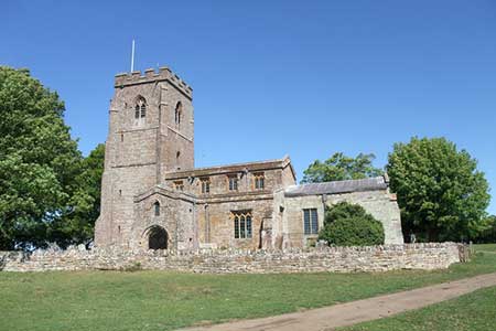
Click image to see photo description.
Woodford Halse and the adjoining village of Hinton are 6.5 miles south of Daventry. Stagecoach Oxfordshire run a bus service No 200 from Daventry to Banbury. On street parking is available although please be considerate to local residents when parking.
The walk starts from the Methodist chapel at the junction of Phipps Road and Hinton Road (grid ref. SP537525). Walk east along Hinton Road, pass under the railway bridge and take the footpath on left after the bridge. Turn right almost immediately into the wood and follow this path through the entire length of the wood until you reach a road (grid ref. SP541530).
Turn left along the road and then turn right onto the Jurassic Way (Great Central Way) at grid ref. SP540530. Stay on the Jurassic Way ignoring the track swinging left to Charwelton Lodge and continue straight ahead onto a grass track. Cross the dismantled railway line and stay on the Jurassic Way as it bears left (grid ref. SP545552) and follow this through to Charwelton. An alternative route is to leave the Jurassic Way before crossing the dismantled railway line mentioned above by taking the footpath on the left at grid ref. SP542547) which leads into Charwelton.
Cross the A361 in Charwelton (grid ref. SP535560) and continue on the Jurassic Way to a minor road. Ignore the bridleway sign immediately opposite instead turn left and join the Jurassic Way further along the road on the right. Follow the Jurassic Way all the way to Hellidon crossing both Steppington and Windmill Hills.
Reaching Hellidon by the village green and Red Lion pub (grid ref. SP518580), follow the road passing St John the Baptist Church to reach another village green. Just before this second green take the footpath on the right into a lane. Then go right over the stile when you spot the black arrow. Continue into the field and go diagonally left and up a slope. Go around the bottom end of the lake and climb the stile into the next field. Turn right and follow the headland around to the left, but shortly after you turn the corner drop down into a dip and over a stile into another field. Then go left and follow the path through you reach the road (grid ref. SP526582).
Turn right and then go left onto a bridleway which is followed to a road (grid ref. SP547587). Turn right along the road and walk down into Badby. Reaching a junction go right up the slope. St Mary the Virgin Church will come into view. (The Windmill pub can be found past the Church and taking a right turn.)
To continue take the footpath (Knightley Way) opposite the church and follow it around the perimeter of Badby Wood and eventually onto a road outside of the gates to Fawsley Hall (grid ref. SP564569). Turn right and walk along the road until you see a bridleway on the left. Take this bridleway following a tarmac track. Take the left-hand fork and follow it until you reach a road (grid ref. SP548557). Cross the road to the footpath and bridleway opposite.
Here you have a choice. For the first option continue along the bridleway through Church Charwelton and eventually onto the Jurassic Way. All that remains is to trace your steps back to the start. The second option is to follow the footpath heading diagonally left. Follow this path all the way passing through a dense and seemingly rarely walked area of shrubbery in the vicinity of the water tower (Wr Twr on OS maps). Once through the shrubbery continue ahead to the outskirts of Woodford Halse. Pass along the left-hand side of a sports ground into an alleyway to reach a road (grid ref. SP544530). Cross the road and walk down the passageway onto another road. Turn right and road walk past St Mary the Virgin Church, under the railway bridge and back to your starting point.
Maps 

| Ordnance Survey Explorer 206 | Sheet Map | 1:25k | BUY |
| Anquet OS Explorer 206 | Digital Map | 1:25k | BUY |
| Ordnance Survey Digital Map Subscription | |||
| Latest Ordnance Survey Discounts | |||
Other walks nearby
| Walk 1790 | Byfield, Aston le Walls & Boddington Reservoir | easy/mod | 8.2 miles |
| Walk 2449 | Canons Ashby Circular | easy | 5.0 miles |
| Walk 3611 | Ashby Gorse from Moreton Pinkney | easy | 5.7 miles |
| Walk 1825 | Chipping Warden, Thorpe Mandeville, Culworth Circular | easy/mod | 10.0 miles |
| Walk 3701 | Upper Boddington Circular | easy | 5.5 miles |
| Walk 2276 | Oxford Canal & Stoneton | easy/mod | 7.0 miles |
| Walk 1070 | Hellidon & Priors Marston | easy | 5.7 miles |
| Walk 1794 | Litchborough & Farthingstone Circular | easy/mod | 6.0 miles |
| Walk 1085 | Upper & Lower Boddington | easy/mod | 7.0 miles |
| Walk 3713 | Cropredy & Chipping Warden Circular | easy/mod | 8.6 miles |
