Upper Boddington Circular
Northamptonshire Walk
County/Area - Northamptonshire
Author - Millennium Way
Length - 5.5 miles / 8.9 km Ascent - 350 feet / 106 metres
Time - 3 hours 10 minutes Grade - easy
Walk Route Description
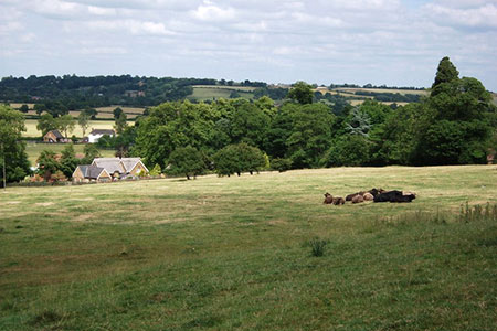
Click image to see photo description.
This gentle Northamptonshire circular walk starts in the pleasant village of Upper Boddington, and meanders across mostly flat farmland & open countryside. Park in the village of Upper Boddington near to The Plough, where refreshment might be welcome after the walk. For the first part of the walk, you will enjoy the delights of The Millennium Way where you will be guided by the distinctive black Millennium Way way markers.
A - We begin our walk from The Plough at Upper Boddington. With your back to The Plough go left down road and turn right into Frog Lane. Here you join the Millennium Way, and you will see our black way markers from now on. Go ahead round left bend and immediately take footpath right (where sign bans cycling) going along to Methodist Church to reach road. Turn left onto road and, at end of houses, pass through gateway. After 30 paces take gate right and go through a copse to cross first footbridge and continue along track to take right field corner wooden gate. Continue with hedge right through gap into field. Go diagonally 1/2 left across field to take a second footbridge into next field, then going ahead to cross a third wooden footbridge. Continue left around edge of next field heading for the way marker post in top left corner. Go left through hedge gap keeping along edge of field with hedge right. Exit field by corner gap and go ahead steadily up field valley to gap in trees to find single plank ditch bridge. Cross plank bridge to field and go with wood left around field edge. At the far hedge gap go left on bridleway keeping hedge and trees right.
B - At field end go through gap in spinney and turn right to go with spinney right. Stay ahead on grass track with wood right to eventually exit by corner gap into field. Go ahead over centre of field to mid fence metal gate. Take gate and turn right to pass dew pond on right, then through small metal gate continuing slightly left in grassy corridor between hedges. Corridor swings right leading down to a gate. Take a look at the views. Take gate with hedge right and continue down through avenue of trees, then through gate and ahead to reach road.
C - Go through large wooden gate, cross the road, and then go through large metal gate into large field. Head directly towards the pylon on the horizon to the right of the large telecoms tower to reach left corner gate (near buildings). Go through gate to pass in front of barn to driveway and take stile immediately right. Then go diagonally left across field passing telegraph pole to take corner stile, then second stile into field and go with hedge and power lines left to take corner gate. Take next gate opposite and go 1/4 right, parallel with power lines, to take mid fence gate to farm driveway. Turn right for 30 paces then left through gate and follow right edge of field to find wooden bridge in top right corner. (Here we leave The Millennium Way).
D - Take wooden bridge into field and go left along field edge to take gap into next field. Go along left edge of field to corner to take wooden gate to farm access track (Shooting School opposite). Go right on access track and, just before the right-hand corner, take large un-waymarked metal gate / fence stile on left into field and continue with wire fence and trees left. On reaching next corner do not go through wooden gate but go right staying in same field continuing with hedge left for approx. 100 yards to take metal gate left into next field. Stay along edge of field with hedge left and around the two sides of square copse projecting into field. On reaching far corner ignore gate left (target shooting area) and instead go right for 50 paces to take stile left then further stile to cross wooden footbridge into field.
E - Go directly ahead across centre of field towards left-hand side of large tree to take mid hedge stile and footbridge to next field (you may find stile blocked, so go through gap to right and then head back diagonally left). Cross field to take obscured wooden footbridge and cross next field to take another obscured footbridge in hedge ahead. Stay directly uphill, often through crops, over next field towards ridge ahead, to find and take cattle grid between two large trees. Stay on farm track with hedge right then cross second cattle grid to eventually reach a lane. Turn left on lane to enter the village of Upper Boddington. After a short distance turn right into London End and go to end of lane which brings you back to The Plough for some welcome refreshment.
Maps 

| Ordnance Survey Explorer 206 | Sheet Map | 1:25k | BUY |
| Anquet OS Explorer 206 | Digital Map | 1:25k | BUY |
| Ordnance Survey Digital Map Subscription | |||
| Latest Ordnance Survey Discounts | |||
Other walks nearby
| Walk 1790 | Byfield, Aston le Walls & Boddington Reservoir | easy/mod | 8.2 miles |
| Walk 1774 | Priors Hardwick & Wormleighton Circular | easy/mod | 8.0 miles |
| Walk 1085 | Upper & Lower Boddington | easy/mod | 7.0 miles |
| Walk 1825 | Chipping Warden, Thorpe Mandeville, Culworth Circular | easy/mod | 10.0 miles |
| Walk 3090 | Woodford Halse, Hellidon & Badby circular | moderate | 13.8 miles |
| Walk 1070 | Hellidon & Priors Marston | easy | 5.7 miles |
| Walk 3713 | Cropredy & Chipping Warden Circular | easy/mod | 8.6 miles |
| Walk 1820 | Napton on the Hill circular | easy | 5.0 miles |
| Walk 2430 | Napton-on-the-hill, Grand Union Canal & Beacon Hill | easy/mod | 7.4 miles |
| Walk 3704 | Napton & Stockton Circular | easy | 6.4 miles |
