Byfield, Aston le Walls & Boddington Reservoir
Northamptonshire Walk
County/Area - Northamptonshire
Author - Lou Johnson
Length - 8.2 miles / 13.3 km Ascent - 450 feet / 136 metres
Time - 4 hours 30 minutes Grade - easy/mod
Walk Route Description
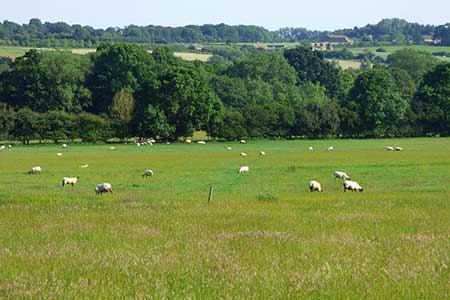
Click image to see photo description.
This walk from Byfield (Northamptonshire) explores quiet countryside lying to the south and east of the village. The route also includes the villages of Aston le Walls and Lower Boddington which, like Byfield, have cottages constructed from the local ironstone. The walk also includes Boddington Reservoir that was built in the early nineteenth century to provide water for the nearby Oxford Canal.
There is limited on-street parking near the small green at the eastern end of Bell Lane in Byfield (grid ref. SP515531). After parking walk west along Bell Lane and pass the school on your left. Continue ahead until you reach a T-junction with The Twistle. Go straight across onto a track with fingerpost on the right. The track passes through trees to enter afield. The path follows the hedge on your left. The path continues with the hedge on your left for 600 metres to a gate (grid ref. SP503523).
Maintain direction across the next field to join a track near a field corner. Continue southwest with hedge on your right to reach a gate. Pass through the gate and continue with the hedge now on your left. Reaching another gate (grid ref. SP499515). Enter the next field and continue to another gate. Turn right and follow the path around the right-hand field edge. Continue ahead to reach Welsh Road (grid ref. SP497510). Turn right and then left along Blacksmiths Lane (road sign on left-hand verge). Follow this lane into Aston le Walls to reach the church on your left.
Just past the church, turn right onto the signed footpath to Appletree. Keep the barns on your right, go through a gate and join a grassy track through trees. Leaving the trees, maintain direction across two fields. In the third field bear half right, cross a track and then turn left along the access drive to Field Farm. Follow this track to reach a lane by a house (grid ref. SP485498). Turn right in front of the house and continue along the lane for 800 metres to a footpath sign on the right to Lower Boddington. You are now following the Millennium Way.
Follow field edge for just over 100 metres and then head slightly left across the field to cross the old railway line. The path goes across the field to a ditch. Bear left to a gate and continue along path between fences. Pass through another gate and cross another ditch. Go through the next gate and continue to reach Paradise Farm (grid ref. SP482518). Bear left to join a farm track which leads to Banbury Road in Lower Boddington.
Go straight across into Owl Edge Lane. Continue to the end of the tarmac and join a path between fences. Continue along the path to reach Hill Road (grid ref, SP483524), Turn right and where the lane bends left, take the left-hand signed bridleway on the right. Continue along the right-hand field edge to reach Welsh Road. Go straight across and walk half left across large field. Reaching the far side turn right and follow the hedge (on your left). Pass a small barn and continue to the foot of the reservoir embankment. Turn right, climb steps to the top of the embankment and turn right to follow the edge of the reservoir, which should be on your left.
Continue along the path, cross the dam wall, and continue along the edge of Boddington Reservoir to enter trees. Cross the footbridge (grid ref. SP500528) and turn right (signed to Byfield). The path follows a hedge on your right. Continue through a gap and then go right across a footbridge in woodland. Entering a field, the path continues through several gates and fields to reach a road (The Twistle). Turn right and then left into Bell Lane to return to the start.
Maps 

| Ordnance Survey Explorer 206 | Sheet Map | 1:25k | BUY |
| Anquet OS Explorer 206 | Digital Map | 1:25k | BUY |
| Ordnance Survey Digital Map Subscription | |||
| Latest Ordnance Survey Discounts | |||
Other walks nearby
| Walk 3090 | Woodford Halse, Hellidon & Badby circular | moderate | 13.8 miles |
| Walk 3701 | Upper Boddington Circular | easy | 5.5 miles |
| Walk 2276 | Oxford Canal & Stoneton | easy/mod | 7.0 miles |
| Walk 1825 | Chipping Warden, Thorpe Mandeville, Culworth Circular | easy/mod | 10.0 miles |
| Walk 1070 | Hellidon & Priors Marston | easy | 5.7 miles |
| Walk 2449 | Canons Ashby Circular | easy | 5.0 miles |
| Walk 1085 | Upper & Lower Boddington | easy/mod | 7.0 miles |
| Walk 1774 | Priors Hardwick & Wormleighton Circular | easy/mod | 8.0 miles |
| Walk 3611 | Ashby Gorse from Moreton Pinkney | easy | 5.7 miles |
| Walk 3713 | Cropredy & Chipping Warden Circular | easy/mod | 8.6 miles |
