The Broads WalksWalking Routes & Hiking Trails
Find The Broads walks from the list below which features the best walking routes in the area. Most are circular walks and are listed from the shortest and easiest to the longest more challenging routes.
The great walks in The Broads National Park listed below include easy circular walks to longer half-day and full day walks. All walks are free to download and print and all routes have GXS files. The routes allow you to explore the watery landscapes that are typical of this part of Britain.
| Walk | Description | Grade | Miles |
|---|---|---|---|
| 2237★ | Somerleyton & Herringfleet Hills | easy | 3.50 |
| 1992★ | Horsey Gap from Horsey | easy | 3.70 |
| 3608★ | Martham Ferry & River Thurne from West Somerton | easy | 4.00 |
| 2240★ | The River Bure & Upton from Acle | easy | 5.00 |
| 1855★ | Horsey Circular | easy | 5.10 |
| 3348★ | River Yare & Claxton from Rockland Staithe | easy | 5.20 |
| 3609★ | Winterton Ness from West Somerton | easy | 5.40 |
| 2239★ | River Bure and Tunstall Dike from Acle | easy | 6.10 |
| 2297★ | Honing & East Ruston Circular | easy/mod | 6.40 |
| 3694★ | River Thurne & Hickling Broad from Potter Heigham | easy/mod | 6.40 |
| 2129★ | River Ant & How Hill from Ludham | easy | 6.70 |
| 2128★ | Stokesby & Muck Fleet from Fleggburgh | easy | 7.10 |
| 2446★ | Rockland St Mary Circular | easy/mod | 8.10 |
| 2320★ | Muck Fleet & River Bure from near Oby | easy/mod | 8.70 |
| 2839★ | St Benet's Abbey & How Hill from Ludham | easy/mod | 8.80 |
★ GPS file ☩ Route profile
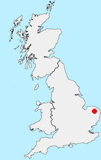
Location Map
The Broads Guide
Walking in the Norfolk and Suffolk Broads offers a unique mosaic of rivers and shallow lakes, marshes, fens and woodland. This unique habitat is home to some of the rarest plants and creatures in the UK. The Broads is also one of Europe's most popular inland waterways. Once an essential transport network the waterways have evolved for recreational use. Besides the blend of wildlife and distinctive landscapes, man has made his mark with distinctive buildings including some fine windmills.
The Broads Walking Guide
Other walks in Britain - For a list of all the areas where walks are available go to the Main Walk Index.
Walk grading - Learn how each walk is assessed and select a walk to suit your ability and experience by going to Walk Grading Details.
Messaging & Social Media
Message Walking Britain and follow the latest news.

Mountain Weather
Stay safe on the mountains with detailed weather forecasts - for iOS devices or for Android devices.