River Thurne & Hickling Broad from Potter Heigham
The Broads Walk
Nat Park - The Broads
County/Area - Norfolk
Author - Lou Johnson
Length - 6.4 miles / 10.4 km Ascent - 100 feet / 30 metres
Time - 3 hours 20 minutes Grade - easy/mod
Walk Route Description
Click image to see photo description.
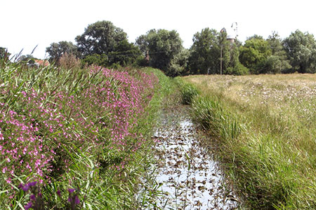
This Norfolk walk explores the watery landscape lying to the west of Potter Heigham in the Broads. The route includes a section of the Weaver's Way from Heigham Bridge that initially follows the banks of the River Thurne past High's Drainage Mill. The walk then turns north along Candle Dyke to follow the shore of Hickling Broad. Turning inland the route continues to visit St Nicholas Church before returning to the start across wet pastures. In season the walk provides the opportunity to see a variety of birds.
The start is Lathams car park at Potter Heigham Bridge (grid ref. TG419185). Please note there is a three hour limit at this car park. An alternative place to park is by the village hall. After parking walk to towards the old Potter Heigham Bridge. Just before this bridge bear left along the north bank of the River Thurne following the Weaver's Way. Continue past High's Drainage Mill. Just over one kilometre after the mill, the path turns north alongside Candle Dyke. Continue along the Weaver's Way for 4 kilometres passing Sound Plantation and Wagonhill Plantation.
Reaching a bird hide opposite Rush Hill Lagoon (grid ref. TG423209) continue for a further 300 metres to a path junction with a fingerpost (grid ref. TG421206). Turn left here and pass through Coll's Plantation. Continue ahead at the next path junction to reach a T-junction of paths (grid ref. TG421201). Turn right following the green arrow to join a road where you turn left to reach St Nicholas Church.
After visiting the church retrace your steps back to the edge of Coll's Plantation (grid ref. TG421204) where your turn right along the southern boundary of the wood (trees on your left). The path passes beside the southern edge of Wagonhill Plantation to pass Glebe Farm (grid ref. TG428197). Continue ahead here. 400 metres beyond the farm you reach a T-junction of paths with High's Drainage Mill in view ahead. Turn right following the yellow arrow and walk beside Middle Wall drainage channel to reach the A419. Cross this road with care and take the footpath opposite. After a further 200 metres, turn left back to the car park.
Maps 

| Ordnance Survey Explorer OL40 | Sheet Map | 1:25k | BUY |
| Anquet OS Explorer OL40 | Digital Map | 1:25k | BUY |
| Ordnance Survey Digital Map Subscription | |||
| Latest Ordnance Survey Discounts | |||
Other walks nearby
| Walk 2129 | River Ant & How Hill from Ludham | easy | 6.7 miles |
| Walk 2839 | St Benet's Abbey & How Hill from Ludham | easy/mod | 8.8 miles |
| Walk 3608 | Martham Ferry & River Thurne from West Somerton | easy | 4.0 miles |
| Walk 3609 | Winterton Ness from West Somerton | easy | 5.4 miles |
| Walk 2128 | Stokesby & Muck Fleet from Fleggburgh | easy | 7.1 miles |
| Walk 1855 | Horsey Circular | easy | 5.1 miles |
| Walk 1992 | Horsey Gap from Horsey | easy | 3.7 miles |
| Walk 2320 | Muck Fleet & River Bure | easy/mod | 8.7 miles |
| Walk 2239 | River Bure and Tunstall Dike from Acle | easy | 6.1 miles |
| Walk 2240 | The River Bure & Upton from Acle | easy | 5.0 miles |
