River Bure and Tunstall Dike from Acle
The Broads Walk
Nat Park - The Broads
County/Area - Norfolk
Author - Lou Johnson
Length - 6.1 miles / 9.9 km Ascent - 100 feet / 30 metres
Time - 3 hours 10 minutes Grade - easy
Walk Route Description
Click image to see photo description.
This Norfolk Broads walk explores the watery landscape so typical of the area. The route walks along the banks of the River Bure and Tunstall Dike. The final section of the walk uses a section of the Weavers' Way long distance footpath. The start is the large car park on the north side of Bridewell Lane in the centre of Acle (grid ref. TG401107) which lies to the north of the A47 west of Yarmouth.
Exit the car park and turn left along Bridewell Lane. It is easier to stay on the north side of this road. This leads into Old Road which should be followed to a T-junction (the A1064). Bear left here and follow the A1064 for a short way. Cross the road carefully to an open area which gives access to the moorings at Acle Dike. Walk along the southern side of the Dike (with the Dike to your left) and continue to the River Bure. Bear right here and continue down the river which should be on your left.
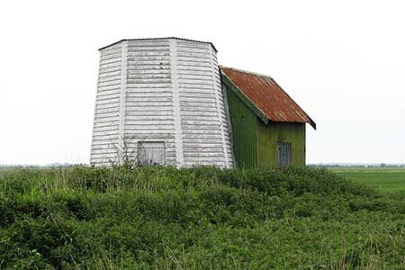
Continue along the grassy banks of the River Bure passing Commission Drainage Mill (sadly with no sails). A short way further you will see the village of Stokesby on the north bank of the River Bure. Continue following the footpath beside the river for a further half a mile to reach a pumping station at the eastern end of Tunstall Dike (grid ref. TG431095). Turn right here and follow the path along the southern bank of Tunstall Dike. The path crosses the A47, a railway line and two drainage windmills to reach the end of a tarmac lane (grid ref. TG420090). After 600 metres turn right on to the signed footpath on your right. This is the Weavers' Way.
The route soon reaches a solitary barn (grid ref. TG409089). Turn right here following the waymarks and continue north. The Weavers' Way passes under the railway and A47 in quick succession to reach Acle Dike and the moorings first encountered at the start of the walk. All that remains is to retrace your route by crossing the A1064, bearing right down Old road, and then keeping to the right into Bridewell lane and the car park.
Maps 

| Ordnance Survey Explorer OL40 | Sheet Map | 1:25k | BUY |
| Anquet OS Explorer OL40 | Digital Map | 1:25k | BUY |
| Ordnance Survey Digital Map Subscription | |||
| Latest Ordnance Survey Discounts | |||
Other walks nearby
| Walk 2320 | Muck Fleet & River Bure | easy/mod | 8.7 miles |
| Walk 2128 | Stokesby & Muck Fleet from Fleggburgh | easy | 7.1 miles |
| Walk 2129 | River Ant & How Hill from Ludham | easy | 6.7 miles |
| Walk 2839 | St Benet's Abbey & How Hill from Ludham | easy/mod | 8.8 miles |
| Walk 3694 | River Thurne & Hickling Broad from Potter Heigham | easy/mod | 6.4 miles |
| Walk 2446 | Rockland St Mary Circular | easy/mod | 8.1 miles |
| Walk 3348 | River Yare & Claxton from Rockland Staithe | easy | 5.2 miles |
| Walk 3608 | Martham Ferry & River Thurne from West Somerton | easy | 4.0 miles |
| Walk 3609 | Winterton Ness from West Somerton | easy | 5.4 miles |
| Walk 1855 | Horsey Circular | easy | 5.1 miles |
