Old Glossop & Bleaklow
Peak District Walk
Nat Park - Peak District - Bleaklow Longendale
County/Area - Derbyshire
Author - Lou Johnson
Length - 9.5 miles / 15.4 km Ascent - 1680 feet / 509 metres
Time - 6 hours 30 minutes Grade - moderate
Walk Route Description
Click image to visit gallery of 6 images.
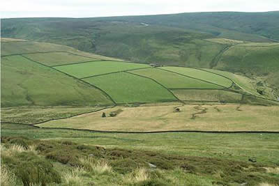
I have completed this Peak District walk in sunshine (on this occasion) and in pouring rain with cloud sitting low on the moors with visibility almost down to zero - the sun was preferable although I learned a lot navigating by map and compass in the cloud. In whatever conditions you see this large area of upland, you cannot fail to be impressed by the rawness of the scene. Although the best known objective of the walk is Bleaklow Head, there are many other points of interest in this pleasant upland excursion to a quieter part of the Peak District National Park.
The walk starts on the eastern edge of Old Glossop, reached by a signed road off the main A57 through Glossop and then driving to the end of Shepley Street where there is adequate parking (grid ref SK045948). Taking the lane heading east, stay with the lane until a stile on your left. Cross this and take the path between walls, which climbs steadily on to the moors. The path is well used and is easy to follow for most of the way eventually following the Yellowslacks ridge until the stream in Dowstone Clough comes alongside. If visibility is good the Wain Stones on Bleaklow Head can be seen on the horizon. It looks close but rest assured that the next section of the walk will take longer than you expect. True there are paths but the grough ridden peat makes hard going especially after a spell of rain.
The relative dryness of the summit area of Bleaklow Head provides some respite and it is well worth lingering a while before heading just west of south to the next objective, Higher Shelf Stones. Having already suffered peat groughs, the next section will test even the most stoic walker. The paths are intermittent, interrupted by squelchy peat and the only point of interest are the Hern Stones where you can kick off the peat from your boots! If possible follow the stream beds where the peat has been completely stripped from the rock always taking care that you are staying on course. Once across the vague col between Bleaklow Head and Higher Shelf Stones the worst of the peat is over and you can start to relax and enjoy the walk again.
Higher Shelf Stones provides a rewarding view including the Kinder Plateau seen across the A57 Snake Pass road. On a sadder note just to the north-east of the summit are the remains of a B29 which crashed in 1949. Besides a small memorial, much of the superstructure is scattered on the moor looking surprisingly shiny considering fifty years of battering from the elements. Turning your back on the bright red poppy on the memorial, the onward route lays south-east across the moor to pick up the obvious dyke which in turn leads to a paved section of the Pennine Way.
Turning south-west good speed can be made across the moor to the crossroads of paths just short of the A57. Turning right at Doctor's Gate you follow the old Roman Road back to the starting point of this route. Like any good walk, the return is just as interesting as the outward half and you will be surprised by the quality of the scenery on this descent. The path follows the southern side of Crooked Clough starting high above the stream. Across the Clough, Higher Shelf Stones and the lesser Lower Shelf Stones can be seen as the path zig-zags down to the stream.
In places there is some erosion but nothing untoward and compared with the groughs on Bleaklow this is wonderful easy walking. Gradually as height is lost the character of the surroundings changes from moorland to pasture. Passing Mossy Lea Farm on your left you can look back to the Yellowslacks ridge content that despite its reputation Bleaklow does have plenty to offer the walker.
Maps 

| Ordnance Survey Explorer OL1 | Sheet Map | 1:25k | BUY |
| Anquet OS Explorer OL1 | Digital Map | 1:25k | BUY |
| Ordnance Survey Digital Map Subscription | |||
| Latest Ordnance Survey Discounts | |||
Other walks nearby
| Walk 1759 | Torside Clough & Longendale from Old Glossop | moderate | 7.4 miles |
| Walk 1703 | Longdendale from Hadfield Station | easy/mod | 9.0 miles |
| Walk 3607 | Reservoirs Walk from Tintwistle | easy/mod | 5.5 miles |
| Walk 1923 | Cown Edge & Whiteley Nab from Chunal | easy/mod | 6.5 miles |
| Walk 2625 | Torside Clough from Longdendale | moderate | 4.5 miles |
| Walk 3027 | Bleaklow Head from Longdendale | moderate | 8.0 miles |
| Walk 1486 | Harry Hut, Mill Hill & Doctor's Gate from Glossop | moderate | 11.3 miles |
| Walk 2637 | Coombs Ridge, Cown Edge from Broadbottom | easy/mod | 7.0 miles |
| Walk 1686 | Cown Edge | easy/mod | 7.3 miles |
| Walk 1179 | Lad's Leap & Laddow Rocks from Crowden | moderate | 6.5 miles |
Recommended Books & eBooks
Walking in Derbyshire
 Walking guidebook to 60 circular day walks in Derbyshire and the Peak District. Includes the Derwent, Wye and Trent river valleys, near Derby, Matlock, Glossop, Bakewell and Ripley. Routes range from easy to moderate and are between 4 and 14km (2 to 10 miles). Walks focus on places of interest, from Stone Age forts to castles to grand estates.
More information
Walking in the Peak District - White Peak East
 Guidebook describing 42 half-day and day walks in the limestone landscapes of Derbyshire's White Peak, part of the Peak District National Park. One of two volumes, this book covers the east of the region, with potential bases including Bakewell, Eyam, Castleton, Birchover, Matlock and Wirksworth.
More information
