Torside Clough & Longendale from Old Glossop
Peak District Walk
Nat Park - Peak District - Bleaklow Longendale
County/Area - Derbyshire
Author - Andy Chaplin
Length - 7.4 miles / 12 km Ascent - 1250 feet / 379 metres
Time - 5 hours 0 minutes Grade - moderate
Walk Route Description
Click image to visit gallery of 3 images.
This Peak District walk starts in the Old Glossop car park on Wellgate (grid ref. SK041948) which is handy when you come back as it is opposite the Wheatsheaf and the Bull's Head pubs. The walk climbs up past Cock Hill to Clough Edge then follows an easy route back around the reservoirs, through the outskirts of Padfield and back to Old Glossop.
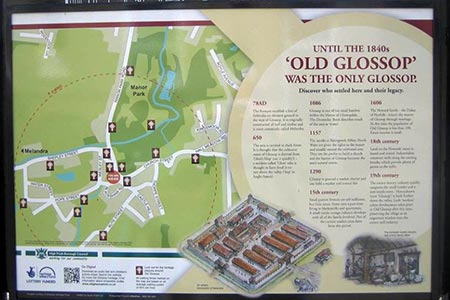
From the car park, where there is an information board about Old Glossop, go east on Wellgate. Continue along Hope Street and into Charles Lane. After 100 metres down Charles Lane, a footpath leads off between the lane and farm track. This is the Glossop Low Quarry track and it takes a route around the old quarry then climbs uphill between the Blakemoor and Edge plantations. There are good views back now to Old Glossop.
When you pass the trig point on Cock Hill, which is over to the left of the track, a path continues to the north east along a line of grouse butts. At grid ref. SK066967 there is a shooting hut and a moors track (from Blackshaw Farm) comes over from your left. Carry straight on north east along a reasonably well-defined path that comes onto the Pennine Way above Torside Clough.
There are great views down the clough to the Longdendale valley. Take the Pennine Way down to the Longdendale Trail and follow that westwards for 2 miles. About half way between Valehouse Reservoir dam and the southern bend of Bottoms reservoir there is a junction of paths over the Longdendale Trail. Go left across fields to Padfield.
In Padfield turn left on Padfield Main Road then right on Peel Street. This becomes a path that heads off towards Little Padfield Farm. Go left through the buildings and then take the footpath that heads south east towards Glossop cemetery. You will come out on Woodhead Road.
A little way down the road on the right there is a path off on the left that skirts the western edge of Swineshaw reservoir then joins the Blackshaw Clough road coming from the reservoir dam. Follow this back towards Old Glossop until it bends to the right then take the track straight on to Blackshaw Road and come out, under the flats, onto Well Gate.
Editor's Note - Old Glossop is worth exploring. The Information board at the start of this walk provides some ideas of what to see.
Maps 

| Ordnance Survey Explorer OL1 | Sheet Map | 1:25k | BUY |
| Anquet OS Explorer OL1 | Digital Map | 1:25k | BUY |
| Ordnance Survey Digital Map Subscription | |||
| Latest Ordnance Survey Discounts | |||
Other walks nearby
| Walk 1168 | Old Glossop & Bleaklow | moderate | 9.5 miles |
| Walk 1703 | Longdendale from Hadfield Station | easy/mod | 9.0 miles |
| Walk 3607 | Reservoirs Walk from Tintwistle | easy/mod | 5.5 miles |
| Walk 1923 | Cown Edge & Whiteley Nab from Chunal | easy/mod | 6.5 miles |
| Walk 1486 | Harry Hut, Mill Hill & Doctor's Gate from Glossop | moderate | 11.3 miles |
| Walk 2625 | Torside Clough from Longdendale | moderate | 4.5 miles |
| Walk 3027 | Bleaklow Head from Longdendale | moderate | 8.0 miles |
| Walk 2637 | Coombs Ridge, Cown Edge from Broadbottom | easy/mod | 7.0 miles |
| Walk 1686 | Cown Edge | easy/mod | 7.3 miles |
| Walk 2521 | Hollingworthall Moor & Walkerwood Reservoirs | moderate | 7.0 miles |
Recommended Books & eBooks
Walking in Derbyshire
 Walking guidebook to 60 circular day walks in Derbyshire and the Peak District. Includes the Derwent, Wye and Trent river valleys, near Derby, Matlock, Glossop, Bakewell and Ripley. Routes range from easy to moderate and are between 4 and 14km (2 to 10 miles). Walks focus on places of interest, from Stone Age forts to castles to grand estates.
More information
Walking in the Peak District - White Peak East
 Guidebook describing 42 half-day and day walks in the limestone landscapes of Derbyshire's White Peak, part of the Peak District National Park. One of two volumes, this book covers the east of the region, with potential bases including Bakewell, Eyam, Castleton, Birchover, Matlock and Wirksworth.
More information
