Longdendale from Hadfield Station
Peak District Walk
Nat Park - Peak District - Black Hill Dovestone
County/Area - Derbyshire
Author - Jake Robertson
Length - 9.0 miles / 14.6 km Ascent - 1000 feet / 303 metres
Time - 5 hours 30 minutes Grade - easy/mod
Walk Route Description
Click image to visit gallery of 2 images.
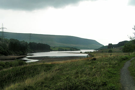
This is a gentle low-level Peak District walk up the deep Longdendale valley along the route of the old Woodhead railway and returning along reservoir paths under the brooding slopes of Bleaklow and Black Hill. The start is at Hadfield station (grid ref. SK024960), which is served by half-hourly trains from Manchester Piccadilly, alternatively there is car parking by the Longdendale Trail (grid ref. SK024961).
Leave Hadfield station and go right onto Platt Street and when the road swings under a bridge go left into the car park and join the Longdendale Trail. From here it is a simple matter of following the trail up the valley all the way to where it meets the road by the Woodhead Dam. It's an easy stroll with the views growing ever more wild and impressive as you head up the valley, the section from the Pennine Way crossing to Pasture Wood beneath Torside and Wildboar Cloughs is particularly spectacular.
At the Woodhead Dam leave the trail and go right down the road for a short distance then cross it and take a signed concessionary footpath down through the wood. It crosses a weir beneath the dam then turns east by the shore of Torside Reservoir for about 1 ½ miles, meeting the Pennine Way for a short section to Torside Dam. Along the way there is a turn off to Crowden, just over the road where refreshments may be bought at the campsite.
Instead of following the Pennine Way over the dam wall take the lower of two tracks on the northern side of Rhodeswood Reservoir for lovely quiet section with Bramah Edge and the Devil's Elbow looming above on the opposite side. Eventually the dam is reached and you should cross it and soon the track becomes a tarmac lane by Deepclough. Follow this lane until it crosses over the Longdendale Trail then immediately take a signposted footpath on the right, passing through fields with superb views of Hadfield, Hollingworthhall Moor and back up the valley. It turns into a walled lane to emerge between houses at Padfield.
Go right then take the second left onto Post Street to a t-junction then go right again on Platt Street which leads downhill back under the Longdendale Trail to the railway station.
Maps 

| Ordnance Survey Explorer OL1 | Sheet Map | 1:25k | BUY |
| Anquet OS Explorer OL1 | Digital Map | 1:25k | BUY |
| Ordnance Survey Digital Map Subscription | |||
| Latest Ordnance Survey Discounts | |||
Other walks nearby
| Walk 3607 | Reservoirs Walk from Tintwistle | easy/mod | 5.5 miles |
| Walk 1759 | Torside Clough & Longendale from Old Glossop | moderate | 7.4 miles |
| Walk 1168 | Old Glossop & Bleaklow | moderate | 9.5 miles |
| Walk 2521 | Hollingworthall Moor & Walkerwood Reservoirs | moderate | 7.0 miles |
| Walk 2637 | Coombs Ridge, Cown Edge from Broadbottom | easy/mod | 7.0 miles |
| Walk 1686 | Cown Edge | easy/mod | 7.3 miles |
| Walk 1923 | Cown Edge & Whiteley Nab from Chunal | easy/mod | 6.5 miles |
| Walk 2625 | Torside Clough from Longdendale | moderate | 4.5 miles |
| Walk 3027 | Bleaklow Head from Longdendale | moderate | 8.0 miles |
| Walk 1486 | Harry Hut, Mill Hill & Doctor's Gate from Glossop | moderate | 11.3 miles |
Recommended Books & eBooks
Dark Peak Walks
 Guidebook to 40 walks in the Dark Peak area of the Peak District National Park. 35 circular routes for most abilities, from 8km to 19km, around Edale, Marsden, Fairholmes, Baslow and Castleton, including Kinder Scout and Mam Tor, and 5 longer (25km to 45km) routes highlighting the best of the Gritstone Edges, High Moorland and Deep Valleys.
More information
Walking in Derbyshire
 Walking guidebook to 60 circular day walks in Derbyshire and the Peak District. Includes the Derwent, Wye and Trent river valleys, near Derby, Matlock, Glossop, Bakewell and Ripley. Routes range from easy to moderate and are between 4 and 14km (2 to 10 miles). Walks focus on places of interest, from Stone Age forts to castles to grand estates.
More information
