Kirkby Stephen & Hartley Circular
Cumbria Walk
County/Area - Cumbria - Eden Valley Mallerstang
Author - Lou Johnson
Length - 5.0 miles / 8.1 km Ascent - 550 feet / 167 metres
Time - 3 hours 0 minutes Grade - easy/mod
Walk Route Description
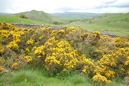
Click image to see photo description.
This circular walk starts from the pleasant town of Kirkby Stephen and explores the rolling country lying to the east of the town. The route includes riverside walking, a section of woodland, views across wild moorland and the Vale of Eden. Part of the return route is along a quiet country lane offering a grandstand view of Kirkby Stephen.
There is plenty of parking in Kirkby Stephen including a car park to the west of the main road (grid ref. NY772088). Wherever you park locate the entrance to the parish church in the Market Square. With your back to the church turn left and walk down the narrow road next to the newsagents. Follow the sign for River Eden and Frank's Bridge down an alley, Stone Shot. At the bottom turn left and cross Frank's Bridge. Turn right along a path following the River Eden which is on your right.
The path joins a walled lane. Shortly after the first bend in the River Eden turn left on a signed footpath (grid ref. NY779080). This leads across a field to a bridge over a disused railway (grid ref. NY780077). Continue on the path through two fields to reach a junction of paths (grid ref. NY782074). Bear left here through woodland to follow Ladthwaite Beck upstream. The path climbs away from the beck before contouring across the northern slopes of Birkett Hill to reach Ladthwaite Farm.
Bear left here and follow the signed path initially alongside a wall on your left. The path then leaves this wall and climbs more steeply up to a tarmac lane (grid ref. NY799075). East from here there are grand views across Hartley Fell whilst directly ahead lies another Birkett Hill! To continue turn west (left) down the tarmac lane. This descends quite sharply in places with the vast expanse of Hartley Quarry to your left.
Continue on the lane until it starts to level out before Hartley village. Cross the first small bridge on the left (grid ref. NY782085) and turn left to locate a footpath on your right. This leads across a meadow back to Frank's Bridge from where you retrace your steps back into Kirkby Stephen.
Maps 

| Ordnance Survey Explorer OL19 | Sheet Map | 1:25k | BUY |
| Anquet OS Explorer OL19 | Digital Map | 1:25k | BUY |
| Ordnance Survey Digital Map Subscription | |||
| Latest Ordnance Survey Discounts | |||
Other walks nearby
| Walk 1382 | Mallerstang circular | easy/mod | 7.0 miles |
| Walk 1386 | Hartley Birkett & Nine Standards Rigg | easy/mod | 4.5 miles |
| Walk 3573 | Wild Boar Fell from Pendragon Castle | moderate | 8.3 miles |
| Walk 1383 | Pendragon Castle | easy | 2.3 miles |
| Walk 1341 | Nine Standards Rigg | moderate | 6.0 miles |
| Walk 1389 | Fell End Clouds | easy | 3.0 miles |
| Walk 2756 | Wild Boar Fell (western approach) | moderate | 7.0 miles |
| Walk 1342 | Randygill Top from Weasdale | moderate | 6.0 miles |
| Walk 1616 | Bowderdale and the Calf | moderate | 10.0 miles |
| Walk 1160 | Wild Boar Fell & Swarth Fell | moderate | 7.0 miles |
Recommended Books & eBooks
Walking the Lake District Fells - Wasdale
 Part of the Walking the Lake District Fells series, this guidebook covers a wide range of routes to 25 Lakeland summits that can be climbed from the Wasdale, Eskdale and Ennerdale valleys, with highlights including Scafell Pike, Great Gable and Pillar. Suggestions for longer ridge routes are also included.
More information
Walking the Lake District Fells - Keswick
 Part of the Walking the Lake District Fells series, this guidebook covers a wide range of routes to 30 Lakeland summits that can be climbed from Keswick, Whinlatter, Bassenthwaite, Caldbeck, Mungrisdale and Threlkeld, with highlights including Skiddaw and Blencathra. Includes suggestions for longer ridge routes.
More information
