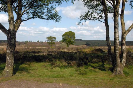
Sherbrook, Stepping Stones & Freda's Memorial from Chase Road Corner
Cannock Chase Walk
Region - Cannock Chase
County/Area - Staffordshire - Cannock Chase
Author - Lou Johnson
Length - 6.0 miles / 9.8 km Ascent - 250 feet / 76 metres
Time - 3 hours 20 minutes Grade - easy
Walk Route Description
Click image to visit gallery of 6 images.
This extended Cannock Chase walk does require a good sense of direction. Ideally you should also be equipped with the OS 1:25000 Explorer map for the area. Although the route is easy to follow for those who know the area, there are points in the walk where you need to be a good map reader. In addition many new paths not marked on the OS map add to the confusion. That said the walk is a worthwhile outing and offers plenty of interest.
The walk starts from the Chase Road Corner car park (grid ref. SJ980175) where there is usually space even on busy days. Walk from the road through the car park and at the end of the parking area pick up a broad path heading just east of south. The route continues in roughly the same direction to meet the Heart of England Way (grid ref. SJ986166). Turn left and descend into the Sherbrook Valley.
Reaching the main valley path turn left. To your right will be the infant Sherbrook and beyond that the boundary of the conifer plantation of Parr's Warren. Ignore many paths on your left and look out for the end of the conifers on your right. This is the first landmark along the valley. Shortly after this point the path bears quite sharply left and then right again in a large loop to regain its position next to Sherbrook. You soon join the Staffordshire Way which comes in from the left. Continue straight ahead for just under a mile with Sherbrook on your right to reach stepping stones across the stream.
Do not cross the stream and continue straight ahead still on the Staffordshire Way which is now quite a wide path or track to reach a junction of broad tracks (grid ref. SJ980202). The Staffordshire Way goes right, but we go left on a broad gravelly track to reach another junction with a sign on the left (grid ref. SJ978201). Turn left onto the Heart of England Way and follow the track as it climbs past Mere Pits on your right. The navigation now gets more problematic. The route goes straight over a junction of paths and tracks (grid ref. SJ979190). At the next junction 100 metres or so further on you turn left. There is a sign to Freda's Memorial but it is easily missed.
You are now walking southwest and after a short distance you will reach the small memorial on your right. Freda's Grave records the life of the New Zealand Rifles' mascot who died in 1918. Retrace your steps to the last junction (grid ref. SJ980189). From here you turn right. Continue south roughly parallel to the road which is on your right. Reaching the trig point a few metres away on your right you will also be able to locate the Glacial Boulder abandoned here after the glaciers retreated at the end of the Ice Age. Note that on some OS maps the position of the Glacial Boulder is incorrect as it lies to the east of the road.
Return to the main path and continue south on the Heart of England Way. This leads you back to the start after bearing right at the first major fork in the path. From this point the path descends through a lightly wooded area to the car park.
Maps 

| Ordnance Survey Explorer 244 | Sheet Map | 1:25k | BUY |
| Anquet OS Explorer 244 | Digital Map | 1:25k | BUY |
| Ordnance Survey Digital Map Subscription | |||
| Latest Ordnance Survey Discounts | |||
Other walks nearby
| Walk 1348 | Sherbrook Valley & Katyn Memorial | easy | 4.0 miles |
| Walk 2023 | Cannock Chase War Trail | moderate | 7.5 miles |
| Walk 1801 | Three Memorials of Cannock Chase | easy | 3.5 miles |
| Walk 1731 | Highlights of Cannock Chase | easy/mod | 10.0 miles |
| Walk 1370 | Sherbrook Valley from Punch Bowl, Milford | easy | 4.0 miles |
| Walk 1189 | Cannock Chase Circular | easy | 6.5 miles |
| Walk 2911 | Seven Springs, Little Haywood, Shugborough & Milford | easy | 6.5 miles |
| Walk 2111 | Milford, Seven Springs, Little Haywood & Shugborough | easy | 6.0 miles |
| Walk 1802 | Shugborough Park from Milford | easy | 4.5 miles |
| Walk 1843 | Haywood Slade & Sherbrook from Seven Springs | easy | 4.0 miles |
Recommended Books & eBooks
Walking in the Peak District - White Peak East
 Guidebook describing 42 half-day and day walks in the limestone landscapes of Derbyshire's White Peak, part of the Peak District National Park. One of two volumes, this book covers the east of the region, with potential bases including Bakewell, Eyam, Castleton, Birchover, Matlock and Wirksworth.
More information
