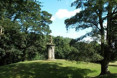
Shugborough Park from Milford
Cannock Chase Walk
Region - Cannock Chase
County/Area - Staffordshire - Cannock Chase
Author - Lou Johnson
Length - 4.5 miles / 7.3 km Ascent - 250 feet / 76 metres
Time - 2 hours 30 minutes Grade - easy
Walk Route Description
Click image to visit gallery of 5 images.
This walk begins with an exploratory look at a small part of Cannock Chase - now designated an Area of Outstanding Natural Beauty. It then includes a walk through the parkland surrounding Lord Lichfield's Shugborough Hall before concluding with a look at some of Britain's canal heritage.
The starting point is Milford Common (grid ref. SJ973211) on the main A513 Stafford to Rugeley Road. A popular place for visitors throughout the year there is ample parking either on the common or on adjacent areas of the Chase. From the main car park head east across the common to the main entrance to Shugborough Hall. Cross the main road and, ignoring the main entrance, follow the main road uphill for a short way to take the first clear footpath on your left.
This leads gently uphill through typical Chase woodland past a covered water store and then heads downhill again. Like much of the Chase there are numerous paths and the best guidance that can be given is to keep the boundary fence of the Shugborough Estate to your left. After a few minutes you reach the main road which is followed as far as the entrance to Shugborough Estate.
Go through this gateway and follow the road, which passes a converted farm on your right before turning left to cross the railway. Stay with the road past Shugborough Park Farm (open to visitors during the season and also home to some rare breeds of farm animals) to reach open parkland. Ahead is the public bridleway way that passes Shugborough Hall with its fine facade on your left. The bridleway leads to the southern side of Essex bridge. Please note provided you stay on the Staffordshire Way, which is a public right of way, through the Shugborough Estate then you do not need to pay the NT admission fee.
Cross the River Trent to reach the Trent & Mersey Canal using the steps by the bridge to reach the towpath. Head north to Great Haywood Junction where you turn left under the bridge to follow the Staffordshire & Worcestershire canal back as far as Tixall Bridge (grid ref. 975217). Here you need to join the lane for the short walk back to Milford Common and your transport.
Maps 

| Ordnance Survey Explorer 244 | Sheet Map | 1:25k | BUY |
| Anquet OS Explorer 244 | Digital Map | 1:25k | BUY |
| Ordnance Survey Digital Map Subscription | |||
| Latest Ordnance Survey Discounts | |||
Other walks nearby
| Walk 1189 | Cannock Chase Circular | easy | 6.5 miles |
| Walk 2911 | Seven Springs, Little Haywood, Shugborough & Milford | easy | 6.5 miles |
| Walk 2111 | Milford, Seven Springs, Little Haywood & Shugborough | easy | 6.0 miles |
| Walk 1370 | Sherbrook Valley from Punch Bowl, Milford | easy | 4.0 miles |
| Walk 2023 | Cannock Chase War Trail | moderate | 7.5 miles |
| Walk 2199 | Brocton & Walton-on-the-Hill Circular | easy | 3.5 miles |
| Walk 2443 | Tixall from St Thomas Priory near Stafford | easy | 7.0 miles |
| Walk 1843 | Haywood Slade & Sherbrook from Seven Springs | easy | 4.0 miles |
| Walk 1753 | Abraham's Valley & Haywood Warren from Seven Springs | easy | 3.0 miles |
| Walk 1394 | Bednall & Acton Trussell from near Stafford | easy | 6.5 miles |
Recommended Books & eBooks
Walking in the Peak District - White Peak East
 Guidebook describing 42 half-day and day walks in the limestone landscapes of Derbyshire's White Peak, part of the Peak District National Park. One of two volumes, this book covers the east of the region, with potential bases including Bakewell, Eyam, Castleton, Birchover, Matlock and Wirksworth.
More information
