Blackpatch Hill & Harrow Hill from near Storrington
South Downs Walk
Nat Park - South Downs
County/Area - West Sussex
Author - Hugh Maguire
Length - 7.2 miles / 11.7 km Ascent - 700 feet / 212 metres
Time - 4 hours 20 minutes Grade - easy/mod
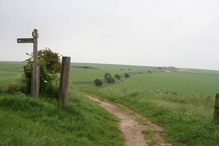
Walk Route Description
Click image to visit gallery of 5 images.
This West Sussex walk in the South Downs National Park starts from the car park (grid ref. TQ070125) easily reached by a narrow lane that climbs onto the Downs from the B2139 road between Amberley and Storrington a few miles west of the A24. The walk follows generally well-marked paths and tracks and includes a section of the South Downs Way and the Monarch's Way.
From the car park head east along the South Downs Way which is followed across the southern flank of Kithurst Hill. After just over a mile from the start you reach a car park at Chantry Post (grid ref. TQ087119). Leave the South Downs Way and take the footpath heading south east across a field. Continue into next field and follow the path which heads half left to reach the field boundary. Stay on the path to the south east corner of this large field (grid ref. TQ090107). Entering the next field ignore the path heading half right across the field and stay on the track alongside the field boundary.
After 800 metres the track reaches the foot of Blackpatch Hill on your left. The track curves gently to the right and then left to continue its southerly route gradually losing height to pass Longfurlong Farm (on your left) to reach a road (grid ref. TQ093082) about two and a half miles from leaving the South Downs Way. Turn right following the signs for the Monarch's Way following the access road for Myrtle Grove Farm. In this large complex of buildings navigate your way to follow the waymarks for the Monarch's Way which heads almost due west running to the south of a large house just beyond a lawnmower business on the left. Continue along the Monarch's Way for a further 800 metres to reach a road (grid ref. TQ083085).
Turn right (north) following the road and after 800 metres as the road sweeps to the left (grid ref. TQ082093) leave the road and follow a track which runs north west and then north around the flank of Harrow Hill. This track re-joins the road (grid ref TQ078103). Continue along the road as it swings left to reach Lee Farm (grid ref. TQ075104). Just before the farm turn right on a clear track heading north. After a kilometre of easy walking you reach a T-junction. Turn left. After just over 100 metres turn right alongside a plantation on your left. Ignore the bridleway on your left and continue to the end of the trees (grid ref. TQ073119). Turn left and almost immediately right onto on the continuing path across a field to reach a cross track (grid ref. TQ072121). If you are interested, you can make a short diversion here to see a derelict WWII Mark 2 Churchill tank, which is located a short way down the track on the left. To continue head straight across the field back to the start.
Maps 

| Ordnance Survey Explorer OL10 | Sheet Map | 1:25k | BUY |
| Anquet OS Explorer OL10 | Digital Map | 1:25k | BUY |
| Ordnance Survey Digital Map Subscription | |||
| Latest Ordnance Survey Discounts | |||
Other walks nearby
| Walk 1917 | Rackham Hill from Amberley | easy/mod | 6.5 miles |
| Walk 1615 | Amberley & East Dean Circular | mod/hard | 21.0 miles |
| Walk 1466 | Amberley and Arundel Circular | moderate | 13.0 miles |
| Walk 1628 | Bignor Hill and The Denture from Amberley | moderate | 8.7 miles |
| Walk 1629 | The River Arun & South Stoke | easy | 4.6 miles |
| Walk 3305 | Amberley Mount and Wepham Down | easy/mod | 8.0 miles |
| Walk 3310 | Washington to Littleton Farm by the South Downs Way | moderate | 13.0 miles |
| Walk 3078 | Cissbury Ring & Chanctonbury Ring from Washington | easy/mod | 8.3 miles |
| Walk 3080 | Arundel Park and the River Arun | easy/mod | 7.2 miles |
| Walk 2835 | Arundel to Amberley | easy | 6.2 miles |
Recommended Books & eBooks
Walks in the South Downs National Park
 Guidebook with 40 circular walks throughout the South Downs National Park, exploring the beautiful chalk hills between Eastbourne and Winchester. The walks range from under 5 miles to 11 miles, including Beachy Head and the Seven Sisters, Ditchling Beacon and hundreds of prehistoric sites. Accessible all year, but wild flowers best in spring.
More information
The South Downs Way
 Guidebook to walking the South Downs Way National Trail, a 100 mile (160km) route between Winchester and Eastbourne through the South Downs National Park, described in both directions over 12 stages. Easy walking on ancient and historical tracks, taking in wooded areas, delightful river valleys and pretty villages. With 1:25K OS map booklet.
More information
