Arundel to Amberley
South Downs Walk
Nat Park - South Downs
County/Area - West Sussex
Author - Lou Johnson
Length - 6.2 miles / 10.1 km Ascent - 250 feet / 76 metres
Time - 3 hours 20 minutes Grade - easy
Walk Route Description
Click image to see photo description.
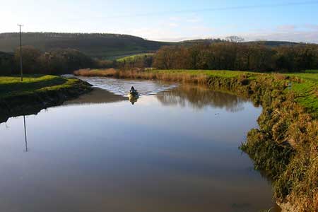
This linear West Sussex walk in the South Downs explores the River Arun from Arundel upstream to Amberley. The start is Arundel railway station (grid ref. TQ024064) where regular trains connect with the end of the walk at Amberley. Parking is available at both stations although my preference would be to park at Amberley and take the train to Arundel to start the walk.
Leave Arundel station and walk towards the town centre along the A27.At the roundabout continue straight ahead towards the town centre. Reaching the bridge over the River Arun, take the footpath on the right before crossing the bridge. This path leads along the river bank following the Monarch's Way long distance footpath. After 800 metres bear right away from the river, cross the railway. Immediately after crossing the railway turn left alongside the railway After 500 metres the path bears right away from railway, crosses a footbridge and reaches a road (grid ref. TQ035078). Turn right along the road and almost immediately turn left on to a signed path into woodland. After 800 metres from the road you will reach a cross path (grid ref. TQ041081). Turn left down to the road.
Cross the road and take the footpath opposite. This path leads to a road at the western end of Wepham Village (grid ref. TQ041085). Turn left and follow the road to reach a T-junction in the village of Burpham (grid ref. TQ040088). Continue straight ahead passing the George Inn on your left. Continue straight ahead down a no-through road to regain the river ban path at grid ref. TQ037088). Turn north along the river (river to your left). After 2 km alongside the river, the path turns north away from the river, crosses the Gurkha footbridge and reaches the road at North Stoke (grid ref. TQ023107). Turn left for a short distance and the right down Stoke Road (opposite the telephone box).
Follow Stoke Road as it bends to the right and then right to reach a footpath sign on your left, just past a red brick house on your right. Follow this path down to the banks of the River Arun (grid ref. TQ021113). Turn right (upstream) and continue along the path, which leads easily to reach the Arun river bridge at Amberley. Turn right along the road to reach Amberley railway station in 200 metres.
Maps 

| Ordnance Survey Explorer OL10 | Sheet Map | 1:25k | BUY |
| Anquet OS Explorer OL10 | Digital Map | 1:25k | BUY |
| Ordnance Survey Digital Map Subscription | |||
| Latest Ordnance Survey Discounts | |||
Other walks nearby
| Walk 1423 | Midhurst Way - Arundel to Midhurst | mod/hard | 19.0 miles |
| Walk 3080 | Arundel Park and the River Arun | easy/mod | 7.2 miles |
| Walk 3305 | Amberley Mount and Wepham Down | easy/mod | 8.0 miles |
| Walk 2487 | Littlehampton to Climping | easy | 5.0 miles |
| Walk 1917 | Rackham Hill from Amberley | easy/mod | 6.5 miles |
| Walk 1615 | Amberley & East Dean Circular | mod/hard | 21.0 miles |
| Walk 1466 | Amberley and Arundel Circular | moderate | 13.0 miles |
| Walk 1628 | Bignor Hill and The Denture from Amberley | moderate | 8.7 miles |
| Walk 1629 | The River Arun & South Stoke | easy | 4.6 miles |
| Walk 1667 | Blackpatch Hill & Harrow Hill from near Storrington | easy/mod | 7.2 miles |
Recommended Books & eBooks
Walks in the South Downs National Park
 Guidebook with 40 circular walks throughout the South Downs National Park, exploring the beautiful chalk hills between Eastbourne and Winchester. The walks range from under 5 miles to 11 miles, including Beachy Head and the Seven Sisters, Ditchling Beacon and hundreds of prehistoric sites. Accessible all year, but wild flowers best in spring.
More information
