Oswaldkirk, Nunnington & Harome circular
North Yorkshire Walk
County/Area - North Yorkshire - Vale of Pickering
Author - Andy Chaplin
Length - 11.5 miles / 18.7 km Ascent - 600 feet / 182 metres
Time - 6 hours 20 minutes Grade - moderate
Walk Route Description
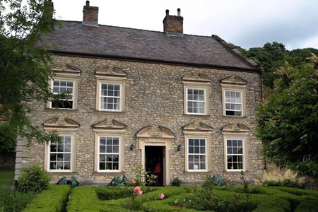
Click image to visit gallery of 3 images.
So some walks are determined by where you want to start from and end up at. The Malt Shovel at Oswaldkirk has that rare combination of great view, interesting building, cheap beer (Sam Smiths) and being situated (literally) just the other side of the road from the North York Moors national park.
The walk takes in the villages of Oswaldkirk, Nunnington and Harome where, if you don't know them already, you can wander around the villages. It also takes in the rivers Rye and Riccal, for train enthusiasts there are sections of the old Helmsley-Gilling railway and long distance path "tickers" get just over 3 miles of the Ebor Way.
You can normally park on the road to Ampleforth alongside the Malt Shovel pub. From here walk back to the main road and take the minor road across and to your right past the Old School House. After 500 metres a path angles off to the left to Leysthorpe Lane. Go right on the road and take the first path off on the left. In 2015 the stiles here were not particularly well-kept, but were passable.
Before Seamer Great Wood you follow the path to the right then look hard for the bridge over the White Beck in the corner to your left - again, it was overgrown in summer 2015. Follow the beck eastwards to the River Rye and then either cross at the ford or go upstream and take the footbridge.
The path follows the river then passes under the old Helmsley to Gilling railway before moving away from the river and passing through another well camouflaged stile. Cross the field towards the footbridge, go back over the Rye and come back around Plump Wood. At the southern end of the wood a sign points you towards Nunnington - three quarters of a mile away.
Follow the path along the south bank of the Rye into Nunnington and turn immediately right, back over the river. The path is a farm track which you leave just before Crow Wood then follow the path across fields towards Crook House Farm. Take paths south and west of the farm to pick up the path alongside the River Riccal and continue on to Aby Green Farm.
Take the road into Harome and at the bend near the church and hotel take the path along the Riccal again. When you come out on Acres Lane turn left and after 1km take the bridleway down to the railway. There was no sign on this in 2015 so it may be worth counting off the 3 fields as you walk along Acres lane before looking for the bridleway gate.
Go under the railway bridge and then follow the Ebor Way. It is reasonably well signed as it makes its way past the fish farm, over the Rye again, past Low Parks Farm and on towards Sproxton Hall. Here the path turns back on itself and follows a road towards Throstles Nest. There is a bench amongst the trees half way along the road.
Watch out for the sign off to the right where the path follows the edge of Green Sykes before dog-legging around Belt Plantation and Seamer Little Wood. From here it is south to Oswaldkirk Bank Top, cross the road, take the first path off on the left and come back into Oswaldkirk above the cliff and then on the road past the Old School House again.
Maps 

| Ordnance Survey Explorer OL26 | Sheet Map | 1:25k | BUY |
| Anquet OS Explorer OL26 | Digital Map | 1:25k | BUY |
| Ordnance Survey Digital Map Subscription | |||
| Latest Ordnance Survey Discounts | |||
Other walks nearby
| Walk 2702 | Ampleforth, Shallow Dale, Yearsley Moor & Wilderness | moderate | 9.5 miles |
| Walk 1525 | Beck Dale & Rievaulx from Helmsley | moderate | 9.8 miles |
| Walk 2760 | Riccal Dale & Howl Dale | moderate | 8.2 miles |
| Walk 1311 | Slingsby & South Holme | easy/mod | 8.0 miles |
| Walk 1920 | Rievaulx Moor from Cowhouse Bank | moderate | 9.5 miles |
| Walk 1524 | Cold Kirby, Rievaulx Bridge & Wass | moderate | 12.5 miles |
| Walk 2566 | Rievaulx Abbey from Kilburn, near Thirsk | mod/hard | 15.0 miles |
| Walk 1498 | Kilburn White Horse, Cold Kirby, Murton, & Sutton Bank | moderate | 14.0 miles |
| Walk 3581 | Gormire Lake from Sutton Bank National Park Centre | easy/mod | 3.4 miles |
| Walk 3398 | Rollgate Bank & Aumery Park from Fadmoor | moderate | 11.0 miles |
Recommended Books & eBooks
Trail and Fell Running in the Yorkshire Dales
 Guidebook to 40 of the best trail and fell runs in the Yorkshire Dales National Park. Ranging from 5 to 24 miles, the graded runs start from bases such as Ribblehead, Dent, Sedbergh, Malham and Grassington and take in the region's diverse delights, from castles and waterfalls to iconic mountains such as Whernside, Ingleborough and Pen Y Ghent.
More information
