Abraham's Valley & Haywood Warren from Seven Springs
Cannock Chase Walk
Region - Cannock Chase
County/Area - Staffordshire - Cannock Chase
Author - Lou Johnson
Length - 3.0 miles / 4.9 km Ascent - 350 feet / 106 metres
Time - 1 hours 50 minutes Grade - easy
Walk Route Description
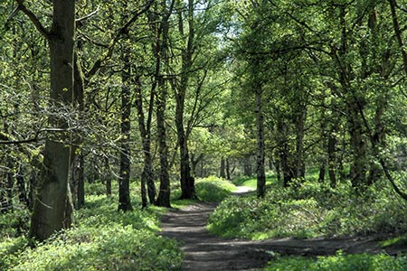
Click image to visit gallery of 6 images.
This short Cannock Chase walk starts from the Seven Springs parking area (grid ref. SK004205), which lies south of the A513 Stafford to Rugeley road at Weetman's Bridge. At the bridge junction take the narrow gravel track south to this popular 'beauty spot'. At busy times of the week the parking area may be full. If so return to the A513 and park in the lay-by adjacent to the bridge.
After parking take the path by the sign "S5 Seven Springs". This path leads into Abraham's Valley and you will soon discover that you have left the crowds behind! You need to keep straight ahead on this wide path for about a mile and a quarter. The path rises gently through trees and in more open areas. After about half an hour of leisurely walking you will reach a cross path (bridleway) at grid ref. SJ999185. You will have passed a number of forest tracks and paths off to the left and right before this junction. However, this junction has a path descending into trees on the left and a broad rising track on the right.
Turn right and keep on the main track as it heads uphill to reach a cross track (grid ref. SJ996185) after about 300 metres. Turn right. Shortly after turning right you will see a raised earth embankment on your left. This is the remains of First World War firing range which was used to train troops for the battlefield. Stay on the main track for three quarters of a mile to reach a fire look-out tower on your right (grid ref. Sj998197). From here you get a good view north into the Trent Valley.
Continue straight ahead at this junction and follow this track downhill past forestry plantations on your left and an open area on your right. Eventually you reach a T-junction with tracks going left and right (grid ref. SK003201). From this point take a narrow path opposite between the trees and through bracken. This path soon leads back to Seven Springs and the car park used at the start.
Maps 

| Ordnance Survey Explorer 244 | Sheet Map | 1:25k | BUY |
| Anquet OS Explorer 244 | Digital Map | 1:25k | BUY |
| Ordnance Survey Digital Map Subscription | |||
| Latest Ordnance Survey Discounts | |||
Other walks nearby
| Walk 1370 | Sherbrook Valley from Punch Bowl, Milford | easy | 4.0 miles |
| Walk 2023 | Cannock Chase War Trail | moderate | 7.5 miles |
| Walk 1189 | Cannock Chase Circular | easy | 6.5 miles |
| Walk 2911 | Seven Springs, Little Haywood, Shugborough & Milford | easy | 6.5 miles |
| Walk 2111 | Milford, Seven Springs, Little Haywood & Shugborough | easy | 6.0 miles |
| Walk 1802 | Shugborough Park from Milford | easy | 4.5 miles |
| Walk 1324 | Glacial Boulder & Sherbrook | easy | 3.5 miles |
| Walk 1413 | Sherbrook, Stepping Stones & Freda's Memorial | easy | 6.0 miles |
| Walk 1348 | Sherbrook Valley & Katyn Memorial | easy | 4.0 miles |
| Walk 2199 | Brocton & Walton-on-the-Hill Circular | easy | 3.5 miles |
Recommended Books & eBooks
Walking in the Peak District - White Peak East
 Guidebook describing 42 half-day and day walks in the limestone landscapes of Derbyshire's White Peak, part of the Peak District National Park. One of two volumes, this book covers the east of the region, with potential bases including Bakewell, Eyam, Castleton, Birchover, Matlock and Wirksworth.
More information
