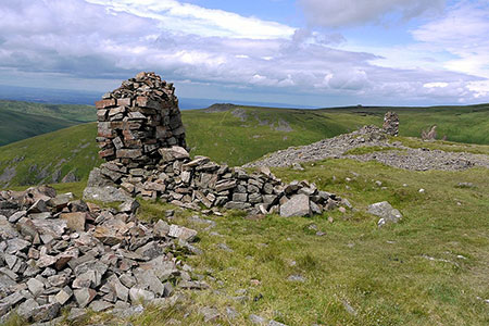
The Cheviot & Auchope Cairn from Langleeford
Northumberland Walk
Nat Park - Northumberland
County/Area - Northumberland County
Author - Lou Johnson
Length - 10.0 miles / 16.3 km Ascent - 2200 feet / 667 metres
Time - 7 hours 10 minutes Grade - mod/hard
Walk Route Description
Click image to see photo description.
This walk to The Cheviot's summit starts from Langleeford. The Cheviot does not have an inspiring summit so a short diversion to the Auchope Cairn from where an outstanding view across a sea of hills can be enjoyed. The walk follows a good path to Scald Hill from where the route continues to The Cheviot. From here the Pennine Way is followed over Cairn Hill to reach Auchope Hill. The descent returns to Cairn Hill from where a pleasant walk beside the Harthope Burn leads back to the start.
The start is the roadside parking (grid ref. NT953225) on the south side of the minor road from Wooler about 600 metres before Langleeford. After parking continue along the road for 200 metres and turn right on the path (signed Scald Hill & Cheviot). Bear left to join a track climbing up the hillside. Cross a stile (grid ref. NT940222) and continue uphill on the good path over grass. Reaching a fence, turn left and with the fence on your right continue to Scald Hill.
Continue following the fence descending through a wet area to start the ascent again. Cross the ladder stile and with the fence now on your left follow paved path to the summit of The Cheviot. Despite being the highest point in the Northumberland National Park the view is disappointing and limited. Continue along the Pennine Way over Cairn Hill, staying with the Pennine Way to reach a fence junction and the Scottish Border (grid ref. NT896194). Continue north-west to reach Auchope Cairn and enjoy the view.
Start the return by walking back to Cairn Hill. Turn right over the stile and descend with fence right down towards Scotsman's Knowe (grid ref. NT905190). Bear left down into the Harthope Burn valley. The path follows the Burn down into the valley although in places the path is quite feint. Just before reaching Langleeford Hope (grid ref. NT932208) you join a clear track which is followed back to the road at Langleeford. The start is a short walk along the road.
Maps 

| Ordnance Survey Explorer OL16 | Sheet Map | 1:25k | BUY |
| Anquet OS Explorer OL16 | Digital Map | 1:25k | BUY |
| Ordnance Survey Digital Map Subscription | |||
| Latest Ordnance Survey Discounts | |||
Other walks nearby
| Walk 1766 | Cushat Law and Bloodybush Edge from Hartside | mod/hard | 12.5 miles |
| Walk 2299 | The Cheviot | moderate | 9.0 miles |
| Walk 1314 | Great Hetha and Elsdon Burn from Hethpool | easy/mod | 4.0 miles |
| Walk 3644 | Blackhaggs Rigg & Great Hetha from Hethpool | moderate | 9.6 miles |
| Walk 3646 | Hethpool, Sutherland Bridge & Great Hetha | moderate | 6.0 miles |
| Walk 3739 | Elsdonburn & Trowupburn from Hethpool | moderate | 8.2 miles |
| Walk 1805 | An introduction to the Breamish Valley | easy | 2.0 miles |
| Walk 2677 | Circuit of Doddington Moor | easy | 3.8 miles |
| Walk 1201 | Black Hag from Kirk Yetholm | moderate | 8.5 miles |
| Walk 1200 | Windy Gyle | moderate | 7.5 miles |
Recommended Books & eBooks
The Pennine Way
 Guidebook to the Pennine Way National Trail with OS map booklet. The 265 mile route from Edale to Kirk Yetholm takes three weeks to walk and is suitable for fit and experienced long distance walkers. The route crosses the Peak District, Yorkshire Dales and North Pennines National Parks. Includes separate OS 1:25,000 map booklet of the route.
More information
Walking in Northumberland
 This guidebook contains detailed route descriptions for 36 day walks in Northumberland including the Cheviot Hills. The terrain varies from wild walks and craggy ascents to gentle riverside strolls. Each route ranges from 4 to 16 miles in length and there is the opportunity to link several walks together to create longer treks.
More information
