Hethpool, Sutherland Bridge & Great Hetha
Northumberland Walk
Nat Park - Northumberland
County/Area - Northumberland County
Author - Lou Johnson
Length - 6.0 miles / 9.8 km Ascent - 1300 feet / 394 metres
Time - 4 hours 20 minutes Grade - moderate
Maps 

| Ordnance Survey Explorer OL16 | Sheet Map | 1:25k | BUY |
| Anquet OS Explorer OL16 | Digital Map | 1:25k | BUY |
Walk Route Description
Click image to see photo description.
This circular walk from Hethpool in Northumberland explores the College Valley upstream to Sutherland Bridge where the route turns north to reach the remote farm at Trowupburn. From here the walk ascends Great Hetha with its Iron Age hillfort. Throughout the walk there are many outstanding views of the Cheviot Hills including the Cheviot, the highest mountain in the Northumberland National Park.
The start is the small parking area at Hethpool (grid ref. NT894281). After parking turn right out of car park and walk north along the road. Where the road bears left, turn right onto the signed St. Cuthbert's Way. Cross the river, and where the track forks bear right. The path soon passes Hethpool Mill on your left to reach a gate. Go through the gate and follow an intermittent path roughly parallel to the College Burn on your right. There are occasional waymarks and the burn acts as a navigational aid. After 3.5 kilometres you reach a gate which leads you onto the Lambden Valley private road (grid ref. NT889248).
Turn right down the road, cross Sutherland Bridge and continue up to a road junction opposite Cuddlestone Hall. On the left is a memorial to the Allied Airmen who died in the Cheviots during the Second World War. Turn right along the road and after 100 metres bear left onto a footpath signed to Trowupburn. Initially a narrow path, continue ahead ignoring the path going left to the hill fort on Blackhaggs Rigg. The path soon enters forest. Cross Whitehall Burn and bar half left through trees to reach a track. Go straight across and follow the little-used path through trees to reach a clear track. Turn left uphill and where the main track bends left, continue ahead along a grassy path.
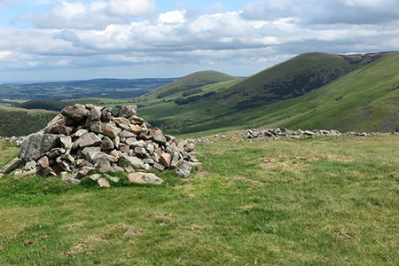
Reaching the end of the forest (grid ref. NT879261) continue ahead for a short way and then bear right downhill heading for Trowupburn Farm. Continue past the farm (on your right) to join a tarmac lane heading uphill. After 400 metres turn right onto a signed footpath to Great Hetha. Follow the grassy track uphill with several way markers to reach the hill fort earthworks on top of Great Hetha. The view from the summit is outstanding. Continue following way markers downhill to reach the left-hand corner of a plantation. Turn right along the edge of the plantation and continue down to the private road used earlier in the walk. Turn left along the road back to the start.
Other walks nearby
| Walk 2299 | The Cheviot | moderate | 9.0 miles |
| Walk 1201 | Black Hag from Kirk Yetholm | moderate | 8.5 miles |
| Walk 1764 | The Cheviot from Langleeford | mod/hard | 8.2 miles |
| Walk 1765 | Comb Fell & Hedgehope Hill from Langleeford | mod/hard | 8.9 miles |
| Walk 1776 | The Cheviot & Auchope Cairn from Langleeford | mod/hard | 10.0 miles |
| Walk 2152 | Hartshope Linn (waterfall) from Langleeford | easy | 4.4 miles |
| Walk 2153 | Housey Crags from Langleeford | easy/mod | 2.0 miles |
| Walk 2677 | Circuit of Doddington Moor | easy | 3.8 miles |
| Walk 1894 | Burnhope Reservoir Circular | easy | 2.8 miles |
| Walk 3296 | Grubbit Law & Hownam Law from Morebattle | moderate | 7.0 miles |
Recommended Books & eBooks
Walking in Northumberland
 This guidebook contains detailed route descriptions for 36 day walks in Northumberland including the Cheviot Hills. The terrain varies from wild walks and craggy ascents to gentle riverside strolls. Each route ranges from 4 to 16 miles in length and there is the opportunity to link several walks together to create longer treks.
More information
Hadrian's Wall Path
 Hadrians Wall Path guidebook to walk the 84 mile National Trail. Described in both directions, the main description is west to east between Bowness-on-Solway and Wallsend, Newcastle, with extensions to Maryport and South Shields. With extensive historical information related to this World Heritage site and separate 1:25,000 OS map booklet included.
More information
Messaging & Social Media
Message Walking Britain and follow the latest news.

Mountain Weather
Stay safe on the mountains with detailed weather forecasts - for iOS devices or for Android devices.