Welcombe Mouth and Darracott
Devon Walk
County/Area - Devon
Author - Lou Johnson
Length - 6.0 miles / 9.8 km Ascent - 1200 feet / 364 metres
Time - 4 hours 10 minutes Grade - moderate
Maps 

| Ordnance Survey Explorer 126 | Sheet Map | 1:25k | BUY |
| Anquet OS Explorer 126 | Digital Map | 1:25k | BUY |
Walk Route Description
Click image to see photo description.
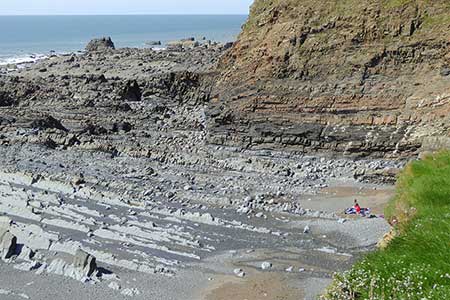
An energetic walk from Welcombe Mouth that explores a section of coast, and the surrounding countryside including the village of Darracott and the Marshland Valley Nature Reserve. The route follows a section of the South West Coast Path, inland paths, and tracks plus some short sections along quiet country lanes.
The start is the small car park above Welcombe Mouth (grid ref. SS123180) which is reached down a narrow lane with passing places from Strawberry Water. After parking turn right (facing the sea) and join the South West Coast Path. Cross the stepping-stones and take note of the unusual rock formations in the vicinity. The path climbs steeply onto the flank of Knap Head. Cross a stile and continue uphill. The SWCP turns left. Continue for 200 metres and turn right (grid ref. SS213184) across the field. The path continues downhill, passes barn on your left and descends into a side valley. The path soon curves to the right and exits at a lane (grid ref. SS218186).
Turn left and continue along the lane for 700 metres to a junction. Turn right (signed Welcombe) and almost immediately left onto a track by a fingerpost (grid ref. SS222190). Continue on track for 250 metres, turn right up steps, cross stile and continue to reach a wide track. Follow the track to a crossroads (grid ref. SS223193). Turn right and follow a clear track that winds down into the valley before rising to a lane at Linton (grid ref. SS231186). Turn left and then right at the fingerpost to follow path across several fields to another lane at The Barton.
Turn left and then right onto the first signed footpath. The path descends to cross a small stream and then climbs a field to reach Well Lane. Turn right to a lane (grid ref. SS230180). Turn left and follow the lane to reach the village green in Darracott. Bear right along the lane signed to Welcombe Mouth. Just after the roads bends right, turn left down a track with large barns (Leddon Farm) on your right. Descend the steep track to cross a stream and a tarmac lane by Gooseham Mill.
The onward route continues west along the valley. Turn right off the tarmac lane through a gate onto a concrete track, recross the river, turn left at fingerpost onto a path. At the fork bear left to reach a stile at a track junction. Navigation needs care. The path stays on the north side of the stream (Marshland Water) and keeps to the valley floor as you pass through the Marshland Valley Nature Reserve. After 600 metres the path rise to meet a track (grid ref. SS223173). Turn left and follow the rising track to reach Little Marshland (grid ref. SS218171).
Turn right and follow the upper path continuing with a hedge on your left to reach the South West Coast Path at Marshland Cliff. Turn right on the coast path and follow the waymarks to descend to Marshland Mouth. Another ascent and descent along the coast path which leads back to the car park at Welcombe Mouth.
Other walks nearby
| Walk 3208 | Stoke & Hartland Quay | moderate | 6.4 miles |
| Walk 1996 | Woodford & Hollygrove Wood | easy/mod | 5.1 miles |
| Walk 1261 | Hartland Point circular | moderate | 10.0 miles |
| Walk 1824 | Hartland Point Circular | easy | 3.0 miles |
| Walk 1719 | Clovelly & the South West Coast Path | easy/mod | 6.0 miles |
| Walk 2295 | Buck's Mill & Peppercombe | easy/mod | 6.2 miles |
| Walk 3755 | Dizzard Point, Millook from Penhalt Cliff | moderate | 6.0 miles |
| Walk 1076 | Dizzard Point & Crackington Haven | moderate | 8.0 miles |
| Walk 2730 | St Gennys & Castle Point from Crackington Haven | easy/mod | 3.0 miles |
| Walk 2731 | Cambeak & Crackington Haven | easy/mod | 4.3 miles |
Recommended Books & eBooks
The South West Coast Path
 Guidebook to walking the entire South West Coast Path National Trail. The route runs for 630 miles from Minehead to Poole along the north Devon, Cornish, south Devon and Dorset coastline. Divided into 45 stages, this long-distance coastal trek could be completed within 4 weeks, or walked in sections. Guide includes maps and essential information.
More information
South West Coast Path Map Booklet - Minehead to St Ives
 Map of the northern section of the 630 mile (1014km) South West Coast Path National Trail. Covers the trail from Minehead to St Ives along the north Devon and Cornish coastline. This convenient and compact booklet of Ordnance Survey 1:25,000 maps shows the route, providing all of the mapping you need to walk the trail in either direction.
More information
Messaging & Social Media
Message Walking Britain and follow the latest news.

Mountain Weather
Stay safe on the mountains with detailed weather forecasts - for iOS devices or for Android devices.