Hartland Point Circular from East Titchberry
Devon Walk
County/Area - Devon
Author - Peter Schofield
Length - 3.0 miles / 4.9 km Ascent - 400 feet / 121 metres
Time - 1 hours 50 minutes Grade - easy
Walk Route Description
Click image to visit gallery of 4 images.
Time prevented my walking the complete route of walk 1261 around Hartland Point so this short walk provides an opportunity to see a little of the superb coastal scenery in the area for those unable to undertake the full route.
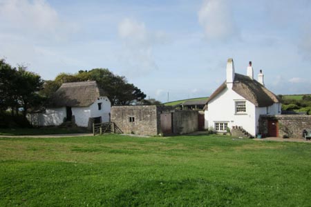
The walk starts at the NT car park adjacent to East Titchberry Farm (grid ref. SS245271). From the CP, take the bridleway that passes the farm which dates back to the 17thC. After 250m, the South West Coastal Path is reached at Shipload Bay. Turn left along the Coastal Path as it winds its way along the cliff top offering expansive views towards Lundy Island. The route continues past an unsightly radar station to reach a small car park on the access road to Hartland Point lighthouse where refreshments are available from a kiosk at certain times of the year.
The scenery and wildlife in this area is magnificent. In the late summer when I walked it, grey seals were visible in the bay, while a peregrine falcon wheeled lazily in the thermals overhead and a couple of lizards were sunning themselves on a stile. The bushes along the path were heavily laden with lush crops of blackberries and sloes. Sadly, I wasn't carrying anything in which to collect them!
From the kiosk, follow the waymarked Coastal Path up to the coastguard station where Hartland Point lighthouse finally comes into view. The route continues along the cliff top passing a memorial to the "Glenart Castle", a hospital ship that was sunk off this coast shortly before the end of the First World War in 1918. The clear path continues along the cliff top before descending to a stile at GR SS228267.
Go left over the stile, passing a static caravan on your right to join a broad track as it gently climbs away from the sea. After 500m, go left at a track junction to continue past Blagdon Farm before shortly arriving at a tarmac lane. Turn right past the toll hut and walk along the quiet lane where the start point is reached after 1km.
Maps 

| Ordnance Survey Explorer 126 | Sheet Map | 1:25k | BUY |
| Anquet OS Explorer 126 | Digital Map | 1:25k | BUY |
| Ordnance Survey Digital Map Subscription | |||
| Latest Ordnance Survey Discounts | |||
Other walks nearby
| Walk 1261 | Hartland Point circular | moderate | 10.0 miles |
| Walk 1719 | Clovelly & the South West Coast Path | easy/mod | 6.0 miles |
| Walk 3208 | Stoke & Hartland Quay | moderate | 6.4 miles |
| Walk 3207 | Knap Head to Mansley Cliff | moderate | 8.0 miles |
| Walk 1788 | Welcombe Mouth and Darracott | moderate | 6.0 miles |
| Walk 2295 | Buck's Mill & Peppercombe | easy/mod | 6.2 miles |
| Walk 1996 | Woodford & Hollygrove Wood | easy/mod | 5.1 miles |
| Walk 1047 | Abbotsham Cliff beach and Kipling's Tor, Westward Ho! | easy | 3.5 miles |
| Walk 2161 | Appledore to Westward Ho! | easy | 4.5 miles |
| Walk 2028 | Croyde to Baggy Point Circular | easy | 5.5 miles |
Recommended Books & eBooks
South West Coast Path Map Booklet - Minehead to St Ives
 Map of the northern section of the 630 mile (1014km) South West Coast Path National Trail. Covers the trail from Minehead to St Ives along the north Devon and Cornish coastline. This convenient and compact booklet of Ordnance Survey 1:25,000 maps shows the route, providing all of the mapping you need to walk the trail in either direction.
More information
The South West Coast Path
 Guidebook to walking the entire South West Coast Path National Trail. The route runs for 630 miles from Minehead to Poole along the north Devon, Cornish, south Devon and Dorset coastline. Divided into 45 stages, this long-distance coastal trek could be completed within 4 weeks, or walked in sections. Guide includes maps and essential information.
More information
