Devon WalksWalking Routes & Hiking Trails
Find Devon walks from the list below which features the best walking routes in the area. Most are circular walks and are listed from the shortest and easiest to the longest more challenging routes.
The Devon walks listed below explore a beautiful county. The South West Coast Path runs along the north and south Devon coasts and provides a number of excellent circular day walks. In complete contrast are the wild moors of Dartmoor with the highest land in southern England. Elsewhere there are many pretty villages to explore as well as vast tracts of rural farmland with a patchwork of fields surrounded by hedgerows. All walks are free to download and print, and most route have GPS files to download.
| Walk | Description | Grade | Miles |
|---|---|---|---|
| 2912★ | Dartington from Totnes | easy | 2.50 |
| 3311★ | Trenchford & Tottiford Reservoirs (Moretonhampstead) | easy | 3.00 |
| 1824★ | Hartland Point Circular from East Titchberry | easy | 3.00 |
| 3458★ | Sharrah Pool from New Bridge | easy | 3.40 |
| 3463★ | Sharp Tor, Corndon Tor & Yar Tor Circular | easy/mod | 3.40 |
| 2219★ | The Avon Dam Reservoir from Shipley Bridge | easy | 3.50 |
| 2838★ | Laughing Tors from Bellever | easy | 3.50 |
| 1047★ | Abbotsham Cliff beach and Kipling's Tor, Westward Ho! | easy | 3.50 |
| 2901★ | Castle Drogo & Sharp Tor from Fingle Bridge | easy | 3.75 |
| 3391★☩ | Valley of Rocks frrom Lynton | easy/mod | 3.80 |
| 1323★ | Broadsands Beach and Brixham | easy | 4.00 |
| 3041★ | Thurlestone circular from Bantham | easy | 4.00 |
| 1866★ | East Prawle & Prawle Point | easy/mod | 4.10 |
| 3393★☩ | Great Hangman Hill from Combe Martin | easy/mod | 4.30 |
| 3462★ | Corndon Tor & Yar Tor Circular | easy/mod | 4.30 |
| 2161★ | Appledore to Westward Ho! | easy | 4.50 |
| 1910★ | Countisbury and Watersmeet from Lynmouth | easy/mod | 4.50 |
| 3749★ | Codden Hill Circular | easy/mod | 4.80 |
| 3657★ | Bigbury-on-Sea, Arymer Cove & Burgh Island | easy/mod | 5.00 |
| 2013★ | The Plym Valley from Plym Bridge | easy | 5.00 |
| 2908★ | Great Links Tor & Widgery Cross from the Fox & Hounds | easy/mod | 5.00 |
| 2018 | Saltram Park & Hardwick Wood, Plymouth | easy | 5.00 |
| 3729★☩ | Foreland Point from Barna Barrow (Countisbury) | moderate | 5.00 |
| 2279★ | Salcombe Regis & Weston Mouth | easy/mod | 5.10 |
| 3633★ | Knathorne & Oldborough from Morchard Richard | easy/mod | 5.20 |
| 3390★☩ | Heddon Valley from Woody Bay | moderate | 5.30 |
| 1795★ | Beer & Branscombe Circular | easy/mod | 5.50 |
| 3201★ | Bellever Tor & Postbridge from Bellever | easy/mod | 5.50 |
| 2028★ | Croyde to Baggy Point Circular | easy | 5.50 |
| 3223★ | Avon Dam Reservoir & White Barrows from Shipley Bridge | easy/mod | 5.50 |
| 2474★ | East Prawle Coast Circular | easy/mod | 5.60 |
| 1636★ | Danger Point & Ladram Bay from Otterton | easy/mod | 6.00 |
| 2012★ | Wembury Bay & St Peter's Church from Noss Mayo | easy/mod | 6.00 |
| 1788★ | Welcombe Mouth and Darracott | moderate | 6.00 |
| 1797★ | Morthoe, Morte Point & Bull Point circular | easy/mod | 6.00 |
| 2015★ | The Meavy & Plym valleys from Shaugh Bridge | moderate | 6.00 |
| 1719★ | Clovelly & the South West Coast Path | easy/mod | 6.00 |
| 2295★ | Buck's Mill & Peppercombe | easy/mod | 6.20 |
| 3757★ | Buckland in the Moor Circular | easy/mod | 6.30 |
| 2188★ | Great Nodden & Great Links Tor | moderate | 6.30 |
| 2154★ | West Anstey Common from Molland | easy/mod | 6.40 |
| 3208★ | Stoke & Hartland Quay from Elmscott | moderate | 6.40 |
| 2230 | Exploring Plymouth | easy | 6.50 |
| 1075★ | High Willhays & Yes Tor from Meldon Reservoir | moderate | 6.50 |
| 3112★ | Soar Mill Cove & Bolt Head from Higher Soar | easy/mod | 6.50 |
| 2639★ | Cosdon Beacon from South Zeal | easy/mod | 6.50 |
| 3460★ | Dr Blackall's Drive & Ponsworthy | easy/mod | 6.80 |
| 3394★☩ | Holdstone Down & Trentishoe | moderate | 7.00 |
| 1657★ | Huntingdon Warren & Lud Gate from Scorriton | moderate | 7.00 |
| 3587★☩ | Kingswear from Coleton Fishacre | moderate | 7.00 |
| 3671★ | Nun's Cross & Peat Cot from Princetown | easy/mod | 7.00 |
| 3276★ | Gara Point & Stoke Point from Noss Mayo | easy/mod | 7.00 |
| 2030★ | Budleigh Salterton, East Devon | easy/mod | 7.00 |
| 3641★ | Avon Dam & Redlake Tramway from Shipley Bridge | moderate | 7.20 |
| 2178★ | Rattlebrook Peat Railway | easy/mod | 7.30 |
| 1260★ | Haytor Rocks & Hound Tor from Saddle Tor | moderate | 7.50 |
| 1678★ | Bleak House & Great Nodden from Lydford | easy/mod | 7.50 |
| 2016★ | Cross Gate to Nuns Cross via Leather Tor | moderate | 8.00 |
| 1083★ | Eylesbarrow & Sheeps Tor from Norsworthy Bridge | moderate | 8.00 |
| 3427★ | Slapton Sands & Stokenham from Torcross | easy/mod | 8.00 |
| 3346★ | Start Point from Torcross | easy/mod | 8.00 |
| 3207★ | Knap Head to Mansley Cliff | moderate | 8.00 |
| 1857★ | Start Point & East Prawle | moderate | 8.20 |
| 1642★ | Burrator Reservoir from Yelverton | easy/mod | 8.50 |
| 1263★ | The Doone Valley from Malmsmead | moderate | 8.50 |
| 1772★ | Hurston, Lettaford & Two Moors Way | moderate | 8.60 |
| 1975★ | Erme Mouth from Bigbury-on-Sea | moderate | 9.00 |
| 2461★ | Warren Point & Bolt Tail from Bantham | moderate | 9.00 |
| 3387★ | Upper Erme Valley & Ugborough Moor | moderate | 9.30 |
| 3202★ | Postbridge & Challacombe Down from Bellever | moderate | 9.80 |
| 1261★ | Hartland Point circular | moderate | 10.00 |
| 1262★ | Watersmeet & Foreland Point from County Gate | mod/hard | 10.50 |
| 2085★ | Cosdon Hill & Oke Tor from Belstone | moderate | 10.70 |
| 2371★ | Kingswear to Brixham | moderate | 10.80 |
| 3432★ | Salcombe to Thurlestone | mod/hard | 11.00 |
| 1727★ | Shallowford, Hoar Oak Tree & The Chains | moderate | 11.70 |
| 3431★ | Beeson to Salcombe | mod/hard | 12.00 |
| 3004★ | Yes Tor, Cranmere Pool and Amicombe Hill from Meldon Reservoir | mod/hard | 12.50 |
| 2636★ | North Moor crossing from Okehampton to Bellever | mod/hard | 14.50 |
Walks that start in adjacent counties / areas.
Walks that start in adjacent counties or areas but cross the boundary and include sections of the route within Devon.
| Walk | Description | Starts In |
|---|---|---|
| 1669★ | Anstey Gate & Hawkridge from Tarr Steps | Somerset |
| 2387★ | Pinkery Pond Circular | Somerset |
★ GPS file ☩ Route profile
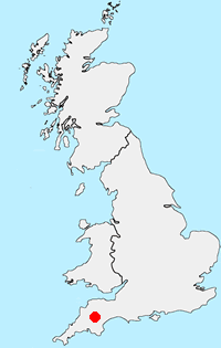
Location Map
Devon Guide
The County of Devon offers a wide range of walking. With two lengthy sections of coastal path along the north and south coasts the variety of walking on offer is hard to match anywhere in the British Isles. Add to this the wild moors of the Dartmoor National Park with the highest land in southern England and you soon realise why Devon has such a high reputation among walkers. Elsewhere there are many pretty villages to explore as well as vast tracts of rural farmland with a patchwork of fields surrounded by hedgerows.
Other walks in Britain - For a list of all the areas where walks are available go to the Main Walk Index.
Walk grading - Learn how each walk is assessed and select a walk to suit your ability and experience by going to Walk Grading Details.
Messaging & Social Media
Message Walking Britain and follow the latest news.

Mountain Weather
Stay safe on the mountains with detailed weather forecasts - for iOS devices or for Android devices.