Appledore to Westward Ho!
Devon Walk
County/Area - Devon
Author - Lou Johnson
Length - 4.5 miles / 7.3 km Ascent - 150 feet / 45 metres
Time - 2 hours 20 minutes Grade - easy
Walk Route Description
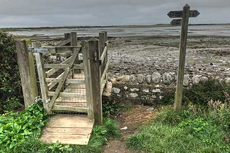
Click image to see photo description.
This walk from Appledore to Westward Ho! uses a section of the South West Coast Path between the two centres. The route follows a clear waymarked path along the south side of the River Taw estuary and a sandy coast following a long pebble ridge for the final section of the walk.
The walk starts from outside the Seagate Hotel in Appledore (grid ref. SS465307) overlooking the Taw estuary. (See final paragraph for return transport details from Westward Ho.) To start the walk, turn north along the Quay with the Taw on your right. Continue past the car park on your right. At the end of the car park bear right along Irsha Street passing between rows of terraced cottages. Follow the street as it bends right and then left briefly passing the river on your right.
At the end of Irsha Street at the junction of Jubilee Road on the left continue ahead down a no-through road. Continue ahead past the Lifeboat Station on the left to join the South West Coast Path. Bear right to pass Watertown Garage on your right and join Long Lane. (Note there is a toll path nearer the coast on this section.) Walk along the lane for 400 metres to the first junction. Turn right and enter Northam Burrows Country Park. Once through the gates bear left following a tarmac drive. Which reaches a small car park after just over a kilometre (grid ref. SS450313).
The SWCP bear rights off the tarmac drive and after 250 metres turns left across a small peninsula. Reaching the north side of the peninsula the path turns left and follows the shore through a sandy landscape with Greysands Beach off to your right. The path slowly veers left and continues through the dunes to reach a visitor centre and toilets by Sandymere (grid ref. SS440308). Continue south beside an access road to a road junction and nearly car park. Bear right and then clamber up onto the pebble bank into Westward Ho! to reach the Slipway Car Park (grid ref. SS434295).
The walk starts from Appledore where the large car park opposite the Seagate Hotel is the most convenient. After arriving at the Slipway Car Park in Westward Ho!, walk along Westbourne Terrace passing an amusement arcade on your right. Continue to a T-junction and turn left into Golf Links Road to a bus stop on the left-hand side of the road (grid ref. SS434294). Take Bus 21 and change at Northam for an onward bus 21A to Appledore with a journey time of 25 minutes. Alternatively, park in Westward Ho! and take the bus to the start of the walk.
Maps 

| Ordnance Survey Explorer 139 | Sheet Map | 1:25k | BUY |
| Anquet OS Explorer 139 | Digital Map | 1:25k | BUY |
| Ordnance Survey Digital Map Subscription | |||
| Latest Ordnance Survey Discounts | |||
Other walks nearby
| Walk 1047 | Abbotsham Cliff beach and Kipling's Tor, Westward Ho! | easy | 3.5 miles |
| Walk 2028 | Croyde to Baggy Point Circular | easy | 5.5 miles |
| Walk 3749 | Codden Hill Circular | easy/mod | 4.8 miles |
| Walk 2295 | Buck's Mill & Peppercombe | easy/mod | 6.2 miles |
| Walk 1797 | Morthoe, Morte Point & Bull Point circular | easy/mod | 6.0 miles |
| Walk 1719 | Clovelly & the South West Coast Path | easy/mod | 6.0 miles |
| Walk 3393 | Great Hangman Hill | easy/mod | 4.3 miles |
| Walk 1824 | Hartland Point Circular | easy | 3.0 miles |
| Walk 3394 | Holdstone Down & Trentishoe | moderate | 7.0 miles |
| Walk 1261 | Hartland Point circular | moderate | 10.0 miles |
Recommended Books & eBooks
South West Coast Path Map Booklet - St Ives to Plymouth
 Map of part of the southern section of the 630 mile (1014km) South West Coast Path National Trail. Covers the trail from St Ives to Plymouth along the west Cornwall and Devon coastline. This convenient and compact booklet of Ordnance Survey 1:25,000 maps shows the route, providing all of the mapping you need to walk the trail in either direction.
More information
South West Coast Path Map Booklet - Minehead to St Ives
 Map of the northern section of the 630 mile (1014km) South West Coast Path National Trail. Covers the trail from Minehead to St Ives along the north Devon and Cornish coastline. This convenient and compact booklet of Ordnance Survey 1:25,000 maps shows the route, providing all of the mapping you need to walk the trail in either direction.
More information
