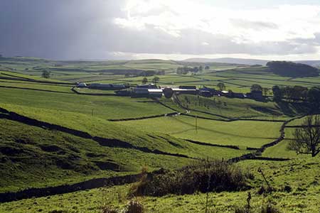
Eldon Hill from Peak Forest
Peak District Walk
Nat Park - Peak District - Kinder Scout Edale
County/Area - Derbyshire
Author - Lou Johnson
Length - 5.0 miles / 8.1 km Ascent - 650 feet / 197 metres
Time - 3 hours 10 minutes Grade - easy/mod
Walk Route Description
Click image to see photo description.
This scenic circular walk from Peak Forest explores the area to the north of this Peak District village. The route uses paths and tracks through limestone scenery to reach Eldon Hill which was once quarried for stone. Eldon Hole is included in the walk which is one of the Seven Wonders of the Peak. Over sixty metres deep this large chasm has seen many tragic deaths so please be careful.
The walk starts from Church Street which lies north of the A623 where on street parking is generally available (grid ref. SK114795). After parking walk back to the A623 and turn left. Continue past the Devonshire Arms and Snelslow Farm. Just after the farm, cross the road and enter a field through a small wooden gate. Walk half-right across the field to the far corner. Cross two stiles. Immediately after the second, cross another on the right and go left along the wall to reach Old Dam Lane (grid ref. SK124794).
Turn right and follow the lane as it starts to climb and bends right. You are now following the Limestone Way. Continue ahead to reach Cop Farm. Keep ahead here onto the Limestone Way which is heading north to join a walled track. Reaching the end of the walled track you pass a trig point on your right. Continue with the wall on your left to reach a wall junction. Go through gate, pass a pond on your right, and continue with the wall on your left. Ignore the path on the left and continue along the wall. After 700 metres you reach a cross track (grid ref. SK135813).
Turn left through a gate and continue along the track. The track soon bends right. Continue ahead following the signed bridleway keeping the wall on your left. Continue ahead through squeeze stile and keep straight on at the path junction (grid ref. SK153814). At the next path junction go left at fingerpost. Immediately cross the stile on the right to enter access land. Go half-left over pathless grass (taking care to avoid old mine workings) to reach the summit of Eldon Hill which is marked with a cairn. Take time to enjoy the view.
Leave the summit in a southerly direction (turn left when approaching the summit) and continue down towards the wall below. You soon reach the fenced enclosure containing Eldon Hole. You can get closer by using the stile on the east side. However, take great care. To continue walk downhill with the wall on your right. Keep to the left of a small copse using a gate and keeping wall on your right continue ahead. Pass between the farm buildings and join Eldon Lane. Continue down the lane to a T-junction. Turn left onto Church Lane and follow the lane around to the right at the next junction. Keep ahead back to the start.
Maps 

| Ordnance Survey Explorer OL1 | Sheet Map | 1:25k | BUY |
| Anquet OS Explorer OL1 | Digital Map | 1:25k | BUY |
| Ordnance Survey Explorer OL24 | Sheet Map | 1:25k | BUY |
| Anquet OS Explorer OL24 | Digital Map | 1:25k | BUY |
| Ordnance Survey Digital Map Subscription | |||
| Latest Ordnance Survey Discounts | |||
Other walks nearby
| Walk 2522 | Rushup Edge & Edale from Mam Nick | moderate | 7.0 miles |
| Walk 1368 | Mam Tor, Upper Booth & Rushup Edge | moderate | 7.0 miles |
| Walk 1831 | Mam Tor & Hollins Cross from Mam Nick | easy | 3.0 miles |
| Walk 1688 | Old Dam & Sparrowpit from Mam Nick | moderate | 9.0 miles |
| Walk 1896 | Horseshoe Dale & Deep Dale from Wye Dale | easy/mod | 6.4 miles |
| Walk 1087 | Mam Tor & Cave Dale | moderate | 6.5 miles |
| Walk 1519 | Catleton & Speedwell Cavern Circular | easy | 4.3 miles |
| Walk 1521 | Cave Dale and Winnats Pass | easy | 4.5 miles |
| Walk 1665 | Hollins Cross & Lose Hill | easy/mod | 6.0 miles |
| Walk 3426 | Lose Hill & Hollins Cross | easy/mod | 5.0 miles |
Recommended Books & eBooks
Walking in Derbyshire
 Walking guidebook to 60 circular day walks in Derbyshire and the Peak District. Includes the Derwent, Wye and Trent river valleys, near Derby, Matlock, Glossop, Bakewell and Ripley. Routes range from easy to moderate and are between 4 and 14km (2 to 10 miles). Walks focus on places of interest, from Stone Age forts to castles to grand estates.
More information
Great Mountain Days in the Pennines
 An inspirational guidebook to 50 classic walks on the rolling Pennine landscape. The graded routes, between 6 and 13 miles in length, cover classic Pennine fells and moorland such as Whernside, Ilkley Moor and Pendle Hill; exploring the North and South Pennines, Yorkshire Dales, Howgills and Dark Peak. Many routes are also suited to fell running.
More information
