The River Usk from Bettws Newydd
Monmouthshire Walk
County/Area - Monmouthshire
Author - Lou Johnson
Length - 6.5 miles / 10.6 km Ascent - 600 feet / 182 metres
Time - 3 hours 50 minutes Grade - easy/mod
Walk Route Description
Click image to see photo description.
A pleasant circular walk from the village of Bettws Newydd in Monmouthshire uses field paths to descend to the fine church at Kemeys Commander. From here the route continues to the River Usk. The river is then followed upstream for four kilometres. Heading back to the start a short ascent offers excellent view to Ysgyryd Fawr and the Sugarloaf.
The start if the Black Bear Inn in Bettws Newydd (grid ref. SO361061). After walk south through the village. After 600 metres turn right onto a signed path just before a large house (grid ref. SO361056). Follow the path in a south-westerly direction across the golf course to reach the B4598 at a stile (grid ref. SO350049).
Cross the road and take the lane opposite (Church Street) and continue into Kemeys Commander. Pass the small church on the left and follow the lane as it bends left. Reaching a large farm, bear right along the lane beside the Dutch barn. Follow this lane to reach the north bank of the River Usk.
Turn right along the riverside path for two kilometres to reach the B498 and the Chain Bridge. Cross the road and take the lane opposite (signed to Bettws Newydd). After 300 metres turn left over a stile by fingerpost and regain the riverside path. Continue for a further two kilometres. After a kilometre, the path leaves the river and continue past Brynderwen Farm on your right. Continue for 300 metres past Brynderwen to reach a footpath on the right (grid ref. SO356074). Follow this path southeast to join the access drive for Brynderwen. Follow the drive to a road (grid ref. SO360068).
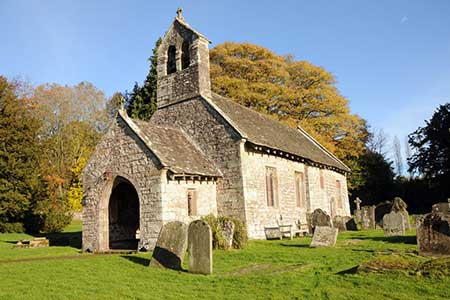
Turn left and after a few metres turn right onto a signed path at a metal gate. On this section of the walk there are fine views to the Sugarloaf and Ysgyryd Fawr. Reaching a lane, turn left to a T-junction. Go straight ahead to join a signed path descending across fields to reach the Church of St. Aeddan. Exit the churchyard to the south-west and follow the grassy path to exit onto a lane. Turn right back to the start.
Maps 

| Ordnance Survey Explorer 152 | Sheet Map | 1:25k | BUY |
| Anquet OS Explorer 152 | Digital Map | 1:25k | BUY |
| Ordnance Survey Explorer OL13 | Sheet Map | 1:25k | BUY |
| Anquet OS Explorer OL13 | Digital Map | 1:25k | BUY |
| Ordnance Survey Digital Map Subscription | |||
| Latest Ordnance Survey Discounts | |||
Other walks nearby
| Walk 3435 | Keeper's Pond & Blorenge | easy/mod | 7.5 miles |
| Walk 2670 | Ysgyryd Fawr (The Skirrid) near Abergavenny | easy/mod | 3.5 miles |
| Walk 1415 | Iron Mountain Trail - 'Llwybr Mynydd Haearn' - Part 1 | easy/mod | 7.5 miles |
| Walk 1512 | Iron Mountain Trail - 'Llwybr Mynydd Haearn' - Part 2 | easy/mod | 5.0 miles |
| Walk 1271 | Sugar Loaf circular | moderate | 6.0 miles |
| Walk 1664 | The Sugar Loaf | easy | 3.5 miles |
| Walk 1272 | Tintern, Devil's Pulpit & Brockweir | moderate | 7.5 miles |
| Walk 2832 | The Wye Valley | easy/mod | 5.8 miles |
| Walk 3717 | Table Mountain from Crickhowell | easy/mod | 5.0 miles |
| Walk 3134 | The Llangatwg Escarpment from near Crickhowell | moderate | 6.5 miles |
