Burnhope Reservoir Circular
Durham Walk
County/Area - Durham
Author - Lou Johnson
Length - 2.8 miles / 4.6 km Ascent - 200 feet / 61 metres
Time - 1 hours 40 minutes Grade - easy
Walk Route Description
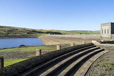
Click image to see photo description.
This easy walk in Upper Weardale provides a circuit of Burnhope Reservoir which lies in a bowl beneath open moorland. The route is easy to follow and uses a concessionary path around the reservoir. The start is the car park at the northern end of the dam (grid ref. NY845392).
After parking walk south across the dam and turn right through a metal gate on the far side. Continue along a gravel path with the reservoir on your right. Reaching a gate, bear right keeping to the gravel track. Continuing along the reservoir the only 'obstacle' is Limekiln Sike where a steep descent to cross the sike needs to be completed. Reaching the end of reservoir, cross two footbridges to reach the northern bank of the reservoir. Continue along the shoreline path to reach the dam and the starting point.
Maps 

| Ordnance Survey Explorer OL31 | Sheet Map | 1:25k | BUY |
| Anquet OS Explorer OL31 | Digital Map | 1:25k | BUY |
| Ordnance Survey Digital Map Subscription | |||
| Latest Ordnance Survey Discounts | |||
Other walks nearby
| Walk 1201 | Black Hag from Kirk Yetholm | moderate | 8.5 miles |
| Walk 1314 | Great Hetha and Elsdon Burn from Hethpool | easy/mod | 4.0 miles |
| Walk 3644 | Blackhaggs Rigg & Great Hetha from Hethpool | moderate | 9.6 miles |
| Walk 3646 | Hethpool, Sutherland Bridge & Great Hetha | moderate | 6.0 miles |
| Walk 3739 | Elsdonburn & Trowupburn from Hethpool | moderate | 8.2 miles |
| Walk 3296 | Grubbit Law & Hownam Law from Morebattle | moderate | 7.0 miles |
| Walk 2677 | Circuit of Doddington Moor | easy | 3.8 miles |
| Walk 2299 | The Cheviot | moderate | 9.0 miles |
| Walk 1764 | The Cheviot from Langleeford | mod/hard | 8.2 miles |
| Walk 1765 | Comb Fell & Hedgehope Hill from Langleeford | mod/hard | 8.9 miles |
Recommended Books & eBooks
Walking in County Durham
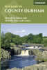 Guidebook offering detailed descriptions of 40 day walks, plus 10 traffic-free cycle routes along old railway trackbeds. Together they cover 450 miles and spread all over County Durham to show the region's history and natural wonders. The terrain covered ranges from field paths to open moorlands, from the North Sea to the high Pennines.
More information
