Durham WalksWalking Routes & Hiking Trails
Find Durham walks from the list below which features the best walking routes in the area. Most are circular walks and are listed from the shortest and easiest to the longest more challenging routes.
| Walk | Description | Grade | Miles |
|---|---|---|---|
| 1488★ | Middleton-in-Teesdale Railway Walk | easy | 2.50 |
| 1894★ | Burnhope Reservoir Circular | easy | 2.80 |
| 1484★ | Kirkcarrion from Middleton-in-Teesdale | easy | 3.50 |
| 3336★ | Cauldron Snout from Cow Green Reservoir | easy | 3.60 |
| 2157★ | Romaldkirk & Cotherstone | easy | 5.00 |
| 3634★ | Catterick Moss & Bollihope Carrs | moderate | 5.60 |
| 2170★ | Eggleston & Mickleton from Romaldkirk | easy/mod | 5.80 |
| 1659★ | Race Head & Sedling Rake from Wearhead | easy/mod | 6.00 |
| 2382★ | Smiddy Shaw Reservoir Circular from Waskerley Farm | easy/mod | 6.20 |
| 2393★ | Weardale Circular from Westgate | easy/mod | 6.40 |
| 2767★ | Lartington & Cotherstone Circular | easy/mod | 6.80 |
| 3424★ | Cronkley Fell from Hanging Shaw | easy/mod | 7.00 |
| 1948★ | Tunstall Reservoir from Wolsingham | easy/mod | 7.30 |
| 3099★ | High Force, Low Force and the River Tees from Bowlees | easy/mod | 7.50 |
| 1955★ | Sunnyside Edge from Wolsingham | easy/mod | 7.50 |
| 2228★ | Romaldkirk Moor from Mickleton | easy/mod | 7.60 |
| 2089★ | College Edge & Cuthbert's Currick from Edmundbyers | easy/mod | 8.00 |
| 1005★ | Harter Fell & Grassholme from Middleton-in-Teesdale | moderate | 8.00 |
| 3274★ | Cronkley Scar & Cauldron Snout from Cow Green | moderate | 8.00 |
| 1553★ | Hannah's Meadow, Baldersdale & Brown Rigg Moss | easy/mod | 8.00 |
| 2258★ | Grassholme Reservoir from Middleton-in-Teesdale | moderate | 8.20 |
| 3593★☩ | Meldon Hill from Cow Green Reservoir | moderate | 9.20 |
| 1482★ | Crossthwaite Common from Middleton-in-Teesdale | moderate | 9.75 |
| 1483★ | Eggleston & Romaldkirk from Middleton-in-Teesdale | easy/mod | 9.75 |
| 2469★ | Great Allotment & God's Bridge from Bowes | moderate | 10.20 |
| 3526★ | Hanging Shaw, Cronkley Scar, Low Force & High Force | moderate | 12.70 |
| 1683★ | High Cup Nick & Cow Green Reservoir | moderate | 12.80 |
| 1485★ | Hamsterley & Middleton-in-Teesdale | mod/hard | 16.50 |
Walks that start in adjacent counties / areas.
Walks that start in adjacent counties or areas but cross the boundary and include sections of the route within Durham.
| Walk | Description | Starts In |
|---|---|---|
| 2815★ | Pennypie and Blanchland from Baybridge | Northumberland County |
| 3722★ | Buckshott Fell & Sikehead Mines | Northumberland County |
★ GPS file ☩ Route profile
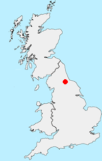
Location Map
Other walks in Britain - For a list of all the areas where walks are available go to the Main Walk Index.
Walk grading - Learn how each walk is assessed and select a walk to suit your ability and experience by going to Walk Grading Details.
Messaging & Social Media
Message Walking Britain and follow the latest news.

Mountain Weather
Stay safe on the mountains with detailed weather forecasts - for iOS devices or for Android devices.