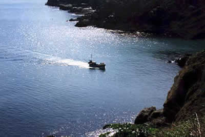
Housel Bay & Bass Point from the Lizard
Cornwall AONB Walk
Region - Cornwall AONB
County/Area - Cornwall
Author - Parc an Grouse Bed & Breakfast
Length - 3.5 miles / 5.7 km Ascent - 400 feet / 121 metres
Time - 2 hours 10 minutes Grade - easy
Walk Route Description
Click image to visit gallery of 2 images.
The Lizard Peninsula is England's most southerly point and not surprisingly it receives many visitors at peak times. A dramatic coastline with a tragic maritime history going back centuries, there is much of interest in this short walk and it should not be dismissed as being too easy!
Park in Lizard village (grid ref SW703125) and from the phone box by the bus stop in the village centre go to the left of the Top House pub taking the road which eventually becomes Penmenner Road. Across fields to your left can be seen the Lizard lighthouse and this is a convenient landmark for most of this walk. This road leads to a rough track (signed as a footpath) that descends to the sea. On reaching the coastal path turn left to pass behind the old lifeboat station that has been superseded by a new station seen later in the walk. You will then reach the café and buildings on the southernmost extremity of England.
Stay with the coastal path past the lighthouse. Shortly afterwards a short diversion to the right leads to the collapsed cave known as the Lion's Den. Return to the main path and descend steps to cross a footbridge at Housel Bay. This is a splendid location and one of the highlights of the walk. Further steps on the opposite side take you back to the cliff top. Turn right past the Housel Bay Hotel. After passing the Lloyds Signal station, now a National Trust property, you stay on the South West Coastal Path to arrive at Bass Point with its coastguard point.
Shortly after the cottages adjacent to the coastguard point the coastal path bears right and continues past the new lifeboat station to descend to Church Cove. Turn left up the road past thatched cottages to pass St Wynwallow Church - the most southerly place of worship in Britain. Stay on this road, which takes you back into the centre of Lizard village.
Maps 

| Ordnance Survey Explorer 103 | Sheet Map | 1:25k | BUY |
| Anquet OS Explorer 103 | Digital Map | 1:25k | BUY |
| Ordnance Survey Digital Map Subscription | |||
| Latest Ordnance Survey Discounts | |||
Other walks nearby
| Walk 1032 | Kynance Cove, Cadgwith & The Lizard | moderate | 8.0 miles |
| Walk 2392 | The Lizard Circular | easy/mod | 5.9 miles |
| Walk 1878 | Poldhu Cove to Lizard Point | moderate | 9.5 miles |
| Walk 2001 | Coverack & Lowland Point | easy/mod | 4.2 miles |
| Walk 1778 | Maenporth and Helford Passage Circular | easy/mod | 8.0 miles |
| Walk 2009 | Gillan & Nare Point from Porthallow | easy | 4.7 miles |
| Walk 2007 | Helford Passage & Frenchman's Creek | easy/mod | 7.0 miles |
| Walk 2088 | Rosemullion Head & Mawnan | easy | 4.0 miles |
| Walk 2757 | St Anthony Head Circular | easy | 3.5 miles |
| Walk 2208 | Marazion - a town stroll | easy | 1.0 miles |
Recommended Books & eBooks
Walking in Cornwall
 This guidebook includes routes to 40 day walks in Cornwall. From short, easy strolls to longer, wilder routes, there is plenty to appeal to both families and experienced walkers. The walks explore the interior and coasts, including walks through picturesque villages, old tin-mining areas and the Lizard and Land's End Peninsulas.
More information
The South West Coast Path
 Guidebook to walking the entire South West Coast Path National Trail. The route runs for 630 miles from Minehead to Poole along the north Devon, Cornish, south Devon and Dorset coastline. Divided into 45 stages, this long-distance coastal trek could be completed within 4 weeks, or walked in sections. Guide includes maps and essential information.
More information
