Maenporth and Helford Passage Circular
Cornwall AONB Walk
Region - Cornwall AONB
County/Area - Cornwall
Author - Lou Johnson
Length - 8.0 miles / 13 km Ascent - 1100 feet / 333 metres
Time - 5 hours 10 minutes Grade - easy/mod
Walk Route Description
Click image to see photo description.
This walk from Maenporth follows the South West Coast Path around Rosemullion Head and Toll Point to reach Helford Passage. The route then turns inland and passes through Mawnan Smith to return to the start. As with many coastal walks the cliff top path undulates with frequent 'ups and downs'. The inland section follows paths and lanes and does involve two short climbs.
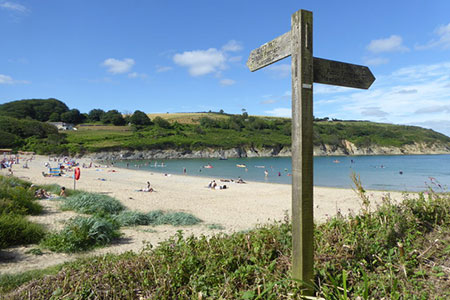
The walk starts from the car park behind the beach at Maenporth (grid ref. SW789196). After parking walk south with the sea to your left. At the end of the beach the road starts to rise. Take the signed path to Mawnan Church on the left (South West Coast Path). You soon reach the cliff top where its is better to follow the path nearest the sea. The path soon descends to Bream Cove before a short climb leads to Rosemullion Head. Again, stay on the path nearest the sea.
The path continues south soon entering trees. (If you have time and energy, a path on the right leads up to Mawnan Church.) Continue along the South West Coast Path descending to Port Saxon. From here an undulating path leads along the cliffs to reach you briefly join a lane that leads to Durgan Beach and village. Pass through the village and bear right past a letter box in a wall. Then turn left onto the coast path signed to Helford Passage. Continue to Polgwidden Cove where the route follows a concrete road for a short way. The path bears left off the concrete and continues through to Helford Passage and a lane (grid ref. SW764269).
Turn right up the lane and continue ahead for 800 metres to reach a crossroads (grid ref. SW767276) where you turn left. Continue straight on ignoring side roads on your left. About 500 metres from the crossroads, bear left on a signed footpath by a bungalow named 'Gate Acre'. The path descends a field to join a track which leads back to the lane. Turn left on the lane and almost immediately right to follow an access track which leads to Lower Penpoll. Follow the signs through the farm and continue across three fields with hedge on your left to reach Higher Penpoll (grid ref. SW772285).
Turn right past a house and continue a short distance down to a stone stile on your left. Cross the stile into a field and continue with hedge right. The path continues with hedge left to cross a stile by a pole (grid ref. SW777285). Continue down an enclosed path between houses to Grove Hill in Mawnan Smith. Cross the road and take path between metal barriers. Continue to a road and turn right. After 80 metres turn left onto signed footpath to Meudon. Continue along path to reach a farm (grid ref. SW786288).
At the farm turn left into the valley. The path crosses several fields to reach a stream (grid ref. SW782290). Turn right just before the stream and walk along the edge of the trees to reach a gate. Pass through the gate into the woodland. You soon reach a fork in the path where you bear left and continue back to the road in Maenporth. Turn left and the start is a short distance along this road.
Maps 

| Ordnance Survey Explorer 103 | Sheet Map | 1:25k | BUY |
| Anquet OS Explorer 103 | Digital Map | 1:25k | BUY |
| Ordnance Survey Digital Map Subscription | |||
| Latest Ordnance Survey Discounts | |||
Other walks nearby
| Walk 2001 | Coverack & Lowland Point | easy/mod | 4.2 miles |
| Walk 2009 | Gillan & Nare Point from Porthallow | easy | 4.7 miles |
| Walk 2088 | Rosemullion Head & Mawnan | easy | 4.0 miles |
| Walk 2007 | Helford Passage & Frenchman's Creek | easy/mod | 7.0 miles |
| Walk 2010 | Housel Bay & Bass Point from the Lizard | easy | 3.5 miles |
| Walk 1032 | Kynance Cove, Cadgwith & The Lizard | moderate | 8.0 miles |
| Walk 2392 | The Lizard Circular | easy/mod | 5.9 miles |
| Walk 1878 | Poldhu Cove to Lizard Point | moderate | 9.5 miles |
| Walk 2757 | St Anthony Head Circular | easy | 3.5 miles |
| Walk 2690 | Portscatho & Porthmellin Head | easy | 5.5 miles |
Recommended Books & eBooks
South West Coast Path Map Booklet - St Ives to Plymouth
 Map of part of the southern section of the 630 mile (1014km) South West Coast Path National Trail. Covers the trail from St Ives to Plymouth along the west Cornwall and Devon coastline. This convenient and compact booklet of Ordnance Survey 1:25,000 maps shows the route, providing all of the mapping you need to walk the trail in either direction.
More information
The South West Coast Path
 Guidebook to walking the entire South West Coast Path National Trail. The route runs for 630 miles from Minehead to Poole along the north Devon, Cornish, south Devon and Dorset coastline. Divided into 45 stages, this long-distance coastal trek could be completed within 4 weeks, or walked in sections. Guide includes maps and essential information.
More information
