Wrekin Circular from near Cluddley
Shropshire Hills Walk
Region - Shropshire Hills
County/Area - Shropshire
Author - Lou Johnson
Length - 4.5 miles / 7.3 km Ascent - 1300 feet / 394 metres
Time - 3 hours 30 minutes Grade - easy/mod
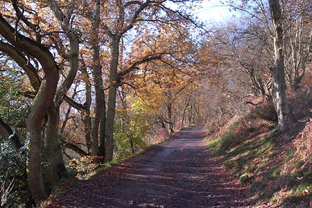
Walk Route Description
Click image to visit gallery of 9 images.
The Wrekin is one of a string of volcanic hills stretching from Telford south to Church Stretton near the Long Mynd. Dominating the modern town of Telford, the hill can easily be seen from the north across the flat lands of Staffordshire, Shropshire and Cheshire. Rising quite abruptly from the surrounding countryside it is no surprise that it makes an excellent viewpoint and each year it sees many visitors at its summit. This route follows a quieter approach and provides an excellent half day excursion.
The start is the car park (Grid ref. SJ638092) on the minor road leading from Cluddley (Junction 7 of the M54) to the village of Little Wenlock. After parking cross the road and take the footpath that leads southeast in front of the derelict toilet block. Climbing gently the path turns south-west to reach a junction (Grid ref. SJ637088). Bear left here and take the clear path that undulates across the south-eastern flank of the Wrekin passing through delightful mixed woodland. Reaching a major junction (Grid ref. SJ629077), keep straight ahead, ignoring the tempting path rising to the right.
A short way further you reach another junction (Grid ref. SJ625074). Bear right here to continue through woodland. You are now reaching a section of the wood that has many paths and care is needed. Reaching an indistinct junction, stay with the main path bearing right past a footpath sign. This leads in about 400 metres to a broader track where you turn right. After a short distance look out for a narrow path (Grid ref. SJ617073) going right and climbing between trees. Despite being the Shropshire Way, this path is hard to spot.
Assuming the path has been located, climb steeply on the narrow path to the summit of Little Hill. Sadly trees restrict the view and it is better to descend to the col and a crossing path (Grid ref. SJ620076). Go straight over here and continue the climb. It is again very steep at first but as the trees thin the gradient eases and quite soon you are able to enjoy the views over the surrounding Shropshire countryside. Ahead you will see the trig point and a brass topograph. Joining the main track, continue northeast along the main ridge past the radio mast. Some way beyond the track doubles back on itself to reach a gate. Go through the gate passing the small café on your left and descend to a path junction. Turn left and within a few minutes you will be back at the start.
Maps 

| Ordnance Survey Explorer 242 | Sheet Map | 1:25k | BUY |
| Anquet OS Explorer 242 | Digital Map | 1:25k | BUY |
| Ordnance Survey Digital Map Subscription | |||
| Latest Ordnance Survey Discounts | |||
Other walks nearby
| Walk 1941 | Outwoods & Beffcote | easy | 4.1 miles |
| Walk 2353 | Aqualate Mere & Sutton | easy | 5.2 miles |
| Walk 2678 | Wenlock Edge & Broadstone | easy/mod | 6.4 miles |
| Walk 3447 | Caer Caradoc, Hope Bowdler & Willstone Hills | moderate | 7.0 miles |
| Walk 2499 | Aqualate Mere & Forton | easy/mod | 8.0 miles |
| Walk 1837 | Norbury Junction Circular | easy | 4.6 miles |
| Walk 2269 | Norbury Junction, Gnosall & Aqualate Mere | easy/mod | 8.1 miles |
| Walk 2027 | Weston, Lee Brockhurst and Stanton | easy/mod | 8.5 miles |
| Walk 1097 | Caer Caradoc | easy/mod | 3.5 miles |
| Walk 2345 | Clee Hills | easy/mod | 6.8 miles |
Recommended Books & eBooks
Hillwalking in Shropshire
 Guidebook to 32 walking routes in Shropshire in the West Midlands. The routes range from 3 miles (5km) to 12 miles (19km), taking in highlights such as The Wrekin, Wenlock Edge, Long Mynd and Stiperstones, Castle Ring and Bury Ditches. Many routes start near delightful towns and villages including Church Stretton, Ludlow and Bishops Castle.
More information
