Brown Clee Hill from Abdon
Shropshire Hills Walk
Region - Shropshire Hills
County/Area - Shropshire
Author - Jake Robertson
Length - 6.3 miles / 10.2 km Ascent - 1250 feet / 379 metres
Time - 4 hours 20 minutes Grade - easy/mod
Maps 

| Ordnance Survey Explorer 217 | Sheet Map | 1:25k | BUY |
| Anquet OS Explorer 217 | Digital Map | 1:25k | BUY |
| Ordnance Survey Landranger 137 | Sheet Map | 1:50k | BUY |
| Anquet OS Landranger 137 | Digital Map | 1:50k | BUY |
Walk Route Description
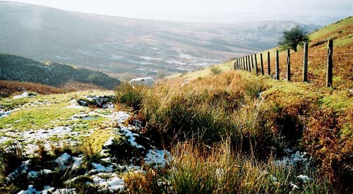
Click image to see photo description.
Twin topped Brown Clee Hill is the highest of all the Shropshire hills yet nowhere near as popular the Long Mynd and other hills in this beautiful County. Rising out of glorious pastoral countryside Abdon Burf, its summit, is a magnificent viewpoint gained by an easy ascent through up ancient common lands.
The start and finish is the church (Grid ref. SO575866) in Abdon village where there is very limited roadside parking. From the church walk north up the road to join the Shropshire Way at a t-junction. Go straight on with the Shropshire Way to the phone box at Bank House. A gate on the left leads into a track that makes a steady ascent around Abdon Liberty, emerging onto the plateau top by a wall (Grid ref. SO 592 863) where the Shropshire Way goes right.
To visit the summit of Brown Clee Hill, go straight ahead on a path up through hummocky ground to reach the OS trig point. From the summit at 1772 ft (540 m) there are extensive views over Shropshire and distant views of the Welsh mountains, the Cotswolds and Cannock Chase. (Note - It is necessary to go to the high point in front of the mast to see the full view north.)
Return downhill and turn left on to the Shropshire Way. Stay on this path and follow it south along to the col at The Five Springs (Grid ref. SO 595 854). From here a gentle climb south by the edge of the woods brings you to the 1670 ft (512 m) top of Clee Burf with a good retrospective view back to Abdon Burf.
Just north of the masts a track leads down to a good path descending Clee Liberty to the impressive fort at Nordy Bank and onward down to a minor road at Cockshutford (Grid ref. SO 574 849). Walk along to the crossroads at Lower Cross Lane and turn right for about a mile walk into Abdon. The church is up a lane on the right near the end of the village.
Other walks nearby
| Walk 2345 | Clee Hills | easy/mod | 6.8 miles |
| Walk 2296 | Brown Clee Hill Circular | easy/mod | 4.5 miles |
| Walk 2678 | Wenlock Edge & Broadstone from Wilderhope Manor | easy/mod | 6.4 miles |
| Walk 3334 | Titterstone Clee Hill and Catherton Common | easy/mod | 5.5 miles |
| Walk 2022 | Wenlock Edge & Aston Munslow | moderate | 7.8 miles |
| Walk 3447 | Caer Caradoc, Hope Bowdler & Willstone Hills | moderate | 7.0 miles |
| Walk 2654 | Titterstone Clee Hill & Cleeton St. Mary from Cleehill | moderate | 7.5 miles |
| Walk 1321 | Caer Caradoc & Hope Bowder Hill | moderate | 9.0 miles |
| Walk 3048 | Caer Caradoc & The Lawley | moderate | 10.0 miles |
| Walk 1097 | Caer Caradoc | easy/mod | 3.5 miles |
Recommended Books & eBooks
Hillwalking in Shropshire
 Guidebook to 32 walking routes in Shropshire in the West Midlands. The routes range from 3 miles (5km) to 12 miles (19km), taking in highlights such as The Wrekin, Wenlock Edge, Long Mynd and Stiperstones, Castle Ring and Bury Ditches. Many routes start near delightful towns and villages including Church Stretton, Ludlow and Bishops Castle.
More information
Messaging & Social Media
Message Walking Britain and follow the latest news.

Mountain Weather
Stay safe on the mountains with detailed weather forecasts - for iOS devices or for Android devices.