 Walking Britain
Pennypie and Blanchland from Baybridge
North Pennines Walk
Region - North Pennines
County/Area - Northumberland County & Durham
Author - Lou Johnson
Length - 3.8 miles / 6.1 km Ascent - 650 feet / 197 metres
Time - 2 hours 20 minutes Grade - easy/mod
Walk Route Description
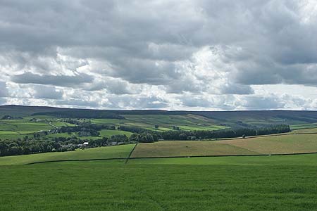
Click image to visit gallery of 3 images.
This walk starts in the Derwent Valley and climbs onto the fringes of the moors before dropping down into the valley at the picturesque village of Blanchland. There is ample opportunity to explore the village before return along the River Derwent back to the start.
The start is the car park and picnic area alongside the River Derwent at Baybridge (Grid ref. NY957499). After parking, exit onto the road and turn left. Turn left again into the lane that runs in front of the cottages and begin the steady climb out of the valley onto the moor. The lane is quite steep in places and with excellent views up valley you have ample excuses to stop and admire the view. Passing the access road to Birkside Farm on your left the climb is nearly over. Reaching a bridleway sign (Grid ref. NY951508), continue straight ahead across the moor to reach the track in front of Pennypie House (Grid ref. NY949517).
Turn sharp right here and follow the lane through the hamlet of Shildon and down the small side valley into Blanchland. This village is picturesque, historic and unusual with many of its stone buildings around the perimeter of a large cobbled square. Blanchland Stores and the old post office are two buildings of note and with two places offering refreshments there is ample excuse to stay awhile and explore.
To continue, walk south through the main square and follow the road south to cross the River Derwent into County Durham. Just over the bridge turn right onto the signed footpath. This path leads through pleasant woodland offering views to the river and beyond. After approximately one kilometre the path reaches a road. Turn right here, cross the river again and the car park is on your left.
Maps 
| Ordnance Survey Explorer OL43 | Sheet Map | 1:25k | BUY |
| Get Ordnance Survey Digital Map Subscription | |||
| Latest Ordnance Survey Discounts | |||
Other walks nearby
| Walk 3315 | Warlaw Pike & Birkside Fell from Blanchland | moderate | 8.0 miles |
| Walk 3722 | Buckshott Fell & Sikehead Mines from Blanchland | easy/mod | 6.5 miles |
| Walk 2089 | College Edge & Cuthbert's Currick from Edmundbyers | easy/mod | 8.0 miles |
| Walk 3140 | Hexhamshire Common & Rowantree Cleugh | moderate | 6.1 miles |
| Walk 1942 | Watson's Pike & Hexhamshire Common | easy/mod | 6.0 miles |
Start Point Details
Ordnance Survey Grid Ref NY957499
Latitude 54.843893 Longitude -2.0684848
Postcode DH8 9UB
what3words start brief.freezing.glance
Walk description may contain detailed information on the start point for this walk.
Further Information
North Pennines Walking
This National Landscape (formerly AONB), the second largest in area, covers some wild and remote landscapes in northern England. The area is dominated by the Pennine hills and includes large areas of undulating heather moors and peat.
Walking GuideAccommodation
Find Accommodation nearby by using the regional accommodation lists
Go to regional accommodation lists
Self Catering & Cottage Holidays
Properties throughout the UK & Europe
Messaging & Social Media
Message Walking Britain and follow the latest news.


Mountain Weather
Stay safe on the mountains with detailed weather forecasts - for iOS devices.