Castle Howard & Coneysthorpe from Bulmer
Howardian Hills Walk
Region - Howardian Hills
County/Area - North Yorkshire - Howardian Hills
Author - Andy Chaplin
Length - 11.4 miles / 18.5 km Ascent - 1025 feet / 311 metres
Time - 6 hours 40 minutes Grade - moderate
Maps 

| Ordnance Survey Explorer 300 | Sheet Map | 1:25k | BUY |
| Anquet OS Explorer 300 | Digital Map | 1:25k | BUY |
Walk Route Description
Click image to visit gallery of 3 images.
This North Yorkshire walk is a combination of well maintained paths around Castle Howard and paths that looked like they had not been walked for some time as you get over to the west side of the route during the return to the start. Highlights include the monuments around Castle Howard, which are interesting, the villages of Bulmer and Coneysthorpe which are picturesque and the views from Slingsby Bank.
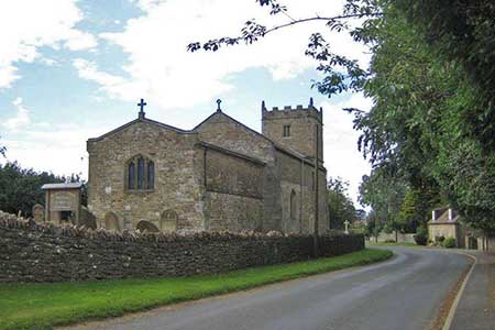
Park in the attractive village of Bulmer (grid ref. SE697676) and follow the main street out eastwards past the parish church. When the road bends left then right, take the road off to the left past the village hall then take the path across fields to the road (grid ref. SE703682). Turn left and walk northwards up the road then take the path on your right through Brandrith Wood to 'The Stray' road and turn left.
Go under the Castle Howard Gatehouse and turn immediately right on the road heading in the direction of the Pyramid and Mausoleum. Shortly after passing the Pyramid on your right, turn left on the path that goes over the New River Bridge then bear left towards the Temple of The Four Winds. Follow the ha-ha wall into Horse Close Rush Wood and then turn left on the track (the Centenary Way) when you come out of the wood and follow it northwards out to the Coneysthorpe gates (grid ref. SE713712).
Turn left and carry on along the Centenary Way through Coneysthorpe village where there are benches on the green that are well placed for a lunchtime stop. Then turn right onto the Centenary Way again and continue north to Coneysthorpe Banks Wood. The path then continues west to Slingsby Banks Wood with good views to the north and south from the ridge.
At grid ref. SE694734 there is a signed junction of paths. Take the path signed to Hall Moor and follow it down to Thurtle Wood. The path is well signed all the way through the wood on the forestry tracks. At the south of Bell Bottom Wood turn left on the track then right on the short bridleway down to the C172 road (grid ref. SE693717). Turn right on the road and in a short way take the bridleway off on the left towards Ganthorpe.
The paths from here become harder to follow. The bridleway skirts the western boundary of Cum Hag Wood. It is then signed off at a gate across the field and before heading south past Moor Hill. At the crossroads of paths north of Ganthorpe (grid ref. SE691707) the bridleway south to Ganthorpe does not seem to exist so go right then left on paths and left again on the road into the village.
In the village take Sleigh Lane off on the right. Then take the first footpath on the left that crosses a field then follows the stream down Mowthorpe Dale. The path on the edge of Mowthorpe Dale wood is completely overgrown so you can walk in the field at the side of the wood. The path comes out near fish ponds in the valley. Turn right up the track towards the Centenary Way. Turn left along the Centenary Way for a short distance and then go left on a path that leads above the three fish ponds and on through Ox Pasture Wood to Bulmer. Again the paths from the fish ponds look like they do not get much traffic.
Other walks nearby
| Walk 3733 | Coneysthorpe & Castle Howard from Welburn | easy/mod | 9.0 miles |
| Walk 3126 | Kirkham Priory & Pretty Wood from Low Hutton | moderate | 11.0 miles |
| Walk 1311 | Slingsby & South Holme | easy/mod | 8.0 miles |
| Walk 1842 | Buttercrambe & Youlthorpe from Stamford Bridge | moderate | 11.8 miles |
| Walk 1704 | Oswaldkirk, Nunnington & Harome circular | moderate | 11.5 miles |
| Walk 1990 | Settrington from North Grimston | easy/mod | 7.3 miles |
| Walk 2702 | Ampleforth, Shallow Dale, Yearsley Moor & Wilderness | moderate | 9.5 miles |
| Walk 2703 | Thixendale & Kirby Underdale | easy/mod | 8.5 miles |
| Walk 3515 | Deepdale and the deserted village of Wharram St. Percy | easy | 5.0 miles |
| Walk 3434 | North Grimston, Birdsall & Wharram Percy | moderate | 12.1 miles |
Recommended Books & eBooks
Trail and Fell Running in the Yorkshire Dales
 Guidebook to 40 of the best trail and fell runs in the Yorkshire Dales National Park. Ranging from 5 to 24 miles, the graded runs start from bases such as Ribblehead, Dent, Sedbergh, Malham and Grassington and take in the region's diverse delights, from castles and waterfalls to iconic mountains such as Whernside, Ingleborough and Pen Y Ghent.
More information
Messaging & Social Media
Message Walking Britain and follow the latest news.

Mountain Weather
Stay safe on the mountains with detailed weather forecasts - for iOS devices or for Android devices.