Great Cockup and Meal Fell from Longlands
Lake District Walk
Nat Park - Lake District - Lake District Northern Fells
Wainwrights - Great Cockup, Meal Fell
County/Area - Cumbria
Author - Lou Johnson
Length - 6.0 miles / 9.8 km Ascent - 1600 feet / 485 metres
Time - 4 hours 40 minutes Grade - moderate
Walk Route Description
Click image to see photo description.
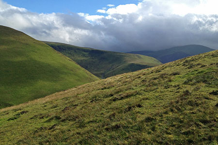
This walk visits the summits of Great Cockup and Meal Fell in the northern fells of the Lake District. The route follows paths for most the way but there are sections where paths are indistinct. This area is generally quiet, and you are likely to see few walkers. In mist careful navigation is essential as the landscape can be confusing in poor visibility.
There is limited parking either side of the bridge over Longlands Beck (NY266358). After parking go through the gate on the north side of Longlands Beck and immediately bear right to ford a beck. Leave the track by bearing right along a grassy path. The path continues up the valley with a wall on your immediate right. Continue for a kilometre to reach sheep pens on your left (grid ref. NY271351). Continue along the grassy path to cross the River Ellen (grid ref. NY274342).
One across the river turn right along a grassy path which is initially hard to locate. However, the path soon becomes more distinct and soon crosses Dale Gill (grid ref. NY264342). About 700 metres beyond Dale Gill turn left and pick up a feint grassy path heading south-east onto the ridge terminating in Little Cockup (grid ref. NY262336). The path continues east to the summit of Great Cockup. Enjoy the view and also look east to Meal Fell so you can assess the lie of the land.
From the summit of Great Cockup head north-east on a grassy path. The path soon veers right (east) and descends towards Trusmadoor Pass. If you lose the path, choose the best route down to the southern end of the pass. From the pass there is a grassy path across the south flank of Meal Fell. Take this path and gain a little height before heading steeply uphill to reach the summit of Meal Fell from where you have a grand view across many of the Northern Fells.
To descend, head north-west down a steep grassy slope. (The attached GPS file provides good guidance.) As you near the base of the fell, head to the point where you crossed the River Ellen (grid ref. NY274342) from where you can retrace your route back to the start.
Maps 

| Ordnance Survey Explorer OL4 | Sheet Map | 1:25k | BUY |
| Anquet OS Explorer OL4 | Digital Map | 1:25k | BUY |
| Ordnance Survey Digital Map Subscription | |||
| Latest Ordnance Survey Discounts | |||
Other walks nearby
| Walk 2244 | Whitewater Dash and Great Calva | moderate | 7.0 miles |
| Walk 2612 | Roughton Gill, Caldbeck Fells | easy | 4.5 miles |
| Walk 2390 | High Pike from Fell Side | moderate | 5.2 miles |
| Walk 1676 | Ullock Pike, Long Side and Carl Side | moderate | 5.5 miles |
| Walk 2040 | Ullock Pike & Carlside | moderate | 5.5 miles |
| Walk 2351 | Caldbeck & Watersmeet from Hesket Newmarket | easy | 4.3 miles |
| Walk 1101 | Carrock Fell, High Pike and Knott | moderate | 11.0 miles |
| Walk 1214 | Carrock Fell & High Pike from Mosedale | moderate | 7.0 miles |
| Walk 2041 | Barf (via the Bishop) and Lords Seat | mod/hard | 4.0 miles |
| Walk 1073 | Skiddaw & Glenderaterra Beck | moderate | 9.0 miles |
Recommended Books & eBooks
The Cumbria Way
 A guidebook to the 73 mile Cumbria Way, an easy long-distance walk though the heart of the Lake District National Park, from Ulverston in the south to Carlisle in the north, with good transport links to either end. The route is largely low-level but this guide offers alternative mountain days to climb some of the famous fells en route.
More information
Walking the Lake District Fells - Patterdale
 Part of the Walking the Lake District Fells series, this guidebook covers a wide range of routes to 35 Lakeland summits that can be climbed from Ambleside, Grasmere and Patterdale and the Thirlmere and Ullswater valleys, with highlights including Helvellyn and Fairfield. Suggestions for longer ridge routes are also included.
More information
